At a glance
What awaits you
Difficulty
Not yet provided
Route length
Not yet provided
Who is it for
Popular visiting hours
Verified busyness data is not available yet
Best time to visit
JanFebMarAprMayJunJulAugSepOctNovDec
BestGoodHot
5-day forecast
Forecast loads when this section is viewed
About this place
Taninim Stream Nature Reserve
A long stone dam spans a gap in the coastal ridge, with channels and the remains of mills below it. Alongside runs Nahal Taninim, its banks fringed with reeds and frequented by waterbirds. Ancient engineering makes sense here through the landscape itself. You can trace why water had to be raised, how it was released towards Caesarea and how a directed flow could turn millstones.
A stream cutting through the coastal ridge
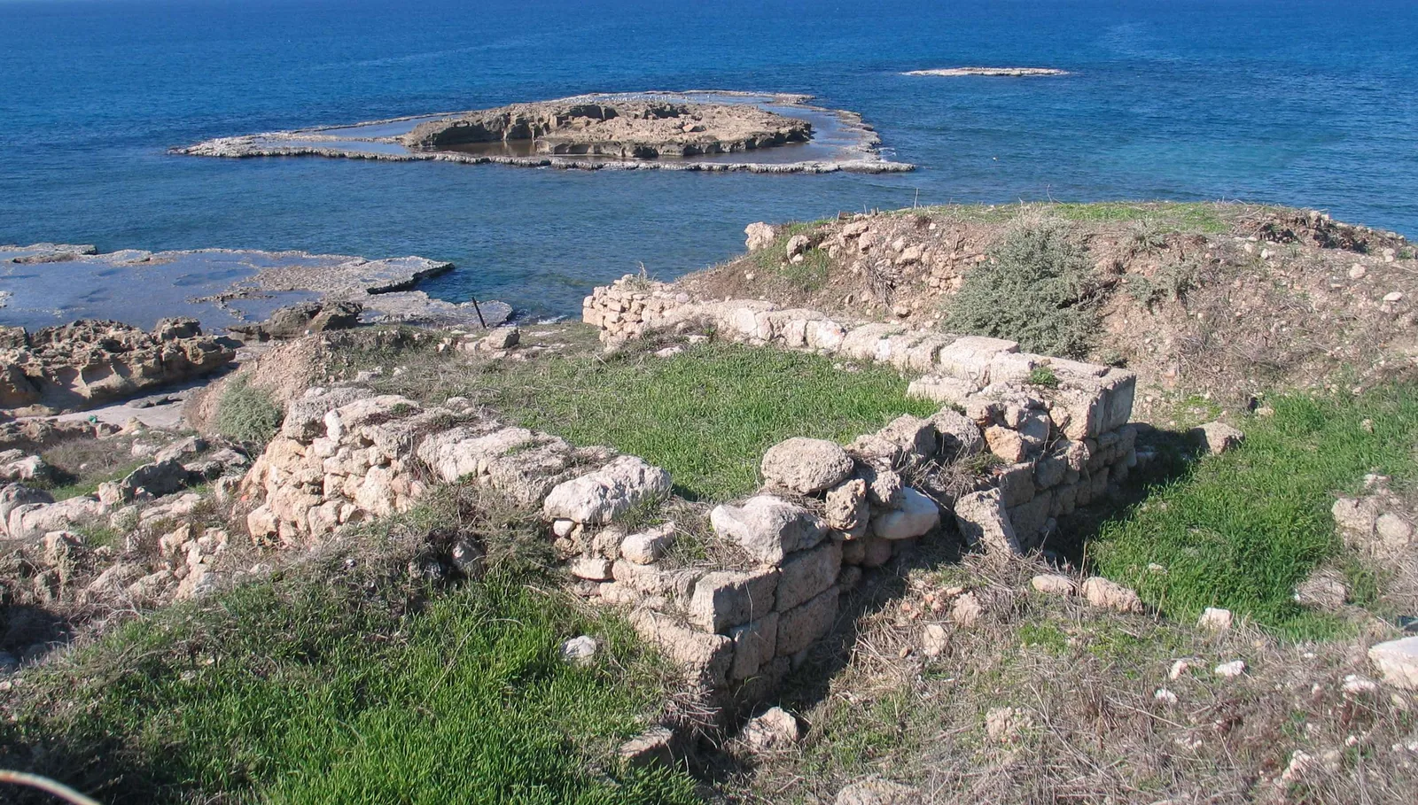
Taninim Stream Nature Reserve lies on the southern Carmel coast, between Ma’agan Michael and Jisr az-Zarqa, north of Caesarea. The stream rises near Ramot Menashe and reaches the Mediterranean Sea. The reserve focuses on the section where water passes through a ridge of kurkar, the cemented calcareous sandstone characteristic of this coast. The Taninim and Ada streams meet here. This gap offered a practical place for a barrier: blocking it allowed builders to raise the water level behind a stone wall. Read the terrain and the engineering remains together. The narrow opening explains where the dam was built, while the dam explains how this stretch of low-lying land became part of a much larger water system.
The scale of the old water system
194 metresLength of the surviving dam
about 6,000 dunamsArea of the ancient reservoir
1922–1932 CEDrainage of the Kebara marshes
Why the water level had to be raised
The great stone dam at Taninim formed part of the late Roman water supply system serving Caesarea. The city needed water, but a gravity-fed aqueduct depended on the height of its starting point relative to its destination, not simply on an abundant flow. The dam raised the level sufficiently for water to be diverted. Together with a second barrier farther north, it created a large seasonal reservoir. The area given above refers to that ancient reservoir, not the present expanse of water beside the walking paths. The main dam is 194 metres long, with later alterations and reinforcements visible in its structure. As you look at it, ask where the water would go if the wall were removed. That simple question helps explain why this was the foundation of the system rather than an ordinary bridge across a stream.
Reading the structures around the dam
1
The stone barrier
The wall blocked the gap in the ridge and held water back. Notice where masonry meets the banks and rock. A natural constriction let builders control an area far larger than the wall itself.
2
The sluice system
Openings and reconstructed wooden gates show how water could be released in controlled amounts. The aqueduct and mills required a regulated flow rather than an unpredictable overflow across the top.
3
The outlet channels
Beyond the regulating structure, water was directed towards different uses. Follow the channels on the plan to see how dam, aqueduct and mills functioned as parts of a connected system.
Three different uses for the same water
- Supplying Caesarea
- A gravity-fed aqueduct
- The aqueduct carried water towards Caesarea on a slight gradient. Its starting height and an uninterrupted route were crucial. A strong source at the wrong level could not solve the supply problem.
- Powering a mill
- Mechanical power
- A change in level and a directed flow turned a wheel connected to grinding machinery. Here the important sequence runs from moving water to rotating millstones.
- Draining the marshland
- Kebara marsh drainage
- In the modern period, the objective changed: water was collected and carried away through drains. The remains of pipe manufacture explain a very different intervention in the same lowland landscape.
Taninim’s mills: different periods below one dam
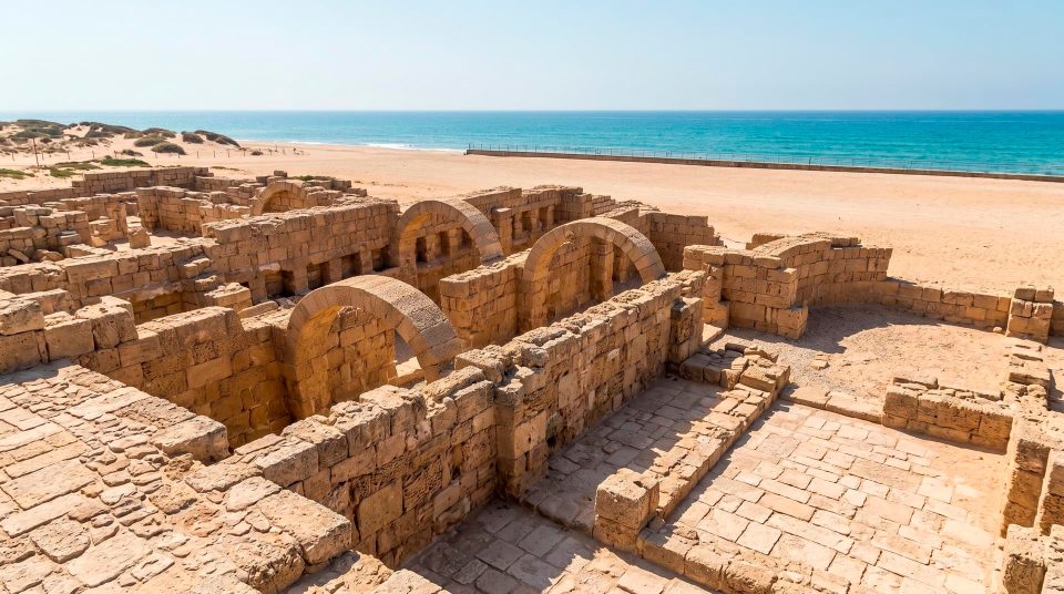
The dam preserves neighbouring mill structures from the Byzantine and late Ottoman periods. Together they allow you to compare successive ways of using the same water resource. The Byzantine mills here are known for their vertically mounted waterwheels. A directed flow acted on the wheel, which transmitted movement to the grinding mechanism. Restored parts make that connection easier to understand than empty foundations alone. A demonstration with the wheel turning, however, should not be treated as a continuously operating attraction. Even without one, you can look for the supply channel, the wheel’s position and the place where the millstones worked. The Ottoman mill adds a later working layer to the landscape. The buildings differ in age and arrangement while sharing the principle of turning water power into useful work.
An unfinished channel and the importance of levels
The unfinished rock-cut aqueduct reveals another side of ancient engineering. A widely given explanation is that work stopped when its builders realised it was too low to carry water to Caesarea by gravity. Treat that as an interpretation of the remains, not a surviving written admission of error. An aqueduct did not need a steep drop along every short section. It needed a continuous, slight fall over its whole route, without obstacles that would stop the flow. Because water runs through this channel, visitor accounts sometimes describe it as a wet trail. The structure is worth examining for its form and purpose alone. Walking through the water depends on permitted access and is not an essential part of understanding it.
The living stream beside the engineering remains
After examining the dam, turn your attention to the stream. Riverside vegetation, reeds and quiet water create a habitat quite different from the exposed stonework. Waterbirds, turtles and other animals of freshwater and bankside habitats live here. Herons and kingfishers are best watched from the path at a respectful distance, without trying to attract them with food. Birds on neighbouring water or banks may be outside an easy viewing angle. A stretch that appears empty still forms part of their habitat. Binoculars help you see more without disturbing the setting. Clear-looking water is neither permission to swim nor evidence that it is safe to drink.
Why it is called Crocodile Stream
Taninim means ‘crocodiles’. The name refers to real animals that inhabited the Kebara marshes and local waterways until the early twentieth century. The last crocodile killed here is generally dated to 1912. Visitors should not expect to see them on a walk today: the name preserves the memory of a former local species. That history is especially striking in a landscape where the extensive marshes no longer survive on their former scale. The origins of this crocodile population have been debated. The suggestion that animals were imported for Roman spectacles should not be presented as established fact. The reliable outline is that crocodiles lived here and subsequently disappeared. Their absence leaves a living stream with an ecosystem of its own to observe.
A quarry and an unsuccessful attempt to make pipes
Near the sluice system is an old quarry associated with a later attempt to manufacture clay pipes for draining the Kebara marshes. Local production failed, and pipes imported from France were used instead. This small industrial story explains a major shift in how people approached the lowlands. Ancient builders retained water to supply a city; twentieth-century drainage carried it away to bring land into use. The manufacturing remains are less visually imposing than the long dam, but they encourage a second look at the surrounding fields. Their present appearance followed substantial changes to the water regime. Both the agricultural purpose and the transformation of wetland habitat belong in the history of the drainage works.
How the purpose of the water changed
- Late Roman period
Stone dams and an aqueduct form a system that raises the water level to supply Caesarea. The landscape becomes part of the city’s infrastructure.
- Byzantine period
Flour mills operate beside the dam. Stored water, released along directed channels, becomes a source of mechanical power.
- Late Ottoman period
New mill buildings and alterations add further phases of use. The surviving remains allow visitors to distinguish several periods of operation.
- Early twentieth century
The local crocodiles disappear, and major changes begin in the marshy lowlands. Drainage works between 1922 and 1932 transform Kebara.
Linking engineering and nature on your walk
- 1
Start with the reserve map
Choose permitted dry paths and the branches you want to follow. Locate the dam, mills and aqueducts separately. A named route is not necessarily an independent loop starting at the entrance.
- 2
Look at the dam in relation to the water level
Begin with the wall and its position in the ridge, then examine how the flow was controlled. Understanding that arrangement makes the individual mechanisms easier to interpret.
- 3
Compare the mills with the unfinished aqueduct
At the mills, a drop provides power; at the aqueduct, direction and elevation determine whether water can reach its destination. These differences turn a series of ruins into understandable engineering problems.
- 4
Pause beside the living channel
For birdwatching, standing quietly in a permitted spot is often more rewarding than hurrying along the whole bank. Add water sections only when access is allowed and you have suitable equipment.
The dam, estuary and sea need different route plans
For navigation, select the official entrance to Nahal Taninim Nature Reserve beside Jisr az-Zarqa. The stream mouth, coastal Tel Taninim and mill area are geographically connected but distinct destinations. Do not automatically add a walk to the sea to a short visit around the dam: it changes both the distance and the return route. In the dry season, bring drinking water and protection from the sun for exposed stretches. After rain, path conditions and actual access to the channel deserve particular attention. Stone beside water can be slippery in any season. Check entry times, permitted branches and the specific route if stairs are a concern. The reserve’s strongest connection with Caesarea is its water-supply history. Seeing flow regulation here and the urban aqueduct afterwards makes the infrastructure behind a major ancient city much easier to understand.
Questions about Nahal Taninim
- Can I see crocodiles in the reserve? No. The local population disappeared in the early twentieth century. The name recalls animals that lived in the Kebara marshes. Today the visit is about the stream, its birds and its water-engineering remains rather than crocodile watching.
- Why was such a long dam needed? It raised the water level so that water could flow by gravity towards Caesarea. A plentiful supply alone was insufficient: the aqueduct had to begin at a suitable elevation. The regulated flow was subsequently used to power mills as well.
- Does the ancient reservoir survive intact? No. The figure of about 6,000 dunams refers to the ancient reservoir formed by the dam system. It should not be confused with the water visible beside the paths today. Drainage significantly altered the surrounding lowlands.
- Do I have to follow a wet trail? No. The dam, channels and mill structures can be understood as engineering monuments without walking through water. Check whether water sections are permitted and what equipment is needed under the conditions of your visit.
- Why was one aqueduct left unfinished? Its abandonment is usually explained by an elevation too low for gravity-fed delivery to Caesarea. This is the accepted interpretation of the surviving structure. The channel illustrates why careful calculation of the gradient mattered so much.
- Does every visitor see the millwheels working? There is no guarantee. Demonstrations depend on the arrangements and conditions at the site. Restored parts remain useful without being set in motion: they show the water’s path and the transfer of movement to the grinding machinery.
- Is the walk to the sea part of a normal loop around the dam? Do not assume that it is. The estuary and Tel Taninim lie farther along the watercourse and need a separate route decision. Use the official map to identify the appropriate branch and how you will return.
Sources
History
Stone dams and an aqueduct form a system that raises the water level to supply Caesarea. The landscape becomes part of the city’s infrastructure.
Flour mills operate beside the dam. Stored water, released along directed channels, becomes a source of mechanical power.
New mill buildings and alterations add further phases of use. The surviving remains allow visitors to distinguish several periods of operation.
The local crocodiles disappear, and major changes begin in the marshy lowlands. Drainage works between 1922 and 1932 transform Kebara.