At a glance
What awaits you
Visit duration
Not yet provided
Difficulty
Not yet provided
Route length
Not yet provided
Who is it for
Popular visiting hours
Verified busyness data is not available yet
Best time to visit
JanFebMarAprMayJunJulAugSepOctNovDec
BestGoodHot
5-day forecast
Forecast loads when this section is viewed
About this place
Migdal Tsedek National Park
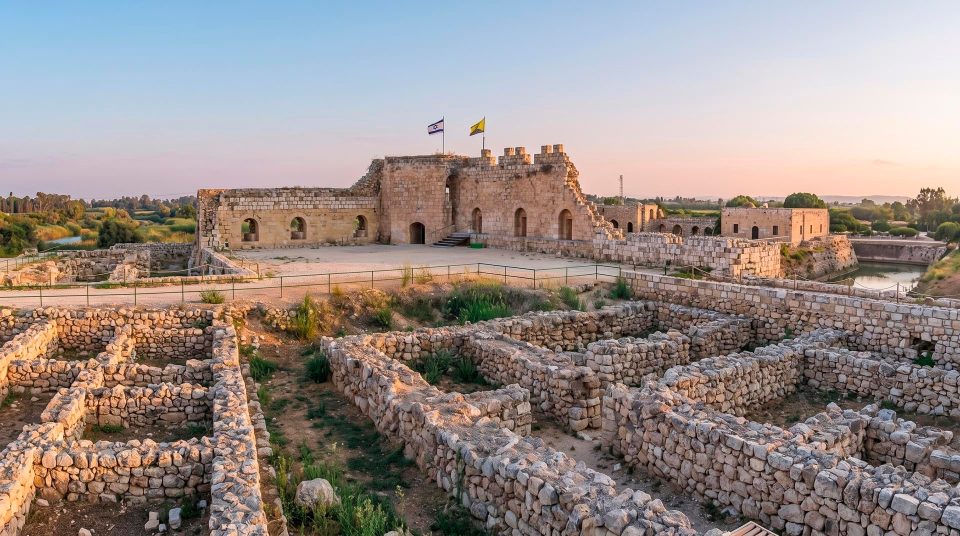
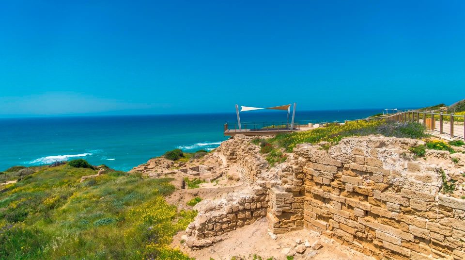
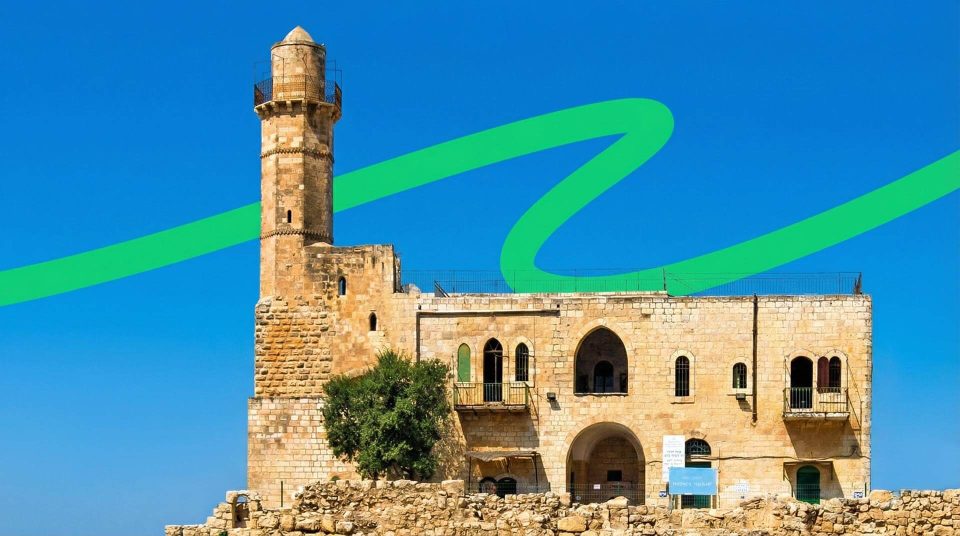
Migdal Tsedek has two distinctive outlines: a fortress on the summit and the stepped faces of former quarries below. Between them lies the site's story, from watching an important road to supplying stone for growing towns. Walk through the old manor's courtyards, look for lime kilns and notice how vegetation has returned to the rehabilitated slopes. The coastal plain stretches beyond, bringing these traces of different periods into a single view.
A hill south of Rosh HaAyin
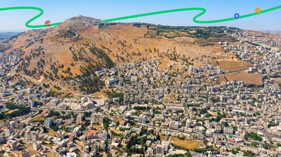
Migdal Tsedek National Park stands south of Rosh HaAyin, on rising ground at the edge of the coastal plain. The fortress can be seen from the vicinity of Road 444; the approach to the main entrance is via Ben Gurion Boulevard. The setting establishes the character of a visit: open ground, uphill walking and long views. Unlike the river landscape of the Yarkon, the story here begins on a dry, stony slope. As you approach the summit, urban development drops below your line of sight and the shape of the plain becomes clearer. Within the park, distinguish the walk to the fortress from the wider routes around the former quarries. They share the same landscape but offer different experiences and require different amounts of energy.
Why the fortress needed this height
The Yarkon springs and marshy lowlands once forced the road along the coastal plain to turn east. Between the wet ground and the hills lay the Afek Passage. Migdal Afek watched it from the higher side, while Tel Afek occupied the area beside the springs. First locate the two on a map, then compare their positions with the view. The military value of the hill lay in observing movement through the landscape, not simply in having a wide panorama. Migdal Afek remains an alternative name for the historical complex known as Migdal Tsedek. Do not combine the two sites across the passage into an image of a single castle: each has its own building history, and the visible structures changed at different times.
Mirabel and the manor house within one complex
1
The Crusader castle
The medieval castle was known as Mirabel. Its summit position made use of the hill's natural advantage. The surviving complex explains why this site was chosen, although it is far from an entirely unchanged Crusader castle.
2
A local ruler’s residence
Sheikh Sadiq al-Jamma'ini later remodelled the fortress remains as a manor house. Residential rooms and courtyards introduced another way of organising the space. Behind the defensive outline is a story of a household, estate management and local power.
3
The work of restoration
Conservation included restoring parts of façades, passages and architectural details. Old photographs helped recover elements of the building's appearance. When looking at carefully finished masonry, allow for the work of conservators rather than assuming that everything visible has survived untouched.
Reading the courtyards and doorways
Inside the complex, the alternation between open courts and roofed spaces is especially revealing. The manor included working courtyards, storage areas and upper-level living quarters. Read the plan through those uses. Where could animals and supplies be kept? Which rooms were separated from the outer courtyard, and how did a passage connect different parts of the house? This is more faithful to the building than imagining a knights' banquet in every room. Door surrounds and lintels deserve a closer look. Some decorative elements were lost and later reconstructed using historical images. You need not expect a museum display in every room: the building itself is the principal evidence. Access to individual rooms and levels follows the permitted visitor route, regardless of whether a staircase or doorway appears open.
Looking across the coastal plain
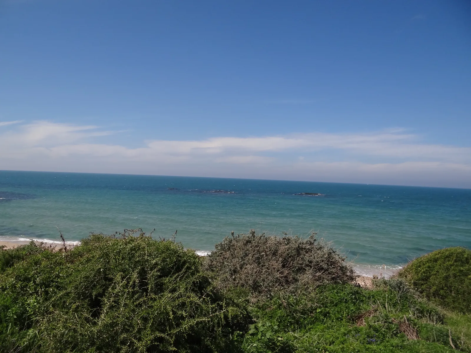
Outside the fortress, the scale changes again. After the courtyards, the view takes in urban neighbourhoods and the broad coastal plain. In clear air, distant landmarks in the Tel Aviv metropolitan area, Gush Dan, may be visible. Haze and lighting affect how far you can see, so a list of distant cities should never become a promise for every visit. For photographs, keep some of the local slope or masonry in the frame to anchor the panorama to this particular hill. The height itself explains the site's strategic role. Roads and lines of development are legible by day; low-angled light picks out the relief of the old quarry faces. Plan around the park's permitted departure time. Photographs of evening lights do not mean a normal visit can always continue after dark.
The Stone Way and another history of Migdal Tsedek
Beyond the fortress, the most distinctive local story is the extraction and processing of stone. The Stone Way passes former quarries and lime kilns. Here, building history begins with its raw materials: before stone became a wall in the growing towns of the coastal plain, it had to be quarried, moved and worked. The straight cuts and stepped faces of the workings differ from a natural slope. Kilns explain another operation, firing stone to produce lime. Seeing the two together helps distinguish quarrying building blocks from making a binding material. This route feels quite different from a walk around an archaeological mound. More recent industrial activity matters as much to the shape of the landscape as the medieval walls above.
What to look for in the former quarries
1
The edge of a working
An exposed cut shows where people changed the shape of the hill. Compare it with the neighbouring slope: straight lines and ledges reveal how material was extracted. There is no need to enter a hazardous hollow to understand the process.
2
Lime kilns
The substantial chambers were built for industrial heating. They served a different purpose from cisterns or burial caves. Look for an explanation of their construction on the information boards; an opening in a kiln is not automatically an entrance for visitors.
3
Returning vegetation
Green growth among the former industrial areas records a new stage in the landscape's life. It has not erased the history of extraction, whose traces the park preserves. The contrast between plants and quarry-cut terrain makes the Stone Way worth exploring in its own right.
From working quarries to national park
- Early twentieth century
The expansion of settlements on the coastal plain increased demand for stone. Quarries and lime production multiplied in the area.
- 1970s
After work ceased, abandoned quarries were used for dumping waste. The industrial legacy became an environmental problem.
- 1994
The fortress was designated a national park. Protecting the historical building provided a starting point for the wider transformation of the area.
- 2005
The park was expanded, bringing a broader landscape around the fortress into the rehabilitation programme.
- 2021
The park reopened to visitors after restoration. The historical hill, former quarries and walking paths became parts of a connected visitor landscape.
Understanding a rehabilitated landscape
Migdal Tsedek does not present the whole area as countryside that people have never touched. Quarrying left hollows and abrupt changes of form; the period of abandonment added pollution. Rehabilitation changed how the place could be used, introducing connected walking routes, restored areas and opportunities to observe the return of vegetation. At the same time, workings and kilns were retained as evidence of labour. A walk is more rewarding when you keep both layers in view. The quarry explains the shape of the ground, greenery shows the developing habitat, and the path lets visitors explore their relationship. Climbing over a barrier to descend into a supposedly more authentic quarry adds nothing to that understanding and may be dangerous.
Choosing a route by what you want to see
- Fortress Way
- Architecture and views
- Choose this for the building and the panorama. Uphill walking is part of the experience, even where the path is well made and does not resemble a rough mountain trail.
- Stone Way
- Quarrying and production
- Kilns, cut quarry faces and rehabilitated ground are the central subjects. Give them a visit of their own, rather than treating the route as an incidental extension of the fortress courtyard.
- Tomb Hill
- Traces of earlier settlement
- North of the fortress, this route adds archaeology to the open slopes. View ancient cavities from the permitted path without climbing down into them.
- Winter pools
- Seasonal habitats
- Seasonal water changes the landscape after rain. Compare this area with the dry slopes nearby; the pools should not be expected to hold water throughout the year.
- Cycle routes
- Exploring the wider landscape
- Designated routes offer another way to explore the wider park. Choose a cycling circuit separately from pedestrian stops at the fortress and kilns.
Tomb Hill and the winter pools
Tomb Hill lies north of the fortress and rewards a more attentive look at the ground. It is a reminder that people lived here before the visible medieval castle. Avoid assigning every hollow to the same period simply because the openings look similar. Signs and the positions of the features explain the archaeology more reliably than an attempt to climb inside. During the rainy season, the winter pools introduce another subject. Temporary filling is normal for these habitats; in summer the same open area can look entirely different. For families, there is a useful question to explore together: why does water remain on one part of a slope and disappear from another? Spring greenery and flowers add to the walk, while the landforms themselves remain worth noticing at any season.
Planning a visit without racing through every trail
- 1
Choose your main interest
For the fortress, allow time for courtyards, doorways and the panorama. If the history of work interests you most, make the Stone Way the centre of the visit. The two subjects call for different walking and looking rhythms.
- 2
Add one nearby route
You might combine your main theme with Tomb Hill or the winter pools, following the routes open on the park map. The full trail list need not become a compulsory itinerary for a single day.
- 3
Allow for the exposed slopes
There is plenty of sun and little continuous shade. Carry enough water and sun protection for the whole circuit. Shoes with a stable grip are particularly useful on the links between the main features.
- 4
Keep energy for the return
The summit panorama is not the end of the journey back to your car. If mobility is limited, choose an appropriate approach and a specific accessible section in advance. A well-surfaced path does not establish accessibility across the entire park.
A landscape for visitors who like to follow the evidence
Migdal Tsedek particularly suits travellers who enjoy working out why a place looks as it does. The summit explains the fortress's position; quarry steps record extraction; a kiln can be compared with a cistern; and new vegetation marks the recovery of industrial ground. Each subject has a visible local example. With children, compare a cut face with a natural slope, then examine the arrangement of a manor courtyard. Photographers can move between very different scales, from a doorway detail to the rounded chamber of a kiln and the wide panorama of the plain. Cooler weather makes several routes easier to combine. In the heat, reduce the exposed connecting walks. The combination of architecture and industrial remains gives the park a character distinct from a straightforward castle stop with a view.
Questions about Migdal Tsedek and its trails
- Are Migdal Tsedek and Migdal Afek different places? They are names for the same historical complex south of Rosh HaAyin. Mirabel was the name of its Crusader castle. For the start of your visit, select Migdal Tsedek National Park rather than nearby Tel Afek, which stands beside the water.
- Is this a surviving Crusader castle? The medieval fabric forms part of a more complex building that was later remodelled as a manor. What you see includes several phases of construction and restoration. Describing every courtyard as an unchanged part of a knights' castle would misrepresent that history.
- What is the Stone Way? It is a route through former quarries and lime kilns, exploring raw-material extraction, lime production and the rehabilitation of an industrial landscape. Its subject is substantial enough to form a distinct part of the visit.
- Do the winter pools always contain water? No. They are seasonal habitats linked to rain. A dry area in summer and a pool during the wet season are two states of the same environment. Summer dryness does not mean that the natural feature has ceased to exist.
- Can I enter the old kilns and tombs? Follow the permitted paths and signs. A visible opening is not confirmation of a safe entrance. The construction of the kilns and the setting of the burial features can be studied from the route and with the help of information diagrams.
- Is the whole park suitable for a stroller? Some routes are developed, but gradients, steps and surfaces vary. Choose a specific suitable section beforehand. Being able to approach the fortress does not mean that movement through all the former quarry areas will be equally straightforward.
- How should I combine the fortress with the quarries? Make one subject your priority and add a suitable section of the other using the park map. First decide how much exposed walking your group can comfortably manage. A long circuit in warm weather calls for a particularly careful assessment of everyone's energy.
Sources
History
The expansion of settlements on the coastal plain increased demand for stone. Quarries and lime production multiplied in the area.
After work ceased, abandoned quarries were used for dumping waste. The industrial legacy became an environmental problem.
The fortress was designated a national park. Protecting the historical building provided a starting point for the wider transformation of the area.
The park was expanded, bringing a broader landscape around the fortress into the rehabilitation programme.
The park reopened to visitors after restoration. The historical hill, former quarries and walking paths became parts of a connected visitor landscape.