At a glance
What awaits you
Visit duration
Not yet provided
Difficulty
Not yet provided
Route length
Not yet provided
Who is it for
Popular visiting hours
Verified busyness data is not available yet
Best time to visit
JanFebMarAprMayJunJulAugSepOctNovDec
BestGoodHot
5-day forecast
Forecast loads when this section is viewed
About this place
Achziv National Park
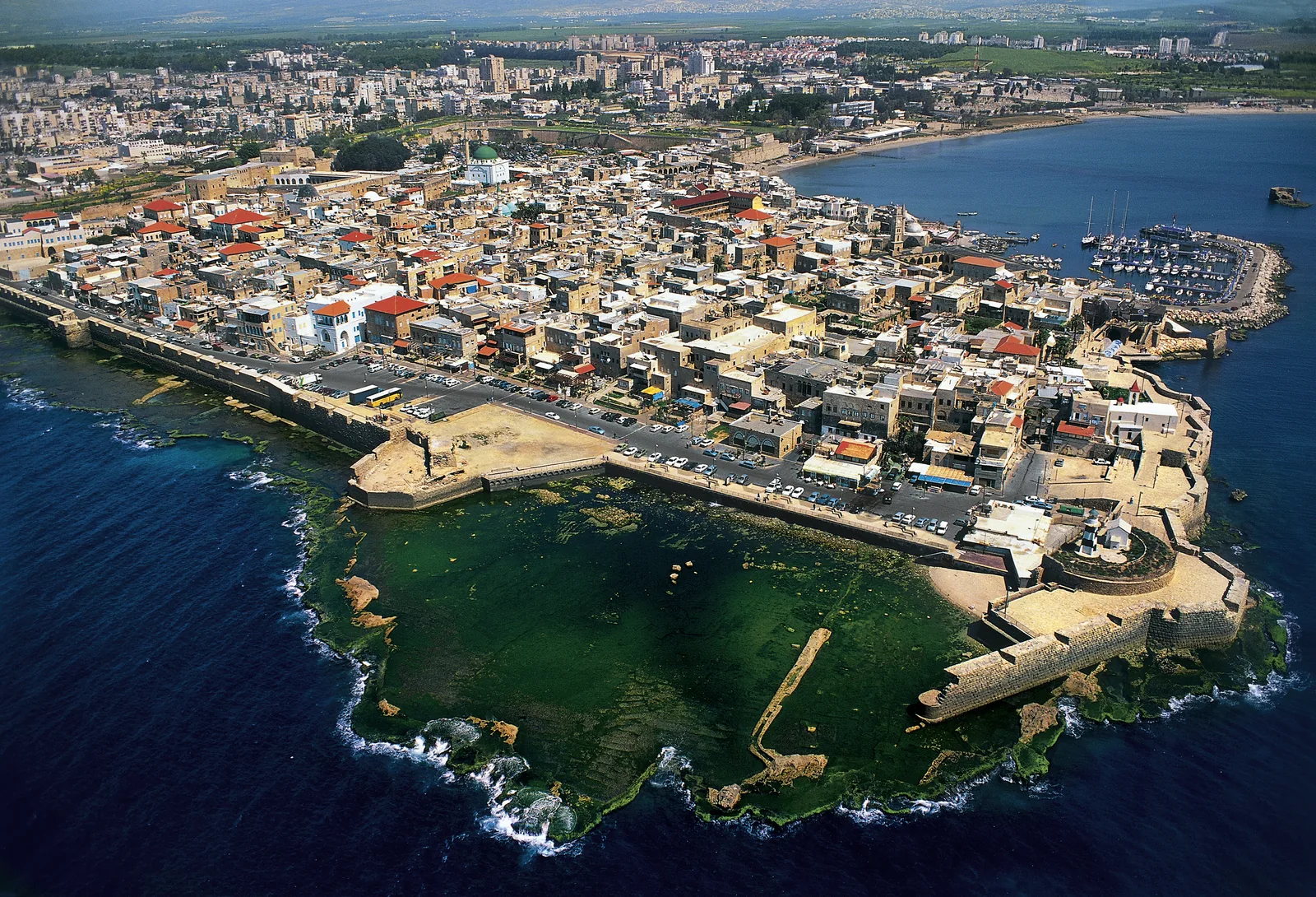
Stone houses rise above a bay, while seawater fills pools between the rocks below. At Achziv, the beach lies beside the mound of an ancient port town and the surviving buildings of az-Zeeb village. A walk here traces the changing uses of one stretch of coast: harbour, home and place of recreation. Begin with a view that takes in both the hill and the sea. The separate ruins and lagoons then become parts of a coherent coastal landscape.
Between Nahariya and the white cliffs of Rosh HaNikra
Achziv lies on the Mediterranean coast of Western Galilee, north of Nahariya. The ancient settlement occupied a hill between two streams: the Kziv reaches the shore to the north, and the Sha'al to the south. The low archaeological mound, rocky waterline and small bays form a continuous landscape. To the north, the mass of Rosh HaNikra closes the view along the coast. Achziv National Park covers a specific part of this shoreline. Neighbouring beaches, the protected marine area and the Rosh HaNikra grottoes have their own boundaries and visiting arrangements. If arriving by car, choose the national park entrance near the Route 4 coastal corridor. A general destination labelled Achziv may lead to another part of the area.
Landmarks along the shore
2 Seawater pools beside the beach
Kziv Stream north of the ancient mound
Kurkar Rock forming the coastal hill
How the Achziv lagoons are formed
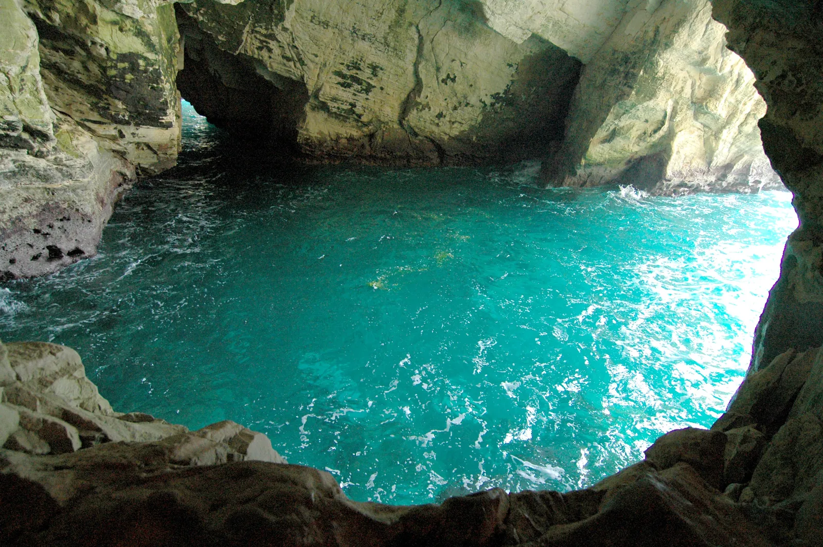
At the water's edge, the defining feature becomes clear. Ridges of coastal rock separate small pools from the open sea, and human work has adapted their shapes. The park description identifies two seawater pools, one shallow and one deep. Achziv's lagoons therefore offer a different setting from a long, even sandy beach: rock barriers, hollows and patches of sand interrupt the line of surf. Kurkar is the local cemented sandstone that forms the coastal hills. Its uneven surface bears the marks of waves and weathering. Rock close to the water can be slippery even when it looks dry. You can examine the pools from the shore by following the outer stone rim and watching how the colour of the water changes over different depths and surfaces. A sheltered appearance does not establish whether swimming is permitted.
Four reasons to explore beyond your beach towel
1
The seawater pools
A view from above helps distinguish the shallows from the darker, deeper area. Look at the rocky boundary between pool and sea. It offers a clear way to understand how natural coastal features were adapted for recreation.
2
The ancient town’s mound
The green surface covers accumulated layers of settlement. Generations built here over the remains of earlier communities. From the hill, it is easier to picture the relationship between the high ground, the coastal road and the harbour below.
3
The buildings of az-Zeeb
The stone houses and mosque belong to the later village on the ancient mound. Their outlines give Achziv its recognisable profile. Large older blocks could be reused, so a single facade does not necessarily represent one building period.
4
Traces of the old harbour
Achziv's ancient harbour lay along the shore beneath the mound. Its remains are more modest than an imagined fortress lined with quays. Look at the position of the bay and the shelter afforded by the coast, rather than expecting a complete port complex.
The history of a coastal settlement
- Middle Bronze Age
Excavations revealed a fortified Canaanite town. Its defences show the importance of this location long before medieval castles or the modern beach recreation area.
- Iron Age
Achziv developed as a Phoenician settlement on the coastal route between Acre and Tyre. Burials and inscriptions help researchers understand its inhabitants' culture and connections with neighbouring towns.
- 701 BCE
Achziv appears in the annals of the Assyrian king Sennacherib. This is written evidence for the town that is distinct in character from the biblical account of the territory of the tribe of Asher.
- Roman and Byzantine periods
The settlement was known by forms of the name Ecdippa, and written sources describe a road station. Its coastal position connected maritime activity with overland travel.
- Crusader period
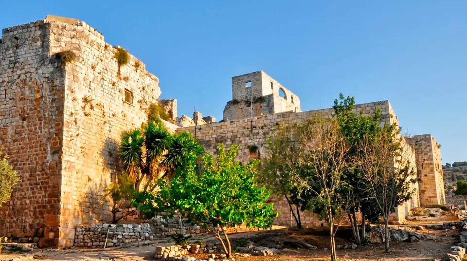
The fortified settlement of Casal Imbert stood here. A medieval vaulted structure survives among later buildings, but visitors should not expect an entire Crusader castle beside the sea.
- 1948
The Arab village of az-Zeeb was depopulated during the fighting. Its surviving houses recall the lives of the villagers and represent a separate, more recent chapter in the history of the site.
What the houses on the hill reveal
Distinguish the visible village buildings from the archaeology beneath them. Most of the standing stone houses belong to az-Zeeb, while much of the Canaanite and Phoenician settlement remains below ground. Villagers worked in fishing and agriculture; the sea formed part of their everyday economy. The domed mosque is a useful landmark in the village skyline. Builders used local stone, sometimes incorporating materials from earlier structures. These combinations make the changing use of the same coastal site especially tangible. From the permitted passages, examine the arches, wall thicknesses and the buildings' positions in relation to the sea. Do not assume every room can be entered. A historic house used for administration does not automatically function as a museum gallery.
Maritime trade and Phoenician evidence
The harbour helps explain why people continued to settle on this hill for so long. The meeting of a sea route and a coastal road offered opportunities to exchange goods, serve travellers and pursue local trades. Burials found nearby, containing pottery and Phoenician inscriptions, add to the picture of the town. Their importance depends on archaeological context: they provide evidence of language, funerary practice and material culture. Some findspots lie outside the ordinary park walk, and visitors should not seek out entrances to rock-cut tombs independently. Stone objects moved to the shore for display also need to be read with their labels. An olive-crushing stone beside the sea, for example, explains agricultural processing. Its present position does not prove that an olive press operated on that exact spot.
The rocky shore as a living habitat
The narrow strip between land and sea is exposed to changing combinations of salt spray, wind, waves and sunshine. Plants suited to these conditions grow in cracks in the coastal rock. Small pools and hollows allow visitors to observe marine life without collecting it. Leave rocks with attached organisms in place, and keep animals in the water. The protected Achziv coastline is also associated with sea turtle nesting. Seeing turtles is not part of a guaranteed visitor programme, and a nesting area is not an observation stand. Barriers and staff instructions take priority over getting a closer view. Pause on a permitted path and study one small section of shore. Its variety is easy to miss when moving quickly from beach to beach.
Choosing your kind of day at Achziv
- A history-focused walk
- The mound and village buildings
- Start with the mound, surviving houses and the position of the ancient harbour. Knowing the settlement's history makes the shoreline easier to understand. This visit can be rewarding without any plan to enter the water.
- Time beside the sea
- Seawater pools
- Identify the authorised swimming area and the lifeguard arrangements that apply to your visit first. Pools, lawns and coastal paths offer different experiences; the entire shoreline should not be treated as one supervised beach.
- Observation and photography
- Coastal shapes and silhouettes
- Photograph the combination of rocky edges, water and houses on the hill. Small details of the shore complement a broad sea view. There is no need to step onto wave-washed rocks for a picture.
- An overnight stay in a tent
- A managed camping area
- The national park has an organised campsite. Overnight stays follow separate arrangements set by the operator. A day visit does not automatically permit you to remain after the park closes.
Connecting the sea and the settlement on foot
- 1
Look at the hill from the landward side
Notice its height above the shore and the positions of the old buildings. This helps distinguish the archaeological mound from modern landscaping and beach facilities.
- 2
Examine the buildings before approaching the water
Read the arches and stone facades as parts of a settlement. Look beyond one overall photograph of the dome: individual walls reveal differences in materials and construction.
- 3
Find a clear view across the bay
Relate its shape to the position of the ancient harbour. Consider where a vessel might find shelter and where the coast faces the open sea directly. You can make that comparison without climbing down to structural remains.
- 4
Allow time for the rocky waterline
From a permitted path, look closely at the small pools and coastal plants. Beach time and a historical walk complement each other without requiring a circuit of the whole coastal area.
A shallow lagoon is still connected to the sea
Picnics, tents and sea wind
Picnic space is an important part of Achziv, but a coastal stop involves different conditions from a rest in woodland. Wind and salt spray are more noticeable, and loose belongings can quickly blow away. For a day visit, bring a source of shade, drinking water and footwear comfortable for the walk between lawn and rocky shore. Campers should confirm pitch arrangements and which facilities will be operating. A night by the sea calls for a securely pitched tent; completely still weather should not be assumed. Keep food and packaging contained so they cannot end up on the shore. Fires and cooking are governed by the rules of designated areas. Open space beside the sea does not grant permission to camp or cook wherever you choose.
The coast through the seasons and its neighbours
In warm weather, visits often revolve around the water, but exposed areas heat up quickly in the sun. In spring, the green mound contrasts with the sea, and exploring the old buildings can become the main activity. Cooler months bring interest in waves and the patterns of the rock. On stormy days, watch from a safe distance rather than approaching the spray. Nearby Rosh HaNikra offers a different coastal landscape of pale cliffs and sea grottoes. Achziv focuses attention on a low shore with a settlement and harbour. Akhzivland, associated with Eli Avivi, is another separate neighbouring site. These names should not be combined into one assumed admission ticket or a promised continuous visitor route. Choose Achziv according to the kind of day you want: history on the hill, time by the pools or a close look at the meeting of stone and water.
Questions before visiting Achziv
- Where is the national park? On the Mediterranean coast of Western Galilee, north of Nahariya. Choose the entrance to Achziv National Park, also listed as Akhziv National Park, in your navigation app. Nearby beaches and Akhzivland may have different approaches.
- Are the lagoons entirely natural? They are based on the coastal rock formations, but human work has also shaped the pools. The official description distinguishes a shallow seawater pool from a deeper one. Their depths should not be treated as identical.
- Can I plan to swim with children? Only if swimming is permitted and conditions on the day allow it. Shallow water does not replace adult supervision or the required lifeguard service. Calm water in an old photograph cannot establish that swimming will be safe.
- What remains of the ancient town? The archaeological mound and traces of the harbour survive; the later village buildings are more prominent above ground. Do not expect a fully preserved Phoenician port or an entire medieval castle.
- Is a visit worthwhile without swimming? Yes. You can examine the stone houses of az-Zeeb, the position of the ancient settlement, the bays and the coastal rock. The historical walk reveals how people lived beside the sea before the modern recreation area was created.
- Can visitors stay overnight? The park has an organised campsite. Confirm accommodation conditions, reservation arrangements and operating facilities separately. Ordinary day admission does not authorise an overnight stay on any part of the coast you choose.
- Are Achziv and Rosh HaNikra one attraction? No. They share the same coastal region, but the national park with its pools and the site beside the white cliffs are separate. Plan access, admission and time for each independently.
Sources
History
Excavations revealed a fortified Canaanite town. Its defences show the importance of this location long before medieval castles or the modern beach recreation area.
Achziv developed as a Phoenician settlement on the coastal route between Acre and Tyre. Burials and inscriptions help researchers understand its inhabitants' culture and connections with neighbouring towns.
Achziv appears in the annals of the Assyrian king Sennacherib. This is written evidence for the town that is distinct in character from the biblical account of the territory of the tribe of Asher.
The settlement was known by forms of the name Ecdippa, and written sources describe a road station. Its coastal position connected maritime activity with overland travel.
The fortified settlement of Casal Imbert stood here. A medieval vaulted structure survives among later buildings, but visitors should not expect an entire Crusader castle beside the sea.
The Arab village of az-Zeeb was depopulated during the fighting. Its surviving houses recall the lives of the villagers and represent a separate, more recent chapter in the history of the site.