At a glance
What awaits you
Visit duration
Not yet provided
Difficulty
Not yet provided
Published access covers parking, service centre, toilets and En Gev room; access throughout all ruins is not confirmed.
Route length
Not yet provided
Who is it for
Popular visiting hours
Verified busyness data is not available yet
Best time to visit
JanFebMarAprMayJunJulAugSepOctNovDec
BestGoodHot
5-day forecast
Forecast loads when this section is viewed
About this place
Susita (Hippos) National Park
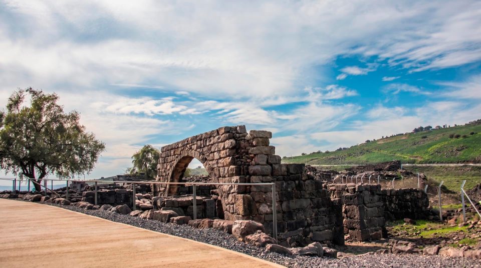
Ancient Susita’s main street runs along the summit towards a blue strip of the Sea of Galilee. Basalt paving lies underfoot, fallen columns surround the square and steep slopes begin just beyond the city walls. Here above the eastern shore, the value of level ground and reliable water becomes easy to understand. Hippos was built as a fully developed ancient city, with a forum, public halls, a water supply and a performance venue. Christian churches later took their place among the same streets.
The city’s scale and its destruction
about 500 mLength of the main street
749 CEEarthquake that devastated the city
1999 CEMajor University of Haifa expedition begins
The summit above Ein Gev
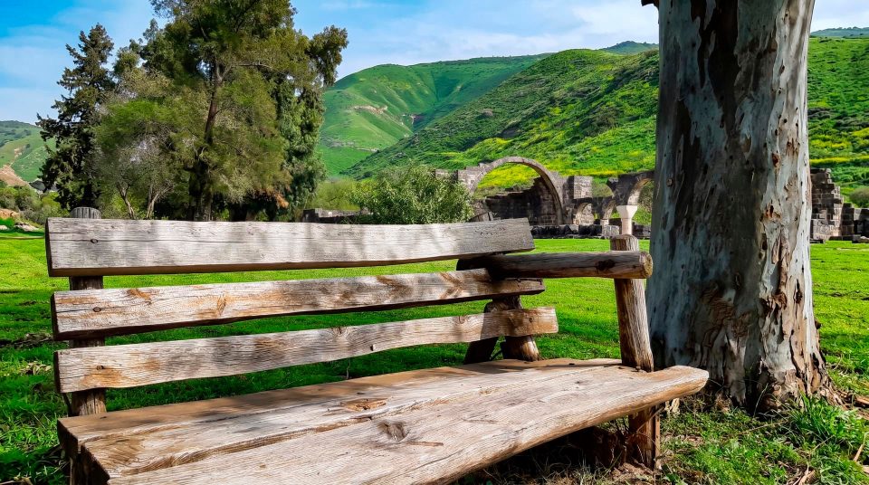
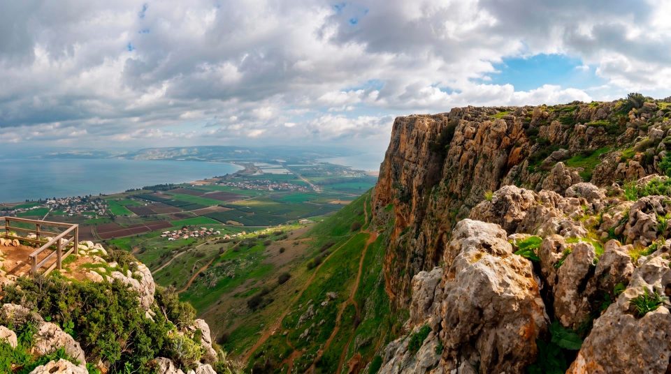
Susita (Hippos) National Park lies east of Ein Gev, on a distinct, elongated summit above the Sea of Galilee, or Lake Kinneret, along the western slopes of the Golan Heights. A narrow connection to higher ground lies on the eastern side. An important city entrance stood here, while steep slopes protected the other sides. From below, the hill appears as a separate mass; on top, it opens into a long platform once densely occupied by buildings. Ancient Hippos looked both towards the lake and towards routes through the eastern uplands. Its Greek name, Hippos, and the name Susita are both associated with a horse. The usual explanation links them to the shape of the summit.
Follow the decumanus through the city
The principal street runs east–west and is known as the decumanus maximus. Use it to make sense of the walk, moving from the entrance area towards the square and then through the city. The ancient street’s length of about 500 metres describes that structure alone, rather than a full visitor route with approaches and side branches. Give the paving some attention. Its surface, water infrastructure and junctions with side streets reveal the practical workings of a city that can be easy to overlook among the columns. The Susita decumanus linked public buildings and residential quarters. Narrow cross streets led towards houses fitted onto the limited summit area. Following their junctions is one way to understand the town beyond its most prominent monuments.
The civic centre and its different buildings
1
The forum
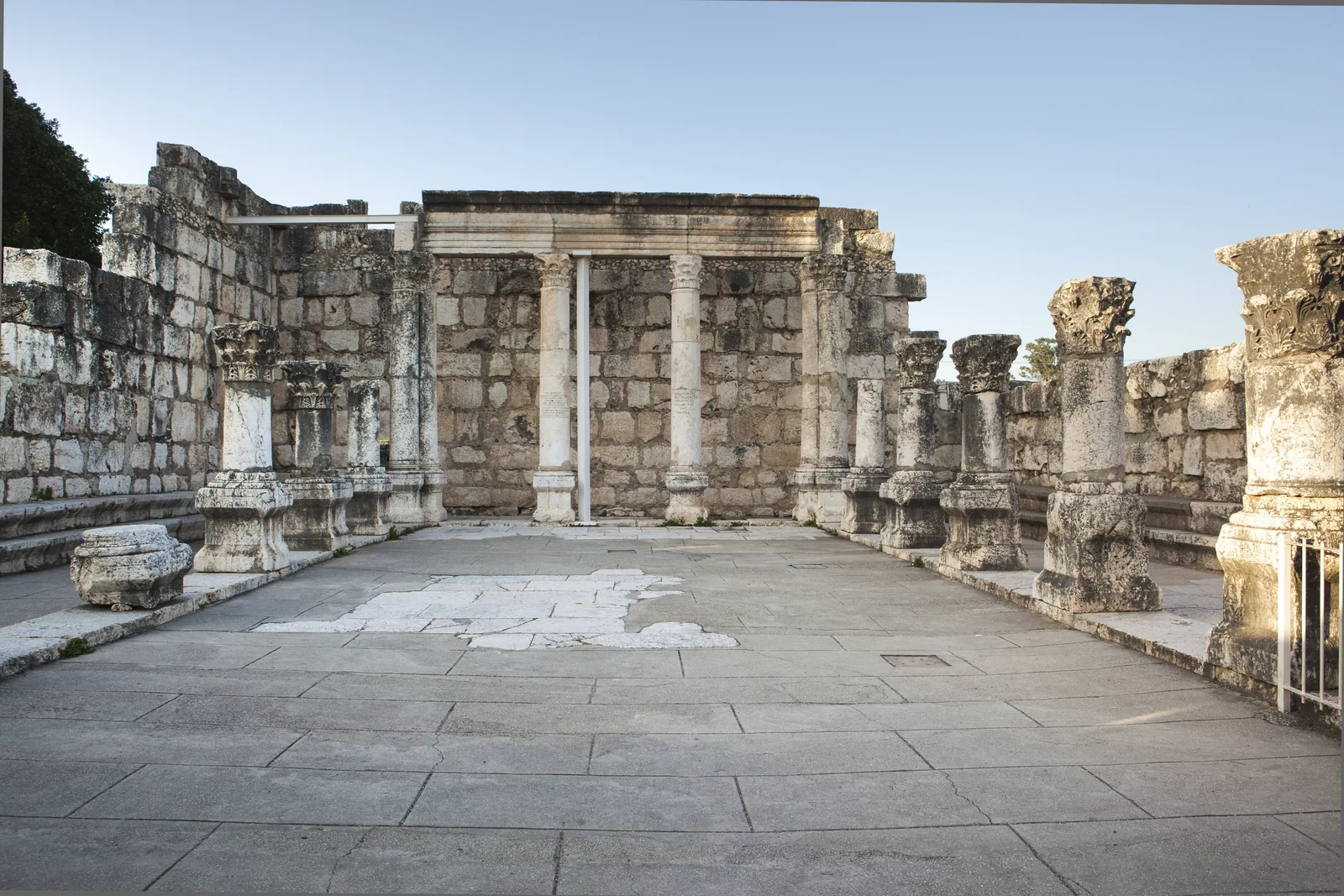
An open paved square provided a public gathering place. Columns and architectural fragments survive around it. Look at how the square meets the street: movement through the city gave way here to meeting, pausing and public activity.
2
The civic basilica
A roofed public hall stood beside the forum. Here, “basilica” describes an ancient building type and does not automatically mean a Christian church. Surviving supports and capitals help you imagine a covered space next to the open square.
3
The kalybe
A monumental building with a niche has been investigated west of the forum. It is interpreted as a kalybe associated with the imperial cult. Earlier researchers considered it a nymphaeum, or ornamental fountain. Its changing interpretation is a useful reminder that an impressive appearance does not settle a ruin’s function.
4
The vaulted reservoir
An underground tank near the square preserves a striking vault. It introduces the storage side of the water system before attention turns to the long-distance supply. An ancient staircase does not establish unrestricted visitor access. Viewing depends on the permitted route.
Reading the fallen columns
Grey granite columns stand out against the dark basalt around the forum. Close inspection reveals shafts, bases, capitals and fragments of cornice, each part of an architectural order. Think of them as components of a real building, rather than isolated pieces of sculpture. One carried weight, another finished a wall and another framed an opening. The columns and ruined rooms belong to a history that includes earthquakes. Their present arrangement, however, should not automatically be taken as an untouched record of a single moment of destruction. Site interpretation can help distinguish a fragment left where it fell from a reassembled structure. Around the square, the city’s formal public architecture can be considered alongside the practical work of construction: how stones joined, what supported a roof and how the edges of an open space were finished.
Supplying a summit city without a spring of its own
Reliable water was essential to the growth of a settlement on this summit. Rainwater collected in cisterns and reservoirs was supplemented in the Roman period by an aqueduct bringing water from distant sources. Surviving basalt pipe sections are particularly instructive. Stone blocks, each bored through the middle, were joined to form a closed conduit. Across a dip in the terrain, the builders used an inverted siphon: water descended through a sealed pipe and rose towards the city under pressure provided by the difference in elevation. That allowed the supply to cross the saddle where a simple open channel would have required a different structure. Within the built-up area, branches distributed water to buildings. The network connected the surrounding landscape with streets and houses. Beside the path, a stone pipe section can easily be mistaken for part of a column. Its central opening and the way the sections joined identify it as infrastructure. There is no need to enter closed tanks or service cavities to understand how the system worked.
A Christian city within the earlier street plan
1
The Northwest Church
The church occupied an area of an earlier religious compound, reusing stone from previous buildings. Nearby excavations revealed workrooms, wine-production installations and an olive press. The church quarter included food processing and storage as well as worship.
2
The Northeast Church
This compact place of worship stood among houses. Burials were found near the sanctuary. The discovery of a woman in a sarcophagus does not, by itself, justify calling it a saint’s tomb. That identification would require additional evidence.
3
The cathedral complex
A large church and baptismal hall reflect the period when Hippos was an episcopal centre. Look at the rows of columns dividing the hall, the sanctuary at the east and the layout of the baptistery. Its religious function distinguishes it from the Roman civic basilica.
4
Mosaics and inscriptions
Geometric patterns and texts naming donors add people to the architectural plans. They record spending, remembrance and community participation. Individual floors differ in preservation and accessibility. View them from the designated positions.
From Hellenistic city to archaeological excavation
- The Hellenistic period
A fortified city develops on the summit. Its position allows control of the approaches, while public squares, sanctuaries and water-storage facilities provide the foundations of urban life.
- The Roman period
Hippos belongs to the group of cities known as the Decapolis. Streets and public buildings are renewed, and the water supply develops. Its connections reach far beyond the nearest stretch of lakeshore.
- The Byzantine period
Church complexes appear within the existing city. Christian life occupies the already developed summit and reuses some stone from earlier buildings. The older urban fabric is transformed gradually, rather than disappearing all at once.
- 749 CE
A powerful earthquake devastates Susita. The city is not rebuilt on its former scale. Its ruined complexes become central to the archaeological landscape seen today.
- 1951–1955 and 1999
Claire Epstein’s rescue excavations first investigate the cathedral complex. In 1999, a major University of Haifa expedition begins, revealing the urban plan much more fully.
Distinguishing the structures as you walk
- Forum and basilica
- An open square and a roofed hall
- Both belong to the Roman civic centre. The square is defined by its open space and relationship with the street; the hall by its supports and roof. The name basilica does not place it in a Byzantine church quarter.
- Odeon and large theatre
- Different scales of performance
- Susita’s odeon was an intimate space designed to be roofed. It is associated with music and recitation. Do not expect a large amphitheatre with an arena.
- Cistern and aqueduct
- Storage and supply
- One stored water; the other brought it from outside the city. Considering them together explains why collecting rainwater alone became insufficient for an expanding urban population.
- An excavated feature and an open passage
- Different rules of access
- A room may have been excavated and described without forming part of the visitor route. This matters particularly for reservoirs, sections of churches and slopes outside the urban core.
A small hall for music and the spoken word
The odeon lies in the western part of the civic centre. Its semicircular arrangement helps you imagine an audience facing a small performance area. In Roman cities, buildings of this kind hosted music, readings and competitions in which voice and audibility mattered more than the scale of the spectacle. The roof is gone, and the open landscape can make the original enclosed setting easy to forget. Try mentally removing the distant horizon and restoring the hall’s interior volume. Some of the stone was reused elsewhere over time. The surviving outline and reconstruction therefore explain the form more reliably than counting the seats visible today. Look back towards the forum from the odeon. Quite different types of public space were fitted together within a very restricted area.
Courtyards and work behind the public buildings
Side streets draw the eye towards residential quarters. Byzantine houses commonly arranged rooms around a courtyard where some everyday work took place. Cisterns beneath houses stored water. Cooking, storage and movement between levels all required careful use of limited ground. Wine vats and oil-processing installations beside the Northwest Church broaden the familiar image of an archaeological town. People worked here, processed harvests and supplied food to its inhabitants. At a plastered basin, look for the route by which liquid moved from the processing area to the collecting tank. Steps inside allowed workers to service and clean it; they do not make it an ancient bathing pool. Comparing a formal square with a workroom gives the city more depth. Public representation, religious observance, labour and domestic life all occupied the same summit.
Build your walk around the city’s layout
- 1
Understand the entrance
On the permitted approach, notice how the summit connects with the eastern uplands, then locate the main street on the plan. Navigate to the designated visitor entrance instead of trying a shortcut across the slope.
- 2
Connect the water system with the civic centre
Look at engineering details along the decumanus, then compare the columns and buildings around the forum. The reservoir becomes part of a functioning urban system, rather than an isolated underground curiosity.
- 3
Choose branches into churches and houses
Use only the open areas shown on the visitor plan. Studying one accessible church complex and courtyard is more rewarding than hurrying towards every excavation mentioned in publications. Save the lakeshore panorama for a safe viewpoint.
An exposed summit sets the pace
Susita’s position above the Sea of Galilee offers wide views, but the archaeological remains should not be expected to provide continuous shade. Stone reflects heat, and pauses beside inscriptions and mosaics extend the time spent outside. Cooler weather makes architectural details easier to study; after rain, uneven paving needs care. Bring stable, closed footwear, drinking water and sun protection. Low walls are not walking surfaces, and fallen columns should not be used as seats for photographs. Keep back from the edge of the summit. Follow official directions for the park’s driving approach. Older accounts of road conditions from Ein Gev or Afik are not a current access map. Check admission arrangements, entry times and access to individual underground features before travelling. In a day along the eastern shore, Susita provides an urban and historical focus. Going down to the water is a separate part of the itinerary.
Questions about Susita and ancient Hippos
- Are Hippos and Susita different places? No. They are names for the same ancient city above the eastern shore of the Sea of Galilee. Both are associated with a horse. Sussita is another spelling found in modern guides; Hippos is the Greek name.
- Is the city right beside the shore? The ruins occupy a summit east of Ein Gev, above the lake. A visit involves an approach to the archaeological site, rather than a walk along the water. A short distance from the shore on a map does not mean level ground.
- What is a decumanus? It is the name for a principal east–west street in an ancient city. At Susita, it links different areas and helps you follow the plan. About 500 metres is the length of the street itself, rather than the full walk.
- Was the basilica beside the forum a church? Here, the term refers to a Roman civic building, a roofed public hall. The Byzantine churches belong to another phase of the city’s history. Shared architectural terminology does not imply a shared purpose.
- Can I enter the reservoir on my own? Only if that visit is explicitly included in the open visitor route. Ancient steps and photographs of the interior do not establish permission to descend. Barriers and instructions on site take priority.
- Did the earthquake of 749 leave every ruin as it is today? The disaster was decisive, but the city had changed before it and was later excavated and conserved. A single event cannot explain every alteration to a building or the current position of every stone.
- What might children find most interesting? Follow the route of water through a stone pipe, find the main street and compare an open square with a roofed hall. These simple investigations make the ruins easier to understand. Adults should stay close on uneven paving and near the slopes.
Sources
History
A fortified city develops on the summit. Its position allows control of the approaches, while public squares, sanctuaries and water-storage facilities provide the foundations of urban life.
Hippos belongs to the group of cities known as the Decapolis. Streets and public buildings are renewed, and the water supply develops. Its connections reach far beyond the nearest stretch of lakeshore.
Church complexes appear within the existing city. Christian life occupies the already developed summit and reuses some stone from earlier buildings. The older urban fabric is transformed gradually, rather than disappearing all at once.
A powerful earthquake devastates Susita. The city is not rebuilt on its former scale. Its ruined complexes become central to the archaeological landscape seen today.
Claire Epstein’s rescue excavations first investigate the cathedral complex. In 1999, a major University of Haifa expedition begins, revealing the urban plan much more fully.