At a glance
What awaits you
Difficulty
Not yet provided
The approximately 600 m vulture trail is accessible; this does not extend automatically to the waterfall and ancient-city routes.
Route length
Not yet provided
Who is it for
Popular visiting hours
Verified busyness data is not available yet
Best time to visit
JanFebMarAprMayJunJulAugSepOctNovDec
BestGoodHot
5-day forecast
Forecast loads when this section is viewed
About this place
Gamla Nature Reserve
From Gamla’s upper trail, the ruined town clings to a narrow ridge, with steep ravines falling away on either side. Griffon vultures may be circling above the cliffs; out on the plateau, another path leads past dolmens to a waterfall. Decide which part of Gamla Nature Reserve matters most to your visit: descending to the ancient town, watching birds or walking above the canyon. Each calls for a different level of effort.
A town on a camel’s hump
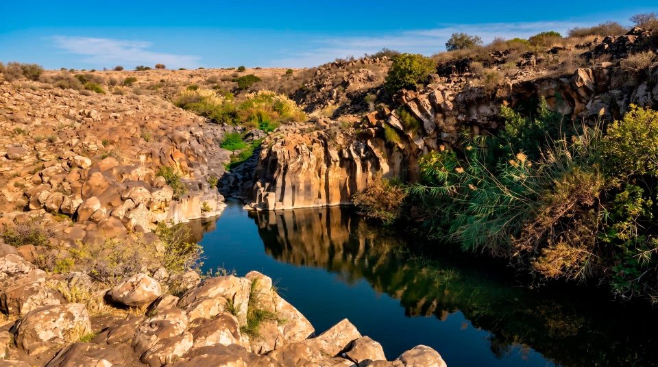
Gamla Nature Reserve lies in the Golan Heights, northeast of the Sea of Galilee, also known as Lake Kinneret. The landscape unfolds in distinct levels: an open plateau, deeply cut stream valleys and a rocky ridge projecting between them. The town’s name is associated with the word for camel, and its hump-like outline is particularly clear from the upper lookout. Start by taking in that whole landform. The position of the defensive wall and the tightly packed residential quarters then make more sense than they would from a single stone down among the ruins. The lake belongs to the wider panorama, but Gamla itself is an inland reserve, rather than a lakeside promenade. The drive in, the walk across the plateau and the descent to the excavations are separate parts of a visit.
Where to focus your visit
1
The ancient town lookout
The viewpoint above the ridge reveals the arrangement of the ruins and the one relatively approachable side of the town. It makes a useful first stop even if you intend to descend. From here, the wall, tower and synagogue become parts of a single, understandable plan.
2
The canyon lookout
Birds of prey nest on the rocky ledges. Give yourself time to scan the cliffs and the space above them, rather than hurrying on to the next landmark. Binoculars help distinguish distant silhouettes. Whether vultures appear nearby depends on the birds themselves.
3
The waterfall and dolmens
A walk across the plateau introduces a much older burial landscape. Large stone slabs form monuments that predate the ancient town; farther along, water drops from a rock shelf into a deep valley. Both the terrain and the focus of this outing differ from the descent to the excavations.
Everyday life in ancient Gamla
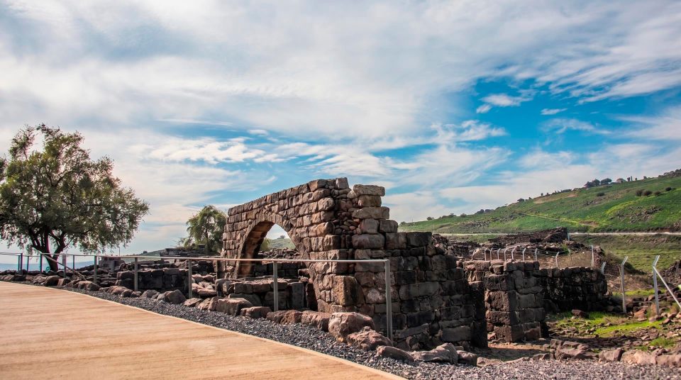
Gamla was a hillside town, with homes, a communal building and a working economy. Its surviving neighbourhoods show how people made use of restricted space. Buildings stepped down the slope, adapting to the bedrock beneath them. The defensive advantages were clear, but during wartime the natural obstacles had to be reinforced with a wall. Along the accessible side of the ridge, fortifications incorporated buildings that were already there. For anyone interested in urban archaeology, this relationship between an ordinary settlement and hastily strengthened defences is particularly revealing. The lookout gives you the overall pattern; among the ruins, masonry, thresholds and internal partitions bring it into focus. Read the low walls as the ground plans of lost houses. Fully reconstructed streets are not what survives here.
A synagogue from the Second Temple period
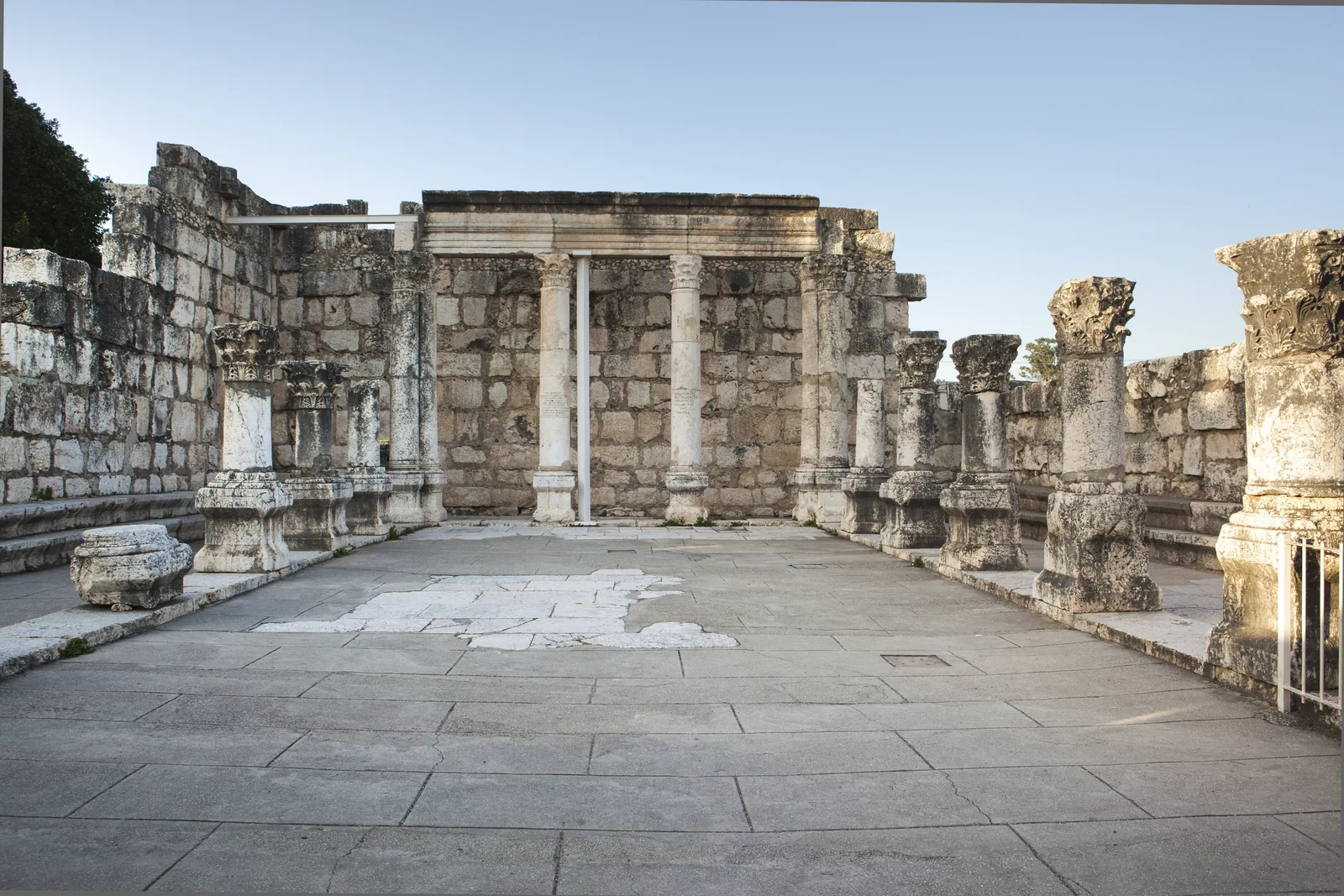
The Gamla synagogue stands near the edge of the ancient town and is dated in the visitor account to the early first century CE. It offers a rare chance to examine a Jewish communal building that was in use before the destruction of the Second Temple. The hall’s layout and stone seating help you picture a gathering of townspeople. Nearby was a mikveh, a pool used for ritual immersion; seeing the two together makes their place in communal life easier to understand. Pause to reconstruct the scale of the room from its surviving outline. This is an early stage in the synagogue’s architectural development, so features of later Galilean synagogues should not simply be assumed here. Its importance lies in its date, surviving plan and connection to a town destroyed in war, rather than in elaborate decoration.
From settlement to archaeological site
- The Hellenistic period
Following earlier occupation, the site was settled again in the mid-second century BCE. Over time, the town whose remains you see today developed on the steep hillside.
- Early first century CE
The synagogue is assigned to this period in the visitor account. Its remains preserve evidence of public and religious life before the town’s destruction.
- 66–67 CE
Gamla joined the revolt against Rome. After a siege, Vespasian’s forces took the town in 67 CE. It was never rebuilt.
- 1968
The ruins were identified again as ancient Gamla. Subsequent research allowed archaeological discoveries to be compared with Josephus’s account of the war.
Understanding the siege beyond the Masada comparison
Josephus provides the principal ancient narrative of the siege. His description of the precipitous slopes helps explain the terrain, although his figures for troop numbers and casualties need critical scrutiny. Archaeology contributes physical evidence through fortifications, traces of destruction and objects associated with the fighting. Popular accounts often compare Gamla with Masada. That conveys the tragedy of its end, but obscures important differences between the two places. Gamla was an inhabited town whose defences were strengthened during war, and fighting took place in its streets. Look for the ways military preparations were fitted into an existing urban environment. A view from the saddle and another down over the crowded houses explain this history more clearly than the heroic nickname “Masada of the North” alone.
Griffon vultures above the canyon
Gamla’s canyons are known as griffon vulture habitat. These large birds ride rising air currents and can soar along the cliffs for long periods. Choose a secure stopping place on the permitted lookout trail. Scan the ledges first, then the sky above the valley. Binoculars make a distant bird easier to identify, while a long lens is useful for photography. Vultures feed on carrion and play an important ecological role, but their appearance at any particular viewpoint cannot be scheduled around a visit. Numbers vary, so a large colony in view on every outing should never be promised. Even without a close sighting, the shape of the canyon helps explain the conservation value of its sheer ledges and the open air above them.
Gamla’s dolmens and the older plateau
Along the waterfall trail, dolmens introduce another period of the plateau’s history. These burial structures were built from large stone slabs. A capstone rests on upright supports, leaving a stone chamber beneath it, rather like a very heavy table. They belong to the Bronze Age and are considerably older than the town of Gamla. The contrast is striking after looking at the town: scattered megalithic monuments occupy open ground, far from the tightly fitted houses on the slope. Their funerary purpose is interesting enough without presenting them as proven altars or the homes of giants. Compare the size of the slabs, the way they were assembled and the position of each chamber in the landscape. Climbing onto a capstone for a photograph puts unnecessary strain on an ancient structure. Examine it from the trail instead.
Viewing Gamla Waterfall across the gorge
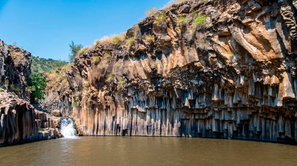
Gamla Waterfall drops from a ledge 51 metres high. Take in the canyon walls as well as the water to appreciate the scale: a slender fall becomes part of a much larger section through the rock. The trail leads to a viewpoint, rather than to an equipped swimming spot at the foot of the falls. The bridge over the stream above the drop and the lookout facing the waterfall offer different views; crossing the bridge does not replace the walk to the lookout. Flow is generally stronger after the wetter season and can diminish considerably in dry weather. That variability is part of this landscape. Much of the approach crosses an open plateau, where sun and wind can feel stronger than photographs of the green gorge suggest. Allow for an out-and-back walk in its own right, rather than a brief detour beside the entrance.
Choosing between Gamla’s walks
- The upper viewpoints
- Panoramas and birdwatching
- See the town’s ridge and the canyon, with time to watch for birds. This gives you an understanding of the reserve’s layout without committing to the descent to the ruins.
- The ancient town
- Hillside archaeology
- A steep, stony trail brings you close to the synagogue, residential quarters and fortifications. Factor in the climb back before you start down, particularly if you have knee problems.
- The dolmens and waterfall
- Megaliths and the stream valley
- The plateau trail crosses an older burial landscape and ends with a view of the waterfall. Exposed stretches call for sun protection and enough drinking water.
- Combining the walks
- A fuller day on foot
- Adding the waterfall outing to the town descent substantially increases the day’s exertion. Choose a combination that suits your group, with separate time set aside to examine the monuments.
The upper trail and a later settlement
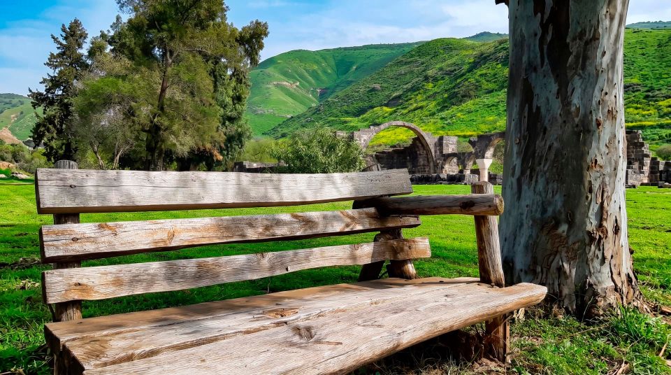
Near the reserve’s lookout area are the remains of Deir Qeruh, a settlement later than the ancient town destroyed on the ridge below. They show that the surrounding area continued to be inhabited after the Roman siege, even though Gamla itself was never rebuilt. From the upper trail, you can compare different uses of the same terrain: settlement on the plateau, the older town below and cliffs occupied by birds. This works well for a group with varied interests. Some can study the town plan from above while others watch the canyon or look at the reserve’s natural surroundings. Keep the distinction between a viewpoint walk and a visit to the synagogue down on the ridge. If the archaeology of the early town is your main reason for coming, a distant overview will only be a starting point.
Seasons, light and the exposed plateau
In winter and spring, green vegetation picks out the contours of the ridge and the waterfall is often more prominent. Rain can make both the stones on the descent and the plateau’s soil treacherous underfoot. In summer, exposed ground heats up quickly. Water deep in the canyon tells you little about conditions on a long walk above it. In clear weather, photographs can explore several scales, from the town’s outline to individual walls and a bird against the opposite slope. There is no need to approach an unprotected edge for a wider frame. With children, choosing one clear theme, such as how the town worked or how vultures fly, can be more rewarding than attempting every branch of the trail. Get the available trail map and any operational restrictions from reserve staff before setting out. A historical description cannot serve as a route map.
Keep your distance from cliffs and birds
Questions about visiting Gamla
- Where is Gamla Nature Reserve? It is in the Golan Heights, northeast of the Sea of Galilee. The town ruins lie below the upper viewpoints, on a steep ridge between ravines. A visit here is an inland outing, rather than a walk along the lakeshore.
- Can I see the town without descending? Yes. The upper lookout reveals its setting and overall plan. To examine the synagogue and neighbourhoods at close quarters, you need to descend and then climb back up. That is a considerably more demanding walk.
- Why is Gamla compared with Masada? Both are associated with resistance to Rome, but Gamla was an inhabited town where heavy fighting took place. “Masada of the North” is a nickname, not a precise account of the events or the settlement’s layout.
- How old is the Gamla synagogue? The visitor account dates it to the early first century CE, before the Romans destroyed the town in 67 CE. It is an important Second Temple-period synagogue. A ritual immersion pool stood nearby.
- Can I swim at Gamla Waterfall? The walk leads to a viewpoint above the canyon. It should not be planned as a descent to a swimming pool. The waterfall drops 51 metres, and the strength of its flow depends on the season and rainfall.
- Are vultures guaranteed at the lookout? No. Gamla is important vulture habitat, but the birds’ whereabouts and movements vary. Binoculars help with distant silhouettes. Approaching nesting cliffs for a closer look is not permitted.
- Should I visit both the town and waterfall in one day? That depends on the weather and your group’s stamina. The steep descent to the town and the exposed plateau trail make different demands. Choose one walk and enjoy it fully if combining both would leave you rushing.
Sources
History
Following earlier occupation, the site was settled again in the mid-second century BCE. Over time, the town whose remains you see today developed on the steep hillside.
The synagogue is assigned to this period in the visitor account. Its remains preserve evidence of public and religious life before the town’s destruction.
Gamla joined the revolt against Rome. After a siege, Vespasian’s forces took the town in 67 CE. It was never rebuilt.
The ruins were identified again as ancient Gamla. Subsequent research allowed archaeological discoveries to be compared with Josephus’s account of the war.