At a glance
What awaits you
Visit duration
Not yet provided
Difficulty
Not yet provided
Route length
Not yet provided
Who is it for
Popular visiting hours
Verified busyness data is not available yet
Best time to visit
JanFebMarAprMayJunJulAugSepOctNovDec
BestGoodHot
5-day forecast
Forecast loads when this section is viewed
About this place
Majrase (Betiha) Nature Reserve
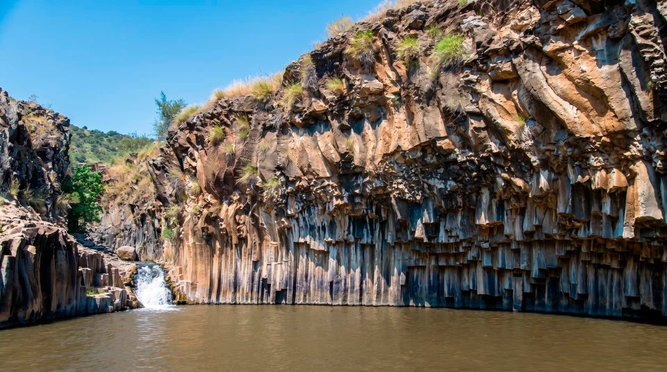
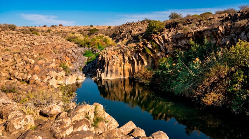
At Majrase, a walk brings you down to the stream’s level. Water is underfoot, with roots and branches close beside you. Daliyot Stream approaches the Sea of Galilee across the green Betiha lowlands, where a river landscape gradually gives way to lagoons. You can follow the channel through the water or observe it from a dry trail. Choose between those two experiences before setting out: a short distance does not mean an equally easy walk for everyone.
Majrase and Betiha: one stream, a wider valley
Majrase Nature Reserve lies near the northeastern shore of the Sea of Galilee, or Lake Kinneret, where Daliyot Stream reaches the low plain before the lake. Betiha names the broader valley and wetland landscape at the foot of the Golan slopes. You may also see it written as Batiha or identified as the Bethsaida Valley. The difference in scale matters when planning a visit: the familiar water trail occupies only one part of this larger system. From Road 92, turn west at Ma’ale Gamla Junction and follow the signs for Majrase. Navigate to the official Betiha Nature Reserve–Majrase entrance, rather than an arbitrary point at the stream mouth or a neighbouring lagoon. The lake is geographically close, but the walk focuses on the channel and its bankside vegetation. It does not provide unrestricted access to any beach you choose.
The water walk at a glance
About 800 mWater section in the official route description
Daliyot The stream at Majrase
Northeast Shore of the Sea of Galilee
Where mountain streams meet the lowlands
Upstream, watercourses descend the slopes. Near the Sea of Galilee, they reach gentler ground and form a network of channels, marshy areas and lagoons. River, marsh, lagoon and lake habitats lie alongside one another in the Betiha Valley. Their succession creates different conditions for plants and animals. Majrase belongs specifically to Daliyot Stream. Other well-known watercourses in the valley should be distinguished from it: Meshushim and Yehudiya join before reaching the lake and form the Zaki channel. Understanding that geography also helps with choosing a route. A photograph of a deep Zaki pool does not describe every metre of Majrase, and a shallow start at Majrase tells you nothing certain about a neighbouring channel. The wider wetland consists of separate places with different depths, currents and visiting rules.
Four things to notice along the way
1
Water between the banks
At channel level, bends conceal the route ahead and alter the stream’s apparent width. Before each step, check the bed and your footing. Observing the water here goes hand in hand with moving carefully through it.
2
Roots along the edge
Some of the bankside vegetation reaches right to the water. Roots, trunks and overhanging branches form the channel’s living boundary. Examine them in place, rather than pulling yourself along them or using them to jump into an unfamiliar pool.
3
Openings and reflections
In shaded stretches, gaps between the tree crowns shape the light on the surface. The dry trail’s higher viewpoint and the view from the stream reveal different aspects of the same place. Stop on a stable surface for photographs and keep the route clear.
4
The transition towards lagoons
The quieter waters nearer the lake belong to the wider wetland system. The marked end of the walk is the place to leave the channel. You can appreciate how the habitats connect while respecting the boundaries of closed areas.
The Majrase wet trail: short distance, different demands
The official description gives the water section as about 800 metres, marked in blue. That figure cannot be converted into the time you would take to walk the same distance on pavement. In the stream, you need to find secure footing and allow for people ahead; suitable stopping places depend on the channel’s width and depth. Some stretches are deeper than the beginning. Cool water does not remove the physical effort or the need to supervise children continuously. If you are unsure of your stamina or balance on an uneven bed, do not judge the whole walk by the first shallow stretch. Decide how to proceed using the permitted route and the actual conditions described at the entrance. Much of the Majrase wet trail’s appeal comes from this change in viewpoint. Bankside greenery is at eye level, and small movements in the current become easier to see. Enjoying those details still requires an awareness that depth varies and that safe movement in water takes care.
The dry trail is a visit in its own right
The Majrase dry trail offers a view of the same streamside environment without walking in the channel. It also provides the return route after the water section. From above, you can see how the flow bends around roots, where vegetation crowds the bank and how the light changes along the water. This is a useful choice for anyone who prefers to stay dry or is particularly interested in plants and observation. The route description identifies adapted sections and approaches. Check the surfaces and access to any particular waterside point against your own requirements, especially if using a wheelchair. A dry route beside this channel should not be confused with a continuous path to every lagoon in the valley. Marked boundaries and conservation restrictions still apply. In cooler weather, the bankside walk offers a way to see Majrase without making entry into the water a compulsory part of the visit.
Choose the walk that suits your group
- Following Majrase through the water
- The wet section
- For visitors prepared to move through water with changing footing. Consider depth, entry restrictions and the abilities of the least confident person in the group before deciding.
- Observing from the dry trail
- Walking beside the channel
- Concentrate on the banks and wetland scenery while keeping your clothes dry. Entering the stream is optional; the bankside route offers its own perspective.
- A group with different abilities
- Agree the plan before setting out
- Choose a shared plan and a meeting point within the permitted area in advance. Waiting at an unplanned exit from the stream may be inconvenient or impossible.
- Zaki
- A different level of preparation
- A separate, more demanding water route with deep pools. It needs its own assessment of access, conditions and participants’ skills, and should not be treated as a continuation of Majrase.
Why the wider wetland needs protection
Betiha’s value depends on the connection between its aquatic habitats. The stream leads into a marshy edge and lagoon system linked to the lake. Different organisms need different conditions, so protecting only the strip convenient for walking would leave much of the habitat unprotected. Look beyond the route itself. Quiet backwaters and dense growth may appear empty, although their seclusion makes them useful refuges. Photographic accounts of Majrase include turtles and dragonflies, but a particular sighting cannot be promised on every visit. Pause and watch without pushing plants aside or approaching an animal. Feeding wildlife, catching small creatures or moving stones alters a patch of habitat that other living things depend on.
Water and banks through the seasons
The water walk is usually associated with spring, summer and autumn, the seasons identified in the official description. Warm air, however, does not guarantee comfortable water temperature or a suitable depth. The amount of water depends on natural conditions, while permission to enter it also depends on the decisions of the managing authorities. On a hot day, shade along part of the channel is welcome, but approaches, waiting areas and the dry return may be in the sun. In winter, attention shifts towards the bankside scenery; assess the dry walk according to the weather and trail conditions. Rain in the catchment matters even if the sky looks calm at the entrance. Before travelling, check the forecast and route notices, including water-quality restrictions. Make that check for the whole outing so that the plan is based on conditions rather than assumptions about the season.
Preparing for a walk in the stream
- 1
Decide who will enter the water
Discuss confidence around depth and each participant’s abilities before buying tickets and changing clothes. If someone is comfortable only in shallow water, account for that in the plan from the start.
- 2
Check the permitted route
At the entrance, identify the start and finish of the water section and the dry return. Use marked exits only. A general map of the valley cannot replace the plan for this particular walk.
- 3
Keep your hands free and protect belongings
Leave unnecessary items out of the water section. Give phones and keys suitable waterproof protection that does not interfere with your balance or attention to the bed. Carry drinking water; the stream is not a drinking-water supply.
- 4
Finish at the marked exit
Leave the channel where directed rather than following it downstream out of curiosity. The dry return is part of the visit, so keep enough energy for the walk back and allow time to change.
Zaki needs a separate plan
Farmers, fishing and the House of the Bek
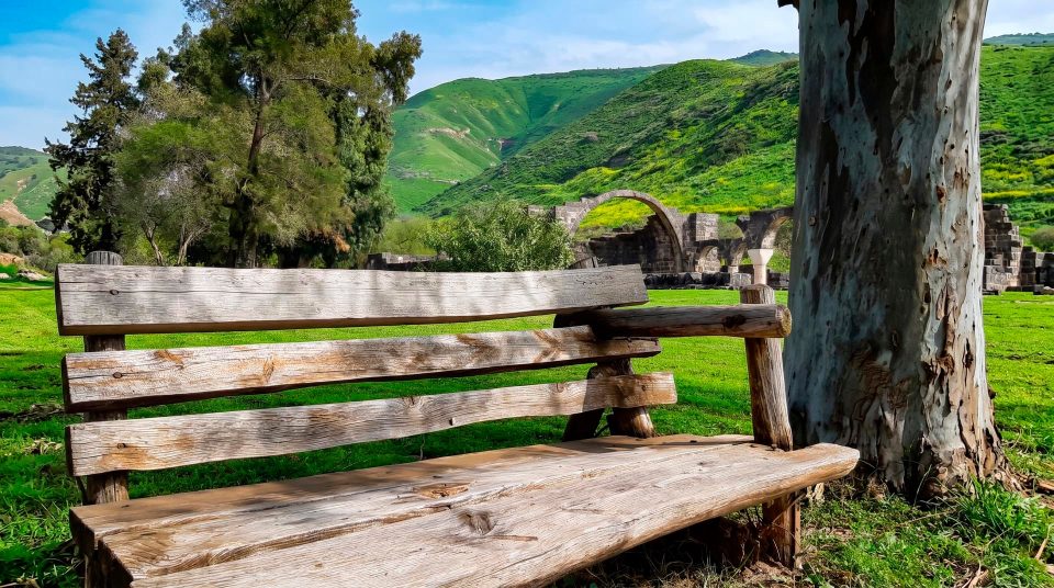
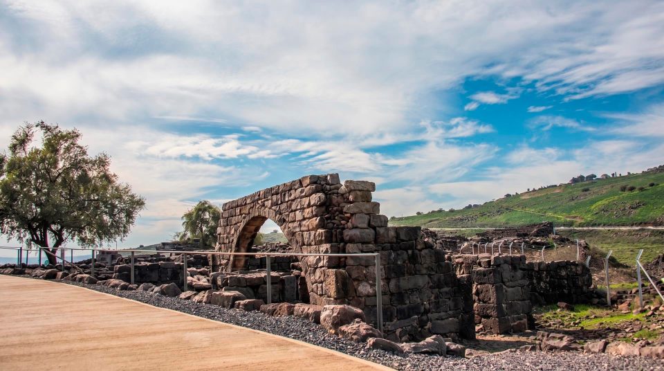
The mouth of Daliyot Stream may look entirely natural, but the surrounding valley has a long history of human activity. Archaeological evidence points to farmers and fishermen using the area from the Bronze Age. Fertile lowlands and the nearby lake help explain its appeal through successive periods. The official description of the wider valley mentions the House of the Bek among its historic features; ‘bek’ is an Ottoman-era title. It should not be presented as an obligatory stop on the short water walk. Reaching that separate feature and establishing access need their own plan, and road conditions away from the main entrance may differ. For a visit to Majrase, the broader context is useful: this protected water system has existed alongside farming and settlement for centuries. The valley’s natural value can be appreciated together with that human history.
Footwear, dry clothes and a picnic afterwards
Wear footwear that stays securely on your feet and gives reliable support in water. Loose flip-flops are poorly suited to an uneven stream bed. Keep a change of clothes and a dry towel for the end of the walk, rather than carrying them unprotected through the channel. The entrance area is described as having changing rooms, toilets, drinking water and a picnic area. These facilities help organise the visit, but the watercourse remains a natural setting with variable depth and no individual supervision provided for your group. Fires are prohibited in the reserve, so bring food that needs no cooking on site. After the water section, a final pause on the bankside trail can reveal details you missed earlier. The channel’s bends and the contrast between sheltered backwaters and brighter openings are often easier to recognise from above.
Questions about walking at Majrase
- Are Majrase and Betiha the same place? Majrase is a particular section at the mouth of Daliyot Stream and the familiar walking area. Betiha is the wider valley, with a network of streams, marshes and lagoons beside the northeastern Sea of Galilee.
- How long is the water section? The official description gives approximately 800 metres. That refers to the water section, rather than the full length or duration of every visit. Allow separately for the dry return, stops and changing clothes.
- Is the water shallow all the way? Do not count on it. Depth varies along the channel and with conditions. An easy start does not describe the entire route; use the information at the entrance and your group’s abilities to decide whether to enter.
- Can I visit without going into the stream? Yes. The dry trail offers views of the bankside vegetation and water. It also serves as the return after the wet section. Follow the marked route and keep out of closed lagoon areas.
- Is the walk suitable for every young child? Suitability depends on depth, balance, confidence around water and constant adult supervision. A fixed age alone cannot replace an assessment of the child’s abilities and the route’s applicable rules.
- Does Zaki begin where Majrase ends? Zaki is a separate route in another part of the water system, associated with Meshushim and Yehudiya. It is more demanding and includes deep pools. Do not attempt to reach it by continuing independently down the channel.
- Can we have a barbecue at the picnic area? There is a picnic area, but lighting fires in the reserve is prohibited. Bring ready-to-eat food, collect your packaging and keep food scraps out of the water and vegetation.