At a glance
What awaits you
Visit duration
180min
Yehudiya loop: about 4 km and 3 hours; children require supervision and some pools are deep.
Source and itineraryDifficulty
Moderate
Yehudiya loop: about 4 km and 3 hours; children require supervision and some pools are deep. Accessibility applies to entrance facilities, not canyon trails.
Route length
Not yet provided
Who is it for
Popular visiting hours
Verified busyness data is not available yet
Best time to visit
JanFebMarAprMayJunJulAugSepOctNovDec
BestGoodHot
5-day forecast
Forecast loads when this section is viewed
About this place
Yehudiya Nature Reserve
From the plateau, Yehudiya appears to be a country of oaks and dark stone. Beyond its rim, deep canyons open up, with water dropping over rock ledges and gathering in natural pools. One direction leads towards village ruins and Yehudiya Canyon; another follows Zavitan and its dripping spring, Ein Nataf. Choosing between them is the first step in planning a visit. Arriving at the reserve’s main entrance does not yet tell you what kind of hike lies ahead.
One reserve, several distinct canyons
Yehudiya Nature Reserve occupies part of the central Golan Heights, where deep valleys cut into relatively open upland terrain. The main entrance is off Road 87, south of Katzrin, and serves routes towards Yehudiya and Zavitan. When choosing a point on the map, distinguish the wider reserve, the stream that shares its name and the particular entrance you need. Meshushim also belongs to this protected area, but reaching its Hexagon Pool involves a different approach. A plan to ‘visit Yehudiya’ therefore needs a more specific destination. Decide first what you want to see: a canyon waterfall, oak-dotted plateau, historic settlement or a gorge requiring technical equipment. That choice makes the likely effort and necessary preparation much easier to assess.
Open woodland beneath a wide sky
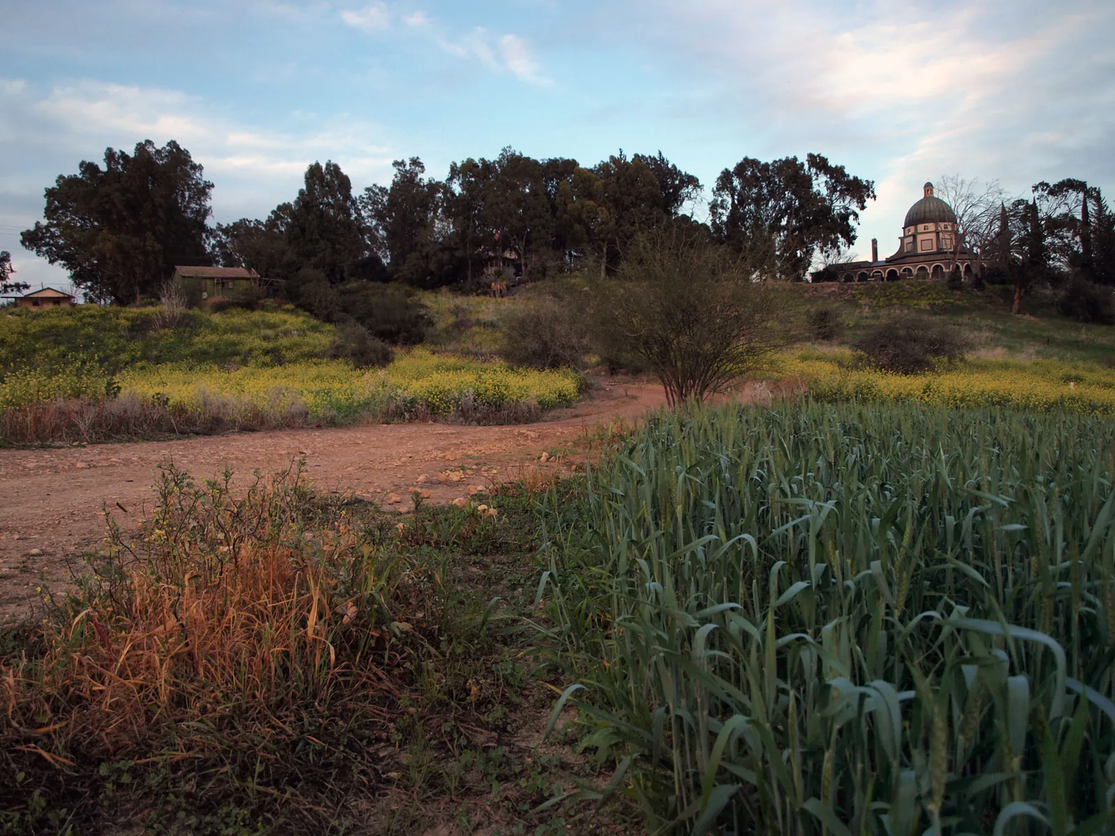
Between the canyons grows open, park-like woodland dominated by Mount Tabor oak. The word ‘forest’ does not mean a continuous shaded corridor here. Open spaces separate the trees, and much of the trail can lie beneath a wide sky. That spacing gives the upper terrain its recognisable character. An individual crown, basalt boulders and the light between trees create a very different sense of scale from the confined channel below. In spring, grass and flowers animate the open ground; in the dry season, dark stone and the outlines of the trees become more conspicuous. The difference has practical consequences for a hike. Cool conditions beside the water do not extend across every plateau crossing. The oaks belong to the local natural setting, but their presence should not be read as a promise of shade along the whole route.
Three ways to experience Yehudiya
1
Yehudiya Canyon
The deep gorge and its waterfall show how water exposed the rock mass. Your chosen trail determines which sections you can visit. A stream’s name on the map does not imply unrestricted passage along its entire bed.
2
Zavitan and Ein Nataf
A different canyon, known for natural pools, rock ledges and a spring that drips from its walls. Seeing these features requires attention to individual stretches of the channel and a route plan of its own.
3
The village above the cliffs
Yehudiya’s village ruins occupy the upper level beside the canyon rim. Later houses, ancient dressed stones and reused architectural fragments introduce the human history of the place.
Yehudiya Canyon and the change in level
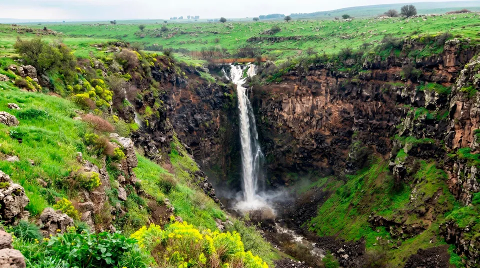
Yehudiya Waterfall marks a pronounced rock step crossed by the stream. From the plateau surface, that drop may barely register until the gorge comes into view. Then the scale of the scenery changes. Rock walls restrict the view, and water becomes its principal moving element. Notice how the channel follows cracks and lower ground: the canyon has an irregular shape shaped by the rock and the flow. For walkers, this is also terrain with natural hazards. Slopes can be unstable, and wet rock needs care. Older descriptions of passages along the stream bed should not be used for navigation. Plan the visit around the official route in use, with its designated approaches to the waterfall and its return path.
Zavitan Stream needs its own route choice
Zavitan follows another canyon, with its own pools, ledges and branches. Walking descriptions distinguish upper and lower sections, but these should not be combined into one standard route. A visitor looking for a quiet view of water and a group equipped for technical canyoning will choose very different paths. Similarities between the basalt walls here and at neighbouring Meshushim reflect the region’s volcanic character. Trails and crossings, however, do not repeat from one stream to the next. Along Zavitan, pay attention to the progression from open plateau to rocky rim and then the channel far below. Those changes in level account for much of both the scenery and the physical effort. Features deep in a canyon require more planning than neighbouring stops beside a road.
Ein Nataf: water seeping from the canyon wall
Ein Nataf’s name reflects the spring’s character: water seeps and drips from the rock face in Zavitan Canyon. Small trickles and wet patches of stone draw the eye here, offering a more intimate view than a waterfall. That contrast with falling, noisy water is part of its appeal. Calling it ‘eternal rain’ would turn a natural feature into a misleading promise, and conditions cannot guarantee the same impression on every visit. To see Ein Nataf, choose a route that includes the relevant section of Zavitan. It will not appear on every walk from the reserve entrance. Treat water running down the wall as something to observe, rather than a reliable drinking-water supply. Take time to look at the texture of the stone and the way moisture spreads across its surface.
The Black Canyon is a technical route
Village ruins at the canyon rim
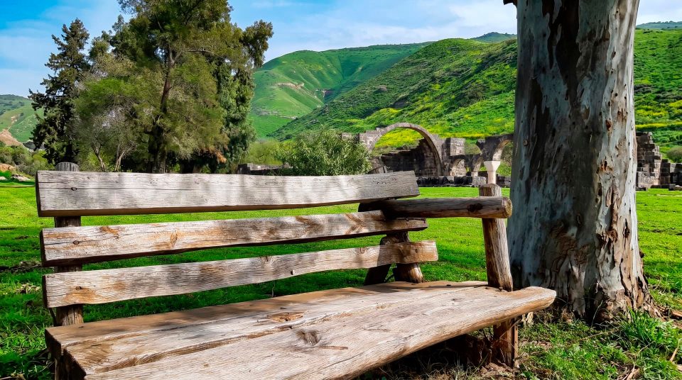
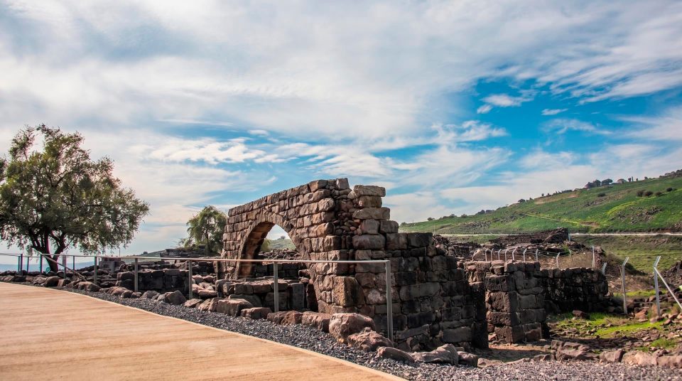
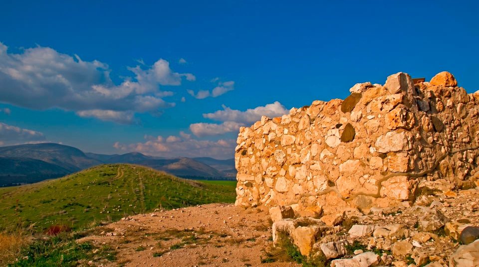
Beside Yehudiya Canyon, a ruined settlement preserves several historical layers. The visible houses include nineteenth-century buildings constructed partly with older dressed stones. Reused material can be easy to miss amid collapsed masonry, so look closely at individual blocks, bases and architectural details. Internal arches helped support the roofs. The simple layouts reveal domestic life through living rooms and spaces for household work. The ruins should not be presented wholesale as an untouched ancient town. A later village reshaped the site and incorporated earlier remains into new buildings. View it from the permitted route and stay out of unstable structures. An arch may be interesting evidence of construction while remaining unsafe to pass beneath.
What the ancient remains can tell us
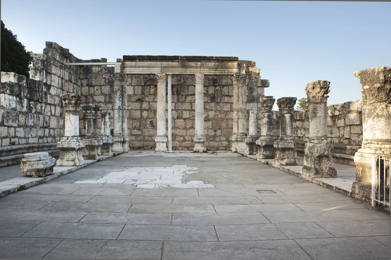
Architectural finds and stones bearing Jewish symbols provide evidence of Yehudiya’s ancient historical layer. They matter for the study of settlement in the central Golan and of local synagogue architecture. An individual find, however, cannot establish that a single community lived here continuously through every later century. Scholars have discussed identifying the site with Sogana, one of the fortified settlements mentioned by Josephus. That identification should retain its status as a hypothesis. For visitors, the clearest feature is the reuse of stone: material passed from an ancient building into a later one, so a single ruined wall may preserve evidence from several periods. Compare rough masonry with carefully worked architectural pieces. Their different treatments make the layers visible without requiring an invented, precise history for each house.
Choose a direction to match your interest
- Water and Yehudiya Waterfall
- Yehudiya Canyon
- Start with a permitted walking route towards Yehudiya Stream. Assess the descent and return, and avoid assuming that every pool on an old map is an accessible destination.
- The dripping spring
- Zavitan and Ein Nataf
- Choose a section of Zavitan that includes Ein Nataf. Match the route to your group’s abilities and distinguish the entrance, turnaround point and exit clearly.
- History above the gorge
- Yehudiya village ruins
- The layered village buildings and ancient stone fragments reward close attention. Stay on the permitted approach and view unsafe structures from outside.
- A technical descent
- The Black Canyon
- Rope descents and waterfalls require specialist organisation. This is a separate undertaking, not an unplanned extension of an ordinary walk.
- The geometry of basalt columns
- The separate Meshushim entrance
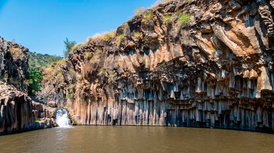
- For the Hexagon Pool, choose the Meshushim section and its own road access. Its inclusion in the wider reserve does not put it beside every trail.
Planning for Yehudiya’s particular terrain
- 1
Name the stream and section
Replace a general intention to walk in the reserve with a specific choice: Yehudiya, a defined stretch of Zavitan or a separate visit to Meshushim. Each involves different logistics.
- 2
Identify the changes in level
Mark the plateau crossing, canyon descent and climb back up on the route plan. A rest beside the water leaves the return ascent still to come.
- 3
Check the water obstacles
If your chosen route involves entering water, establish its particular requirements in advance. A trail name alone does not tell you that swimming is compulsory, or that the entire walk stays dry.
- 4
Leave time for the details
Village ruins, open oak woodland and a dripping spring each need different pauses. One carefully chosen route leaves more time to understand the terrain than several canyons attempted at the limit of daylight.
The plateau and canyon through the seasons
In spring, flowers and fresh growth make the open spaces between the oaks especially conspicuous. After rain, assess the stream bed and slopes using the forecast and the administration’s guidance. Summer heat is more noticeable on the upper crossings, while the sight of water below can create a false impression of an easy hike. In autumn, the woodland’s structure, dark basalt and village architecture tend to attract more attention. In every season, carry enough drinking water for the full route. A natural stream cannot replace the bottle in your pack. Photographers will find strong contrasts between broad daylight above and shaded canyon walls below, but seeking a viewpoint off the trail is dangerous. Plan a lakeside break at the Sea of Galilee separately from a Yehudiya hike. Nearby points on a map can conceal substantial changes in elevation and a much more demanding day.
Allow time for the section you choose
Yehudiya is best understood by noticing its differences: oaks across the open plateau, water deep in a canyon, a small spring on a wall and a village built with stone from several periods. A chosen route may show only part of that picture, which is a reasonable scope for one visit. Give the particular section enough attention instead of trying to fit every named feature into a single hike. Keep to marked trails, observe restrictions beside cliffs and stay out of decaying buildings. Before setting out, confirm access to the trail you need and the administration’s entry requirements. The reserve’s name stays the same across these very different outings; the specific route determines the terrain and preparation involved.
Questions about Yehudiya’s routes
- Is Yehudiya a single water trail? The name describes both the wider reserve and an individual stream. The area contains different destinations, including Zavitan. Choose a particular trail with a clearly understood entrance and exit.
- Where is the main entrance? It is off Road 87, south of Katzrin, and serves routes towards Yehudiya and Zavitan. The Meshushim Hexagon Pool uses a different road approach, so the entrances are not interchangeable.
- Where can I see Ein Nataf? The dripping spring is in Zavitan Canyon. It is not included in every reserve walk. Choose a route that explicitly passes through the relevant section, with a manageable effort level and a clear return plan.
- Is the Black Canyon suitable for a first hike? This is a technical section with waterfalls and rope descents, requiring preparation and advance coordination. It should not be chosen as an impromptu branch of an ordinary walk to the water.
- Can visitors swim in every pool? There is no general permission covering all pools. Check whether water entry is allowed and establish conditions in the specific section before setting out. Old photographs of swimmers confirm neither present rules nor safety.
- Does the oak forest shade the whole walk? The woodland is open, with substantial gaps between trees. Sun protection is particularly important on the plateau crossings. Shade inside the canyon does not describe conditions along the entire route.
- Are all the village ruins ancient? Surviving buildings include later houses incorporating ancient stones. The site’s interest lies partly in these multiple historical layers. View unstable structures from outside, staying on the permitted route.