At a glance
What awaits you
Difficulty
Easy
Official loop: about 1 km, 1–2 hours, partially accessible. Existing 90 minutes fits the stated range.
Route length
Not yet provided
Who is it for
Popular visiting hours
Verified busyness data is not available yet
Best time to visit
JanFebMarAprMayJunJulAugSepOctNovDec
BestGoodHot
5-day forecast
Forecast loads when this section is viewed
About this place
En Afek Nature Reserve
From the wooden boardwalk at Ein Afek, water lies on both sides of the path. Fish move through gaps in the reeds, birds cross the pools, and the heavy walls of an old mill rise behind the greenery. Beside Kiryat Bialik, on the coastal plain south of Acre, the reserve protects part of the marsh landscape at the headwaters of the Naaman River. Medieval industry and the painstaking restoration of a wetland are both written into this small stretch of water.
Ein Afek in conservation history
1979 yearDeclared a nature reserve
1996 yearAdded to the Ramsar List
66 hectaresArea of the designated Ramsar site
The Naaman springs on the coastal plain
Ein Afek Nature Reserve lies east of Kiryat Bialik in the Zevulun Valley, the southern part of the Acre Plain. Its springs and marsh pools form the headwaters of the Naaman River. The river continues towards the coast near Acre, while the visitor walk stays within the protected wetland. This setting explains the surprise of arriving: roads and residential neighbourhoods are close by, yet inside the reserve the view opens onto reeds, pools and waterlogged ground. Afek is the name of both the ancient settlement mound and the surrounding springs. When planning your journey, select the reserve beside Kiryat Bialik. Tel Afek and Afek also appear elsewhere in Israel; a matching place name alone may lead you to the wrong destination. The figure of 66 hectares describes the Ramsar designation. It does not indicate the length of the paths or how much ground visitors can explore.
Four ways to look at the marsh
1
The boardwalk
The raised walkway brings you close to the wetland without pushing a trail through its vegetation. Open stretches reveal reflections and movement below the surface; narrow gaps show where reeds meet water. A few steps can change the whole composition of the view.
2
The fortified mill
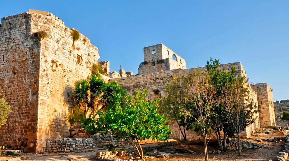
The stone building recalls a time when the springs helped supply medieval Acre. Thick walls and the different levels of the structure suggest how carefully this valuable production site was protected. Its position beside the water helps explain where the power came from.
3
The wet meadow
Low, open ground provides a different habitat from the dense reedbeds. Some plants and animals need precisely this more open vegetation. Keeping the meadow in that condition requires active management, including controlled grazing.
4
The mound of Tel Afek
Climbing towards the ancient settlement changes the scale of the visit. Details at water level give way to a view across the plain. From here, it is easier to understand why people settled beside the springs and how this patch of marsh fits into the wider coastal landscape.
A marsh brought back through restoration
Ein Afek has changed considerably over the centuries. Much of the surrounding marshland was drained. Later, groundwater pumping reduced the flow of the springs; some outlets weakened or dried up, putting the aquatic habitat under further pressure. The Ramsar description explicitly identifies the restoration of drained swamps. That history gives the quiet pools a different meaning: keeping them alive involves maintaining both the water supply and the plant communities. Measures used in dry years have included deepening pools and supplying water from nearby boreholes. The shorelines, channels and stretches of open water therefore reflect natural processes alongside human intervention. Understanding that combination makes the landscape more interesting. Protecting a wetland depends on looking after its hydrology, the movement and availability of water throughout the site. Legal protection alone cannot keep a spring flowing or sustain the plants and animals that depend on it.
A mill serving the city by the sea
The mill at Ein Afek belonged to the medieval economy around Acre. During the 12th and 13th centuries, military religious orders built waterworks here and processed grain. Water supplied the energy, but it first had to be collected and directed towards the machinery. Dams, the height of the impounded water and the position of each mill were all parts of the same engineering problem. The surviving fortified building suggests the value of the equipment, grain stores and access to the springs that needed protection. Look first at how it sits in the low ground, then at its walls and interior spaces. Its industrial purpose helps explain the fortress-like appearance. The building continued in use and was altered later, so its entire present form should not be assigned to a single date. A small ethnographic display has also been housed here. The surviving architecture remains central to understanding the springs, whether or not an indoor exhibition forms part of your visit.
Changing uses of water
- 12th–13th centuries
The Hospitallers and Templars operated mills dependent on the same water resource. Disputes concerned water levels, the operation of the installations and passage along the river. The flow linked neighbouring estates while also becoming a source of conflict.
- Early 20th century
Diesel engines began replacing water-driven machinery. Milling became less dependent on the strength of the current, although the water and the land around it retained their economic importance.
- 1937–1939
Marsh drainage continued around nearby settlements, partly to combat malaria. The later protection of surviving wetlands belongs to a very different phase in the relationship between people and this landscape.
- 1979 and 1991
The site was declared a nature reserve in 1979. Water buffalo were brought from Hula in 1991 to help maintain the open wet meadow, making grazing animals part of the conservation programme.
- 12 November 1996
Ein Afek joined the Ramsar List of Wetlands of International Importance. The designation recognises the aquatic ecosystem as a whole, extending well beyond any individual viewpoint.
Wildlife to watch for
1
Fish beside the boardwalk
Catfish, carp and tilapia are recorded in the pools. Pause at the boundary between sunlight and shade and give your eyes time to adjust. A large dark shape moving below the surface can be more absorbing than the wider view. Feeding is unnecessary and changes animal behaviour.
2
Waterbirds
Coots, ducks, night herons and little egrets use different parts of the water and banks. Watch how they feed: one stays on open water while another waits at a shallow edge. What you see depends on the season and the birds themselves; an identification board cannot promise a particular encounter.
3
Turtles
Look along the waterline and at exposed resting places where turtles may bask. The path provides a good observation point. Moving closer often sends an animal into the water before anyone else has a chance to see it.
4
Water buffalo
Grazing buffalo help keep the wet meadow open by eating vegetation that would otherwise spread. They are working within a managed ecosystem. This is not a petting area, and seeing them cannot be guaranteed on every visit. Keep your distance rather than pursuing a close photograph.
Reeds, reedmace and open-water plants
The marsh contains several distinct plant habitats. Tall reeds screen the water and provide cover; reedmace grows in shallower areas; other leaves and stems appear along the edges of open pools. Purple loosestrife grows on damp banks, with tamarisks and brambles in places. For a visitor without botanical training, comparing the shape of these habitats can be more useful than trying to name every plant. Notice where sunlight reaches open water, where stems conceal the bank and where dry ground begins. Those boundaries help determine where animals feed and shelter. Aquatic plants also depend on water quality and quantity. The blue water lily described in accounts of the reserve has needed restoration; its presence should never be presented as a promise of continuous carpets of flowers. Dry stems, fresh shoots and reflections offer their own rewards, revealing different stages in the life of the wetland even when little is in bloom.
Tel Afek: settlement above the springs
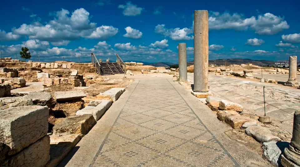
Near the southern part of the reserve, the mound of Tel Afek contains the accumulated remains of ancient settlements. People lived beside these springs long before the medieval mills; a Canaanite centre existed here during the Bronze Age. Later, the site belonged to the coastal Phoenician world. Its position is the essential starting point: dependable water, the open plain and routes of communication gave successive communities reasons to settle here. Do not expect every ancient period to appear as a separate building on the surface. An archaeological mound holds much of its sequence below ground, and visitors see only some of the investigated remains. From the higher ground, compare the low wetland with the plain around it. After following the boardwalk, this wider view is especially revealing. The marsh becomes part of the settlement history of the Acre region, connected to the people and routes that used its water.
Choosing the focus of your walk
- A first look at the wetland
- Boardwalk and open pools
- Start where both the water and the banks are clearly visible. Frequent short pauses reveal more than a brisk circuit. Leave room for others to pass on narrow sections of boardwalk.
- The history of water management
- The mill and the surrounding ground
- Compare the position of the building with the pool and the arrangements for controlling flow. The subject here is production and resources in medieval Acre; the mill makes most sense within that larger working landscape.
- Birdwatching and photography
- Quiet observation
- Binoculars help you look through gaps in the vegetation. For a photograph, wait for a bird to move into the open rather than trying to reach it through the reeds.
- Visiting with a pushchair or wheelchair
- Check the particular sections you need
- Ask separately about the boardwalk, approaches to the mill and the route up the mound. Paths beside water do not establish that the whole reserve is step-free. Assess the climb to Tel Afek on its own terms.
Seeing more on a short walk
- 1
Pause before anything moves
At still water, reflections register first; fish and small movements of birds emerge afterwards. Stopping reveals details easily missed while walking. Give animals space and let them move naturally, without attracting them with food or noise.
- 2
Compare two kinds of bank
Look at the open wet meadow and then the dense reeds. The contrast explains why controlled grazing matters. Both habitats are valuable, even if one happens to make a more striking photograph.
- 3
Look from the water towards the mill and mound
The mill connects a natural resource with skilled work; Tel Afek links it to much older settlement. Following those connections brings water, industry and life on the plain into a coherent story.
Seasonal light and changing wildlife
In the cooler part of the year, lingering beside the pools to watch birds is more comfortable. Rain greens the surrounding plain, while spring brings fresh growth and flowers along the banks. Water remains the visual focus in summer, but exposed paths can still be hot. Choose softer light and less intense heat for observation, while remembering that wildlife cannot be assigned an appointment. Rain and damp conditions may make the walking surfaces slippery. Slow down on the boardwalk, and stop moving before looking through a camera viewfinder. Ein Afek makes a quiet counterpoint to the urban sights of Haifa Bay and Acre. Allow it its own character as a wetland visit, with time to watch the water and understand the habitat. It serves a different purpose from a beach stop or a long mountain hike.
Observe the wetland without disturbing it
Questions about Ein Afek Nature Reserve
- Where is Ein Afek? East of Kiryat Bialik, on the coastal plain south of Acre, at the Naaman springs. For navigation, select Ein Afek Nature Reserve beside Kiryat Bialik: other places in Israel also use the name Afek.
- Is this a natural marsh or a group of artificial ponds? The reserve protects surviving marsh habitat and restores water environments affected by drainage and pumping. The landscape combines natural springs, historic waterworks and continuing conservation management. Its present appearance reflects all three.
- Why were water buffalo brought here? To help maintain the open wet meadow. Grazing limits overgrowth and preserves the vegetation structure needed by meadow species. The buffalo contribute to ecosystem management; they are not part of a visitor animal-contact programme.
- What is the history of the mill? The fortified building is associated with medieval water management and the supply of flour to Acre. Mills belonging to neighbouring military religious orders depended on the same flow, making water levels and the way the installations operated matters of serious dispute.
- Will there always be plenty of birds? No. Species and their positions change with the season and during the day. Bring binoculars and allow time to pause. A species list describes what the habitat can support, rather than a guaranteed collection of sightings on one visit.
- Can a pushchair or wheelchair use the whole reserve? Check access for each path and building you want to visit. The waterside boardwalk, approach to the mill and climb to Tel Afek pose different questions. A promise that the entire circuit is accessible would be unreliable without checking those details.
- Why is Ein Afek a Ramsar site? It is a protected wetland with valuable habitats for plants and animals. The 66-hectare designation highlights the restoration of marshes, wet meadows and the importance of conservation education. It concerns the ecological value of the whole designated area.
Sources
History
The Hospitallers and Templars operated mills dependent on the same water resource. Disputes concerned water levels, the operation of the installations and passage along the river. The flow linked neighbouring estates while also becoming a source of conflict.
Diesel engines began replacing water-driven machinery. Milling became less dependent on the strength of the current, although the water and the land around it retained their economic importance.
Marsh drainage continued around nearby settlements, partly to combat malaria. The later protection of surviving wetlands belongs to a very different phase in the relationship between people and this landscape.
The site was declared a nature reserve in 1979. Water buffalo were brought from Hula in 1991 to help maintain the open wet meadow, making grazing animals part of the conservation programme.
Ein Afek joined the Ramsar List of Wetlands of International Importance. The designation recognises the aquatic ecosystem as a whole, extending well beyond any individual viewpoint.