At a glance
What awaits you
Visit duration
Not yet provided
Difficulty
Not yet provided
Route length
Not yet provided
Who is it for
Popular visiting hours
Verified busyness data is not available yet
Best time to visit
JanFebMarAprMayJunJulAugSepOctNovDec
BestGoodHot
5-day forecast
Forecast loads when this section is viewed
About this place
Castel National Heritage Object
From inside the Castel trenches, stone almost hides the road. On the summit, it opens into view again, together with the slopes on the approaches to Jerusalem. That change of perspective explains the hill’s importance: the fighting here concerned a stretch of road used by supply convoys heading for the blockaded city. The former village headman’s house, a water cistern and post-war defences reveal several chapters of history within the memorial site.
Castel and the high ground above the Jerusalem road
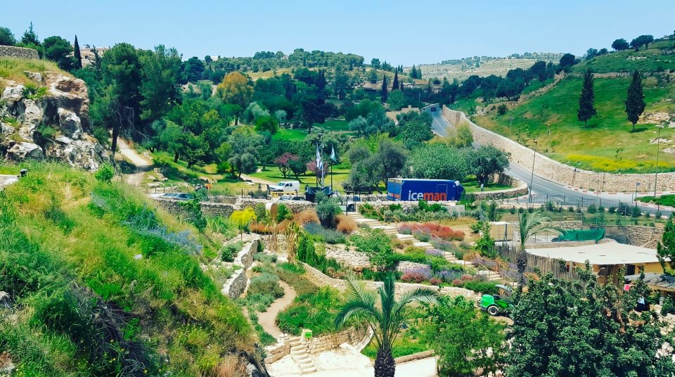
Castel stands on the edge of Mevaseret Zion, west of Jerusalem, overlooking the Highway 1 corridor. Urban neighbourhoods come close to the hill; this is not an isolated mountain fortress in empty countryside. From the summit, the relationship between terrain and movement is clear. The road dips into lower ground before climbing again towards Jerusalem, while the commanding height overlooks its course. Modern tunnels and interchanges have changed the landscape. Yet the slope and its field of view still explain why this small piece of land was so fiercely contested. Castel National Heritage Site is best approached as a historic hill with an uphill walk and a memorial. Although often called Castel National Park, its official designation emphasises its national heritage status.
The main elements of the walk
1
The approach through the trenches
Passages cut into the slope lead towards the upper hill. Their bends, changes of level and restricted views matter to the experience. The visible trenches, however, belong to the military position established after the fighting of 1948.
2
The old water cistern
An older underground structure has been adapted for a film about the battle. Traces of plaster remain inside. Its original purpose recalls the practical needs of settlement on high ground: rainwater had to be collected and stored.
3
The mukhtar’s house
The remains of the village headman’s house on the summit serve as a viewpoint and part of the memorial. They overlook neighbouring districts, the road corridor and the hills towards Jerusalem. Names of fallen Jewish fighters are commemorated on the nearby rock.
4
The scenic descent
A path through the hillside vegetation leads from the upper area towards the entrance. It changes the pace after the defences and memorial inscriptions. The official description identifies a resting corner beneath an oak; the descent remains part of a walking route.
Al-Qastal before the memorial
Before the war, the Arab village of al-Qastal occupied the hill. Historic photographs show stone houses beside the road and a building on the very top. The village was destroyed after the fighting, and the surviving mukhtar’s house became the principal architectural landmark. Knowing this changes how the site is read. It was a settlement before becoming a military post and later a memorial complex. The name Castel is associated with the Latin castellum, meaning a small fort. Historical descriptions also mention a medieval stronghold called Castellum Belveer. Reliably identified remains of Roman and Crusader castles, however, are not on display here. An old wall cannot confidently be called part of an ancient citadel simply because it looks old. The clearest history visible on the surface belongs to the village and the more recent fortifications.
Why the convoys depended on control of the heights
During the 1948 war, the road from the coastal plain was essential to supplying Jerusalem’s Jewish population. Convoys carrying food and other cargo crossed mountain terrain where movement could be halted from high ground and at narrow sections. Castel stood near the eastern part of this corridor. The battles for the hill formed part of the effort to open the route to the city and are associated with Operation Nachshon. Keep the scale of the task in mind: capturing one summit gave control over the nearby stretch, but the road contained many vulnerable points. The panorama explains that dependence more clearly than the word “strategic”. Trace the direction of the climb towards Jerusalem and look for places where the hillside closes in on the road. The supply story then acquires a recognisable geographical setting.
The April days remembered here
- 3 April 1948
Jewish forces occupy the hilltop village. Arab forces soon attempt to regain the position, and the height becomes the focus of repeated attacks and a difficult defence.
- 8 April 1948
The Arab commander Abd al-Qadir al-Husayni is killed near Castel. In the attack that follows, Arab forces regain the height. His death and the losses among the defenders make this a pivotal day in accounts of the battle.
- 9 April 1948
Jewish forces take the hill again. Many Arab fighters have by then left the position to attend al-Husayni’s funeral in Jerusalem. Control of the height is subsequently consolidated.
- After the war, until 1967
Castel serves as a military post. Trenches and shelters built for that position form a prominent part of today’s route, showing that the hill’s military history continued after the April fighting.
The trenches belong to a later chapter
The battle for Castel can become the sole focus of a visit, leading every defensive structure to be assigned automatically to those days. Pause here to separate the periods. The trenches on the visitor route were built after the 1948 war, when the post continued to defend the approaches to Jerusalem until the Six-Day War. There are therefore two different kinds of evidence. The memorial, historical material and terrain tell the story of April; the layout of the trenches shows a later organisation of defence. Inside a passage, earth and stone screen a person from the surrounding landscape. Above, a broad field of view returns. This contrast offers a practical way to discuss observation, shelter and communication between positions. There is no need to imagine every bend as the exact location of a particular wartime incident.
A water-storage chamber with a story on screen
The hillside cistern adds another historical layer to the route. Collecting rainwater was an essential part of running a settlement on the summit. The structure has since been used as a space for a film about the battle. A screen presentation can bring events into sequence when, outside, they appear as separate signs and names. Afterwards, look again at the slope and road: their relationship is easier to understand once you know the order of events. The chamber itself deserves attention too, particularly its surviving wall finish. Being underground does not make it an ancient fighting bunker. Film arrangements depend on the conditions of an individual visit, and the historical value of exploring the hill need not depend entirely on catching a screening.
The summit’s view and the names beside it
The mukhtar’s house is easy to recognise by its position above the rest of the site. Today it anchors the memorial narrative. On the upper viewing area, look at the surrounding landscape first, then take time to read the commemorative inscriptions. Giving each its own attention keeps the human story from being lost behind the highway panorama. The memorial honours Jewish fighters killed in the battles for the height; the hill’s wider history also includes the Arab village and the opposing forces. With children, start with concrete questions: why did the city need this road, why did a small hill matter, and how does remembering the dead change a place’s purpose? Quiet conversation suits the memorial stones. Running through fortifications or acting out a battle interferes with both thoughtful exploration and the commemorative setting.
An educational route for groups
1
Cooperation
Group activity stations explore friendship and mutual support. Connect them with the history of the convoys and those defending the position. The task then has a particular historical context rather than standing alone.
2
Leadership and determination
Other stations address decisions and responsibility in difficult circumstances. An independent family can choose several stops; a guided group benefits from linking them to a shared theme for the visit.
3
Reliability
This theme concerns how far people can depend on one another. After the historical account, it is easier to discuss it through participants’ actions rather than broad ceremonial language. Ask at the entrance which activity elements are operating.
Choosing the focus of a visit
- Understanding the history
- Terrain and chronology
- Start with introductory material, then relate the trenches, cistern and summit to one another. Understanding the sequence of periods matters more than quickly completing every activity station.
- A family walk
- An ascent with pauses
- Alternate historical explanations with looking at the road and hillside. Set the pace for the slowest child, remembering that the route involves a hill.
- A memorial visit
- The mukhtar’s house and inscriptions
- Reserve a separate, quiet period on the summit. Keep energetic group activities apart from reading the names and taking a moment to remember.
- Visiting with limited mobility
- Choose specific areas and levels
- The introductory area and upper hill have different conditions. The upper dirt path is described as unsuitable for walking frames and wheelchairs. Promising equal access to every part of the hill would be misleading.
Spring flowers and an exposed summit
The greener parts of Castel soften the impression left by its fortifications. Seasonal flowers appear on the slopes in spring, and the return walk offers a change of focus from military history to plants and the texture of stone. Observe flowers from the trail rather than climbing across the slope or picking them. In summer, exposed upper sections become hotter than places beneath trees. Wind is noticeable on the summit in cooler weather; after rain, stone and earth require careful footing. For photographs, the old house, trenches and modern road corridor make a revealing combination. A worthwhile picture does not require stepping beyond the permitted path. Looking along the road towards the city is particularly informative, though distant detail depends on weather and visibility.
Planning the visit to the hill
- 1
Navigate to the entrance
Use Castel National Heritage Site in Mevaseret Zion as your destination. The approach is associated with the Harel interchange on Highway 1. A map pin on the summit is not, in itself, a vehicle entrance.
- 2
Prepare for the memorial setting and terrain
The visit combines defences, slopes and historical interpretation. Secure, closed shoes are more practical than loose sandals in the trenches. Carry water and a hat for the exposed upper area.
- 3
Check what your group needs
Before setting out, confirm admission arrangements, hours, tickets and the particular level of accessibility required with the Israel Nature and Parks Authority. An organised group should arrange any educational programme separately.
- 4
Allow time to get back down
There is still a descent after reaching the upper viewing area. Do not time your departure from the summit against the last possible admission time. If continuing to Jerusalem, allow separately for the drive through local streets back to the main road.
Castel and Ein Hemed offer contrasting perspectives
For a broader look at the western approaches to Jerusalem, nearby Ein Hemed introduces a different subject: springs, a streambed and a medieval fortified farmstead. The contrast is especially apparent after Castel. On the hill, the central themes are the view of the road and remembrance of war; in the hollow, attention turns to water and agriculture. The two places have separate entrances and need a transfer plan. For a deeper visit to Castel, leave energy for an unhurried descent and another look at the panorama rather than adding a stop simply to increase the day’s tally. One of the most meaningful pauses here can come on the summit, when the eye returns to the road after reading the names.
Questions about visiting Castel
- Is Castel in Jerusalem itself? The hill lies west of Jerusalem, on the edge of Mevaseret Zion, beside the Highway 1 corridor. Navigate to the heritage site’s official entrance rather than an arbitrary point on the summit.
- Can I see a Crusader castle here? The name and historical accounts are associated with fortifications, but reliably identified ruins of a Crusader castle are not displayed here. The principal visible features belong to the former village, the later military post and the memorial.
- Are the trenches left from the April battle? The trenches on the visitor route were constructed after the 1948 war. Castel remained a military post until 1967. Distinguish the time of the battle from this later phase of fortifying the height.
- What is the mukhtar’s house? It is the house of the headman of the former village of al-Qastal, on the summit. Its remains became a viewpoint and part of the memorial. From here, the road and surrounding slopes can be related to the account of the fighting.
- Can the whole route be completed with a wheelchair or pushchair? The upper dirt path and trenches do not form a universally accessible route. Conditions differ in the introductory area. For a step-free visit, confirm the specific areas and levels that can be reached.
- Do I need a guide for a first visit? An independent visit is possible as a historical walk using the interpretive material. A guide is particularly useful for a group wishing to connect the sequence of fighting with the terrain and educational stations.
- Is this a place for an ordinary picnic? Treat a rest stop as an addition to a historical visit. The site includes a memorial and an exposed uphill walk. If the main aim is a day on lawns beside water, nearby Ein Hemed is closer to that kind of outing.
Sources
History
Jewish forces occupy the hilltop village. Arab forces soon attempt to regain the position, and the height becomes the focus of repeated attacks and a difficult defence.
The Arab commander Abd al-Qadir al-Husayni is killed near Castel. In the attack that follows, Arab forces regain the height. His death and the losses among the defenders make this a pivotal day in accounts of the battle.
Jewish forces take the hill again. Many Arab fighters have by then left the position to attend al-Husayni’s funeral in Jerusalem. Control of the height is subsequently consolidated.
Castel serves as a military post. Trenches and shelters built for that position form a prominent part of today’s route, showing that the hill’s military history continued after the April fighting.