At a glance
What awaits you
Difficulty
Not yet provided
Route length
Not yet provided
Who is it for
Popular visiting hours
Verified busyness data is not available yet
Best time to visit
JanFebMarAprMayJunJulAugSepOctNovDec
BestGoodHot
5-day forecast
Forecast loads when this section is viewed
About this place
Tel Lachish National Park
Vineyards spread below Tel Lachish, while a stone ramp on its slope marks the line along which Assyrian siege engines approached the city wall. Above it, a walk from the gates to the palace foundations brings the defended city into focus. Tel Lachish National Park brings together unusually different kinds of evidence: the ground on which a siege was fought, the victors’ carved account, and letters written by people facing a later war.
A hill between the plain and the inland roads
Ancient Lachish stands in the southern Shephelah, the foothill country between the coastal plain and the Judean highlands. It is beside modern Moshav Lachish, southeast of Kiryat Gat. Rising above the Nahal Lachish valley, the mound is conspicuous among the surrounding farmland. A tel is a settlement mound built up through successive episodes of construction and destruction. Its shape combines natural topography with the accumulated remains of a city. Lachish was a Canaanite centre in the Bronze Age and later became one of the principal fortified cities of the Kingdom of Judah. Its position on the approaches from the plain made it valuable for controlling movement inland. The seemingly peaceful vineyard landscape helps explain that strategic logic: the summit overlooks open approaches, while the city itself stood behind a raised edge and defensive walls.
The landmarks that reveal the city plan
1
The gate complex
An outer entrance, a courtyard and an inner gate formed successive lines of control. Follow their arrangement to understand how someone moved from the road into the city, and why the entrance could not simply be a straight, exposed passage.
2
The palace-fort
The massive foundation on the summit supported the main administrative complex. Its platform, surviving walls and connection with the street from the gates are the clearest features. What survives is the lower part of the building; its former height takes some imagining.
3
The siege area
The Assyrian siege ramp lies on the southwestern slope. Inside the defensive perimeter, archaeologists investigated a counter-ramp built by the defenders. Together, the two works reveal opposing engineering solutions to the same threatened breach.
4
The well
A deep well in the northern part of the mound shifts attention from warfare to an everyday problem. A large settlement needed a reliable water supply even when its houses and stronghold stood high above the valley.
Why the gates occupy so much ground
Allow the entrance more attention than a quick photograph of a tower. The approach road reached a complex projecting beyond the city wall, then led through an outer passage into an internal courtyard. A change of direction slowed attackers and made it possible to defend the bottleneck from several sides. Chambers flanked the passage through the inner gate. In peacetime, too, the entrance was a place of supervision, communication and administration. The exposed remains belong to several building phases, and some sections have been reconstructed to make the layout legible. Every course of stone should not be assigned to the same siege. First follow the permitted visitor route through the entrance, then look back towards the outer road. From within the city, it is harder to appreciate how far the gate complex projected beyond the main defensive outline.
A stone ramp built for an assault
In 701 BCE, the army of the Assyrian king Sennacherib besieged Lachish. On the southwestern side, it built a sloping stone ramp to bring heavy siege equipment up to the fortifications. The immediate problem was height: a battering ram could do little while a steep slope still separated it from the wall. The ramp connected the open approach with the defensive line. Its scale is easiest to understand from the side, where the direction of the ascent and the wall above can be seen together. Excavation removed part of the ramp, so its present profile does not reproduce the complete structure used during the assault. Even so, it preserves evidence of a substantial, organised effort involving stone and earth. It gives a concrete answer to how an army could attack a fortified hill before artillery. There is no need to climb the archaeological structure itself to understand its purpose.
The defenders’ counter-ramp inside the wall
As the siege engines drew closer, the defenders piled up earth on the inner side of the fortifications. Their counter-ramp strengthened the threatened sector and created an additional defensive line where a breakthrough was expected. The two works had opposite purposes: the Assyrians raised an approach outside, while the inhabitants reinforced the ground behind the wall. Looking only at the external ramp leaves half the story unexplained. Comparing the structures reveals a siege as a continuing contest of labour and practical decisions. Archaeologists found weapons and evidence of intense burning in this area, but visitors walk among conserved remains. Read the overall profile of the site rather than expecting to identify every moment of the battle on today’s surface. Many archaeological conclusions came from layers that were examined and removed during excavation.
The Nineveh reliefs tell the victor’s story
The fall of Lachish was carved on stone panels in Sennacherib’s palace at Nineveh. The Lachish reliefs are now in the British Museum; here in the national park, you see the landscape of the event. Comparing the two is particularly revealing. The panels depict siege operations, military equipment and defeated people being led away. Palace art, however, served to glorify the Assyrian king. Its composition was not a neutral record, and it is best read alongside the excavated fortifications. Lachish offers the rare opportunity to hold both the carved scene and the real slope it represents in mind. Looking at an overview of the panels before your visit is useful preparation. On the ground, locate the direction of the assault first, then work out its relationship to the city gates and the higher part of the stronghold.
The Lachish letters belong to a different war
Pottery sherds bearing letters in ancient Hebrew were discovered in a room near the gate. Inscribed fragments of this kind are called ostraca. The Lachish letters date to the final period of the Kingdom of Judah, before the Babylonian destruction, and are therefore later than the Assyrian siege. That distinction is easily lost when all the finds are folded into a single story about the fortress falling. The correspondence reveals official relationships, the exchange of messages and an atmosphere of anxiety. One text mentions watching for signal fires and being unable to see Azekah. That statement alone does not establish a precise reconstruction of the neighbouring city’s last hours. The letters matter because they preserve the working language of people responsible for communication and order, alongside royal images celebrating victory. At the mound, you visit their archaeological findspot; the original letters are not displayed in the open along the trail.
Understanding the palace through its platform
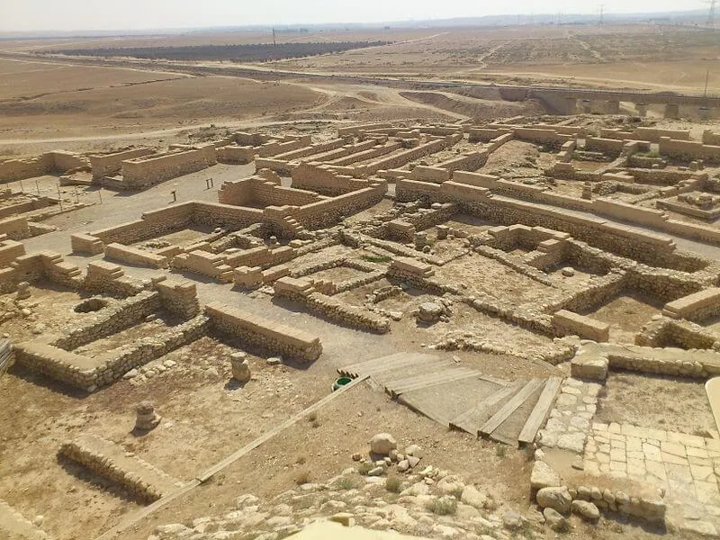
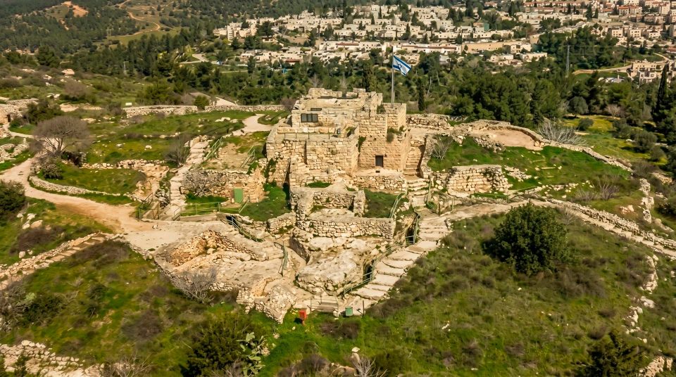
The large foundation at the centre of the summit shows how greatly the administrative building exceeded ordinary houses in scale. The palace-fort was enlarged in several stages, with courtyards and service rooms around it. Its raised platform strengthened its dominance over the city and provided a base for a large complex on a mound already shaped by earlier construction. The surviving walls look austere, but they once supported a building of which much has disappeared. As you explore, distinguish foundations and supporting fill from the rooms themselves. Remains from later periods add another layer to the picture. A projecting stone is not sufficient evidence for a royal throne, and individual sections should not be attributed to a particular ruler without supporting interpretation. The overall scale of the residence is a more secure guide than an attractive guess about a single feature.
The well and the jujube tree
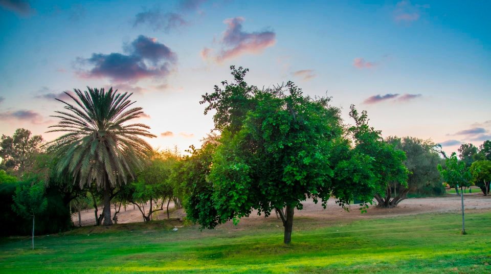
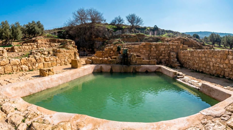
The 44-metre-deep well reflects the challenge of reaching water below a high settlement. Its location towards the valley follows the underlying groundwater: the resource sustaining the city lay far beneath the mound’s surface. For people under siege, such a structure had a very different significance from that it has for a walker carrying bottled water. A jujube tree grows nearby, a conspicuous feature in the open landscape. Local stories associated with it belong to folklore and cannot establish the tree’s age. View the well from the permitted area, without attempting to descend or allowing children near unprotected edges. This is a good place to pause the account of royal campaigns and consider the labour that ordinary life on a fortified hill required.
Historical layers to keep separate
- The Bronze Age
A major Canaanite centre develops on the mound. Temples and early defences precede the better-known city of the Kingdom of Judah.
- The Iron Age
Lachish becomes an important fortified and administrative city of Judah. Its gates, palace and defensive works are repeatedly rebuilt.
- 701 BCE
Sennacherib’s Assyrian army captures the city. The siege ramp and the reliefs from Nineveh belong to this event.
- The early sixth century BCE
Rebuilt after the Assyrian conquest, the city suffers Babylonian destruction. The inscribed letters belong to the troubled period preceding it.
- 1932–1938
James Leslie Starkey’s expedition uncovers key parts of the site. After his death, Olga Tufnell continues the publication of the excavation material.
- 1973–1994
Systematic excavations led by David Ussishkin refine the city’s archaeological sequence and the understanding of the Assyrian assault.
Distinguishing evidence from interpretation
- The stone ramp
- Physical evidence of the siege
- Its position explains how siege equipment reached the defences. Its excavated condition differs from its complete form during the assault.
- The palace reliefs
- The victor’s official account
- The panels from Nineveh present the Assyrian version of victory. They complement the archaeology but also served a political purpose.
- Letters on pottery
- Documents of everyday communication
- The later city’s working correspondence preserves the language of official messages. It relates to the Babylonian crisis rather than the Assyrian one.
- Biblical references
- Textual tradition and historical context
- Written accounts are important to the history of how Lachish has been understood. Archaeological methods establish particular construction dates and the identification of individual walls.
When the open hillside is easier to explore
Tel Lachish National Park occupies an exposed agricultural landscape. In cooler weather, it is easier to linger beside the outer defences and climb towards the palace without hurrying. Spring greenery picks out the lines of the hills; in summer, the vineyards draw attention to the valley’s working agriculture. View them from permitted routes. They are cultivated land, rather than an extension of the archaeological display. There is little shade on the mound, so carry water and wear a hat on sunny days, even for a shortened visit. Stone and earth paths can be slippery after rain. For a first visit, a careful circuit of the gates, ramp and palace platform is more informative than rushing around the entire perimeter. Those features alone make the organisation of the city intelligible.
A route that follows the evidence
- 1
See the city from outside
Before climbing, relate the mound to its slope and the approaches from the valley. Use the park plan to identify the southwestern siege area.
- 2
Follow the route through the gates
Compare the outer entrance, courtyard and inner passage. At the room where the letters were discovered, remember that they belong to a later historical episode.
- 3
Climb towards the palace
Trace the connection between the street and the main platform. From the summit, it is easier to understand how the stronghold controlled both the city and the surrounding approaches.
- 4
Turn towards the water supply
The well adds the problem of survival to the military story. Choose actual paths, viewing areas and your return route from the visitor map, rather than drawing imaginary shortcuts between landmarks in a photograph.
Questions about visiting Tel Lachish
- Was Lachish involved in only one siege? No. The Assyrian assault of 701 BCE and the later Babylonian destruction belong to different periods. The siege ramp relates to the first, while the famous inscribed letters reflect the circumstances before the second.
- Where is the Assyrian siege ramp? On the southwestern slope of the mound. View it from permitted points where you can see its gradient and relationship to the fortifications. Archaeological excavation has partly altered its present profile.
- What are the Lachish ostraca? They are pottery fragments bearing messages written in ink. They formed part of official correspondence in the late Kingdom of Judah. At their findspot, visitors see the archaeological context; the originals are not left outdoors along the trail.
- Can I see the original Assyrian reliefs here? The panels from the palace at Nineveh are in the British Museum. Tel Lachish lets you see the actual slope and city defences represented in the Assyrian account of victory.
- Does the palace survive as a roofed building? No. What you mainly see is a platform and wall remains. These convey the scale of the administrative complex, but imagining the upper rooms requires a reconstruction. Do not expect intact palace halls.
- Can I visit the mound without climbing? The principal remains of the city stand on the hill. Approach conditions and access to particular viewpoints need to be considered against each visitor’s abilities. Visitor facilities do not remove the constraints of the terrain.
- Can I combine the visit with exploring the vineyards? The vineyards are visible in the surrounding valley and form an important part of the landscape. Entering cultivated land or picking grapes is not included in a park visit. Exploring them requires a separate arrangement that permits access.
Sources
History
A major Canaanite centre develops on the mound. Temples and early defences precede the better-known city of the Kingdom of Judah.
Lachish becomes an important fortified and administrative city of Judah. Its gates, palace and defensive works are repeatedly rebuilt.
Sennacherib’s Assyrian army captures the city. The siege ramp and the reliefs from Nineveh belong to this event.
Rebuilt after the Assyrian conquest, the city suffers Babylonian destruction. The inscribed letters belong to the troubled period preceding it.
James Leslie Starkey’s expedition uncovers key parts of the site. After his death, Olga Tufnell continues the publication of the excavation material.
Systematic excavations led by David Ussishkin refine the city’s archaeological sequence and the understanding of the Assyrian assault.