At a glance
What awaits you
Difficulty
Not yet provided
Route length
Not yet provided
Who is it for
Popular visiting hours
Verified busyness data is not available yet
Best time to visit
JanFebMarAprMayJunJulAugSepOctNovDec
BestGoodHot
5-day forecast
Forecast loads when this section is viewed
About this place
Ashkelon National Park
Rows of mudbrick line Ashkelon's Canaanite gate. Carved marble marks the Roman basilica, while the circular ends of ancient columns project from medieval walls. Behind them all is the sound of the Mediterranean. Ashkelon National Park occupies the site of the old coastal city, where a walk can connect different generations of defences, the questions surrounding an ancient port and a final view over the sandy shore.
A city on the edge of a coastal ridge
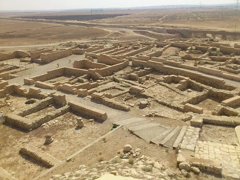
Tel Ashkelon lies southwest of the centre of modern Ashkelon, beside the Mediterranean. The underlying landform is kurkar, the calcareous sandstone formed from cemented coastal sand. A cliff protected the seaward side of the city, while fortifications enclosed it on land. To understand the ancient plan, work from the edge towards the centre: begin with the defensive outline, then move to public buildings and everyday infrastructure. Today's lawns conceal much of the former built-up area, and excavated ruins occupy only selected patches. The open spaces between them do not mean that the ancient city was empty. A much denser urban fabric lies beneath the soil and later layers of occupation.
The Canaanite gate and its fragile building material
The Canaanite gate at Ashkelon is the main stop in the northern part of the park. It dates to the Middle Bronze Age, and its arched passage was built largely from sun-dried mudbrick. This material made large structures possible, but excavation left it especially vulnerable to rain and weathering. The protective shelter and conservation work are integral to the monument's survival. The gate was built and rebuilt in antiquity; what visitors see reflects both archaeological excavation and restoration. Lightweight construction was used in the reconstructed parts of the arch to avoid adding a heavy load to the ancient fabric. Look closely at where the passage meets the mass of the defences. A relatively small entrance served a large city, yet it was also a weak point requiring particular protection. Nearby stone structures make a useful comparison with the mudbrick, showing a change in building practices without the need for a museum display.
The earthwork as a defensive system
The Canaanite fortifications combined a ditch, a steep earthen slope and a wall above. Stone and a compacted coating strengthened the outer face. The gradient made ascent difficult and prevented siege equipment from being brought easily against the wall. Seen across the landscape, the rampart is more conspicuous than any individual brick: it defines the old city's curve on the north, east and south. Later inhabitants reused this advantageous defensive line. In places, medieval masonry consequently stands above a much earlier earthen foundation. Step back along a permitted path to take in the entire slope before returning to its details. From directly beneath a wall, it is easy to miss the central engineering idea, the shape of the embankment itself.
The Roman centre: buildings, sculpture and gatherings
1
The basilica
Ashkelon's Roman basilica was a public building used for civic business and social life. Rows of columns, capitals and marble finishes suggest the scale of its central space. Here, ‘basilica’ should not automatically be understood as a Christian church: this architectural form also had a secular history.
2
Sculptural fragments
Finds associated with the basilica include images of Nike, goddess of victory, and Atlas supporting a sphere. They belong to the shared artistic language of the Roman Mediterranean. Study the drapery, the foliage carved into capitals and the contrast between smooth column shafts and richly worked tops.
3
The odeon and apsidal remains
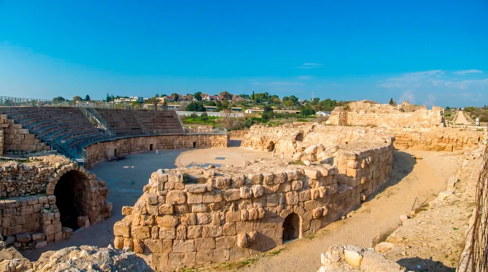
Nearby excavations include structures with semicircular ends and a small odeon. These add to the picture of public life in the city. Distinguish the ancient odeon from the modern venue for large events: a similar arrangement of seating does not make every performance space an ancient building.
How columns became part of the walls
The medieval defences reveal another fate for Roman marble and granite. Circular column ends appear among the stones: earlier architectural pieces were reused as building material and as elements binding the masonry together. For the builders they offered strong, available stone. For visitors they are unusually clear markers of time. A Roman public building might have lost its original purpose long before one of its columns found another job inside a defensive wall. Avoid assigning the whole surviving circuit to a single ruler or siege. Muslim dynasties and Crusaders rebuilt Ashkelon, repairing and altering inherited fortifications. The most striking examples juxtapose a smooth cylinder with the rough mass of the wall. Photograph them from the path rather than climbing onto the masonry.
Fresh water beside a salt sea
A port city still needed its own fresh-water supply. Ashkelon drew on groundwater and wells; standing beside the sea did not solve that problem. Near the basilica survives an animal-powered water-lifting installation, often called an antilia well. It belongs to a much later phase of agricultural use of the site. An animal walking in a circle turned a mechanism carrying buckets or scoops. Water rose from the shaft into a holding pool and could then be channelled to irrigation. Look at the relationship between the circular track, the well and the pool. This small working system tells a story of cultivation after the decline of the large city. Today's park lawns, classical ruins and traces of former gardens belong to different stages in the life of the same landscape.
A port understood through indirect evidence
Ashkelon was connected to maritime trade and to the overland route between Egypt and the northern Levant. The shore beside the tell, however, does not resemble Caesarea's harbour, where substantial port structures are readily recognisable. Researchers continue to discuss the location and arrangement of ancient anchorages here. For some periods, larger vessels are thought to have unloaded through smaller boats off an open shore. Promising a walk along surviving ancient quays would therefore be misleading. Instead, consider the relative positions of the sea, the gate and the raised city. The approach from the coast towards the northern entrance helps explain why trade and places of worship developed beside the defences. One notable discovery near the gate was a small silver-coated bronze calf figurine. It is an archaeological find, rather than a large freestanding sculpture to look for on the walking route.
Successive cities on the same shore
- Middle Bronze Age
The Canaanite city acquired substantial earthworks and an arched gate. The gate's material and the line of the ramparts remain the principal visible traces of this period.
- Iron Age
Ashkelon became one of the main Philistine cities. Maritime connections distinguished it from settlements farther inland.
- 604 BCE
A Babylonian army destroyed the city. Evidence of destruction separates Philistine Ashkelon from the later phases of occupation.
- Roman period
A monumental civic centre developed, with a basilica, marble columns and sculptural decoration.
- Middle Ages
Muslim rulers and Crusaders fought over the city and its walls. Pieces of earlier buildings were incorporated into the fortifications.
- 1920–1922 and from 1985
John Garstang's excavations, followed much later by the Leon Levy Expedition, turned scattered ruins into evidence for a systematic study of the city. The excavated areas reflect the work of several generations of researchers.
What to look for at the main sites
- Canaanite gate
- A passage through the earthworks
- Rows of mudbrick and the reconstructed outline explain the entrance's design. A protective shelter safeguards material particularly sensitive to the weather.
- Basilica
- Civic life in Roman Ashkelon
- Compare the spacing of the columns and the details of the capitals. Individual fragments help convey the scale of the city's public centre.
- Medieval wall
- Older buildings as a source of stone
- Look for circular column ends among the stones. They are evidence of the reuse of ancient buildings, rather than decoration carved specifically for the wall.
- Water-lifting well
- Agriculture after antiquity
- Trace the connection between the lifting mechanism and its holding pool. This installation explains how gardens were worked within the area of the former city.
The coastal cliff and the sand below
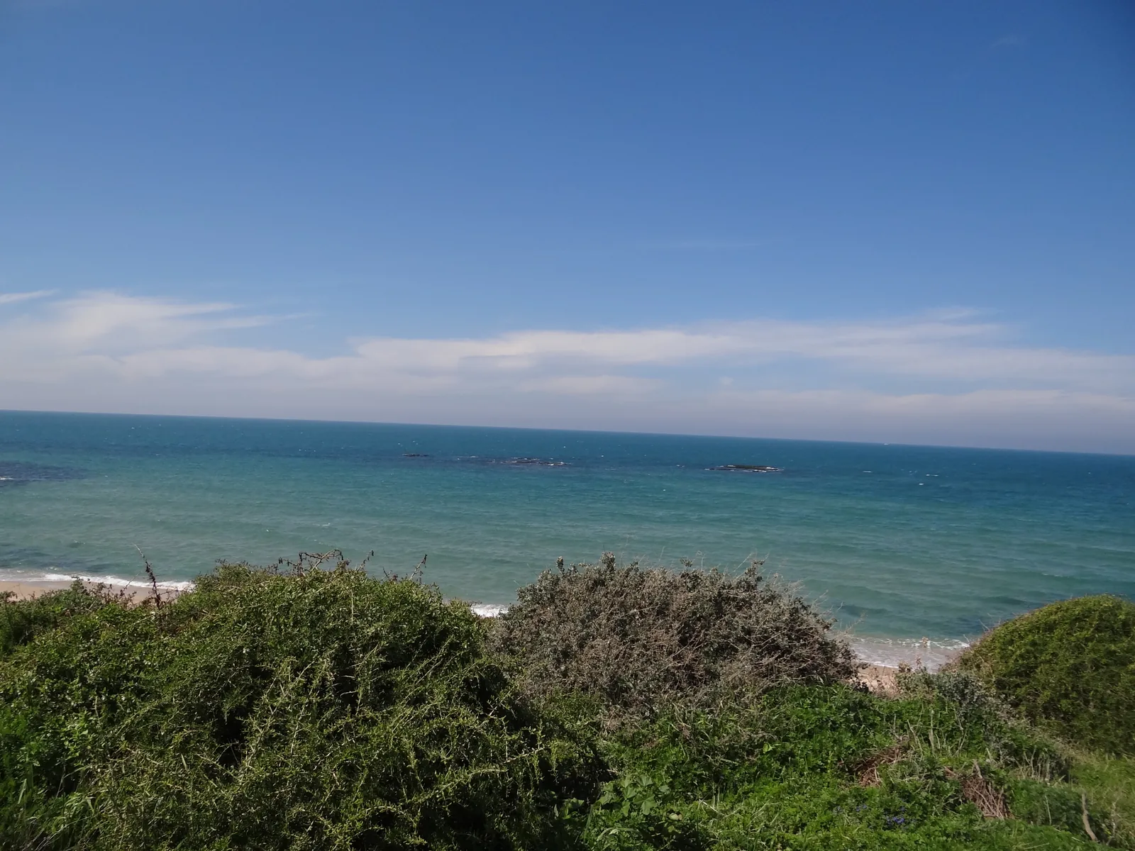
Beside the sea, archaeology gives way to a lesson in erosion. The sandy beach lies below the kurkar edge, where traces of former buildings are visible in places. Wind, waves and runoff gradually reshape that boundary. A picturesque ruined wall above the sea does not mean it is safe to approach closely. Use designated paths and permitted viewing points. Stay away from overhanging sections and do not try to scramble down loose ground. Even without going onto the beach, the sea makes the city's geography clear. Swimming belongs to the separate arrangements of the managed beach and lifeguard service. A visit to the antiquities can stand entirely on its own.
Putting the sites together into a coherent walk
- 1
Begin with the defences
Find the Canaanite gate and view the rampart from a distance. Understanding the city's outline first makes individual remains easier to read. Use the park map to choose the route between stops.
- 2
Compare building periods
After the mudbrick passage, examine the stone fortifications with reused columns. Seeing the two in sequence makes the differences in material particularly clear.
- 3
Turn towards city life
At the basilica and water-lifting well, shift the subject from sieges to commerce, gatherings and water. Ashkelon comes into focus as an inhabited city with a working economy, rather than one enormous fortress.
- 4
Finish with the shore in view
A final sea view connects the gate and public buildings with the reasons the city developed. Keep a rest on the lawn separate from the archaeological circuit so the outing remains manageable for everyone.
Light, wind and the smaller details
Cooler weather makes the exposed fortifications and the walk between the northern area and civic centre more comfortable. A summer sea breeze may feel refreshing, but it does not remove the heat from open paths. Photography offers several different subjects. At the gate, look for the rhythm of brick courses and the depth of the passage; at the basilica, examine fine carving. Along the wall, a circular column end contrasts with irregular masonry. The sea horizon supplies a sense of scale without any need to approach an unprotected edge. Children can search for recurring building materials: mudbrick, kurkar and marble. The comparison helps explain how the same city changed, sometimes dismantling its own older buildings to obtain stone.
The archaeological route and beach have separate rules
Questions about ancient Ashkelon
- Is the park beside the modern marina? No. It occupies the site of the ancient city southwest of central Ashkelon. The marina and northern city beaches are separate destinations on the coast. Choose the national park entrance when planning your journey to the archaeological site.
- Has the entire gate survived from the Bronze Age? Ancient masonry survives, but it has been conserved and partly supplemented during restoration. The visible outline of the arch includes reconstructed elements. This careful combination of original fabric and new work makes it possible to display such a fragile monument.
- Was the Roman basilica a church? Here the term refers to a public building in the Roman city. Basilicas served civic business and social activities. The architectural form later became widespread in Christian building, but that later association should not determine how you interpret this structure.
- Can I see an ancient harbour with quays? There is no surviving harbour here with a clearly traceable outline of quays. The locations and arrangements of ancient anchorages are still studied. The coast, gate and trading history help explain Ashkelon's maritime life without a preserved harbour complex.
- Do I have to combine the antiquities with swimming? No. The archaeological sites make a complete visit in their own right. Swimming depends on the beach's permitted arrangements and suitable conditions. Admission to the park alone does not authorise entering the sea.
- What can children look for between the ruins? Ask them to find different materials and compare their uses: brick at the gate, carved marble at the basilica and reused columns in the walls. At the well, follow the route of the water from the lifting mechanism to the holding pool.
- Must I follow one long walking circuit? You can organise the visit around selected archaeological stops, with a break on the lawn. Use the park map to identify connections and permitted paths. The seafront section and beach do not have to form part of the same circuit.
Sources
History
The Canaanite city acquired substantial earthworks and an arched gate. The gate's material and the line of the ramparts remain the principal visible traces of this period.
Ashkelon became one of the main Philistine cities. Maritime connections distinguished it from settlements farther inland.
A Babylonian army destroyed the city. Evidence of destruction separates Philistine Ashkelon from the later phases of occupation.
A monumental civic centre developed, with a basilica, marble columns and sculptural decoration.
Muslim rulers and Crusaders fought over the city and its walls. Pieces of earlier buildings were incorporated into the fortifications.
John Garstang's excavations, followed much later by the Leon Levy Expedition, turned scattered ruins into evidence for a systematic study of the city. The excavated areas reflect the work of several generations of researchers.