At a glance
What awaits you
Difficulty
Not yet provided
Route length
Not yet provided
Who is it for
Popular visiting hours
Verified busyness data is not available yet
Best time to visit
JanFebMarAprMayJunJulAugSepOctNovDec
BestGoodHot
5-day forecast
Forecast loads when this section is viewed
About this place
Ein Haniya National Park
At Ein Haniya, water emerges from the rock, follows a restored channel and feeds an ancient stone pool. A Roman ornamental fountain stands nearby, with agricultural terraces rising above it. Within this small stretch of the Rephaim Valley, you can follow the water from its source and see how a spring supplied farmland, became a piece of architecture and acquired a place in Christian pilgrimage.
Ein Haniya in the Rephaim Valley
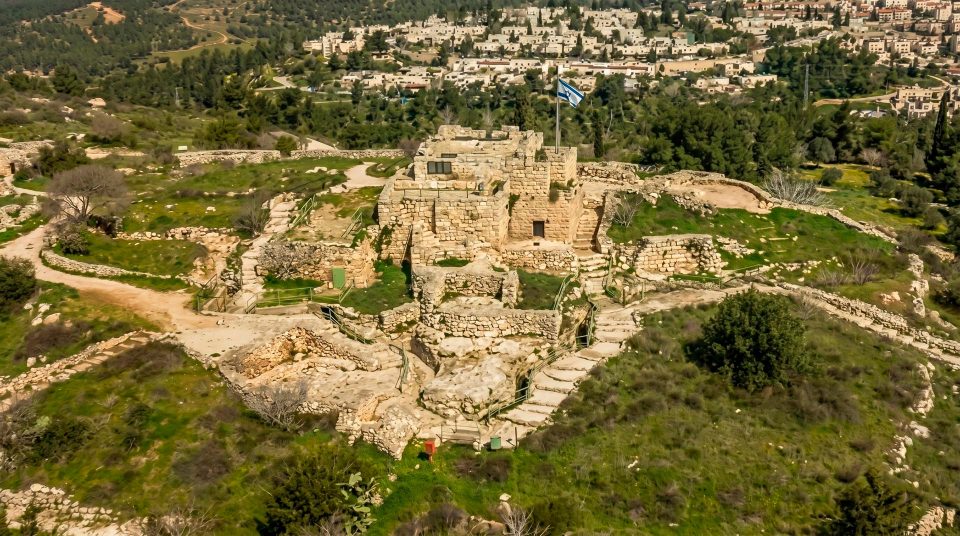
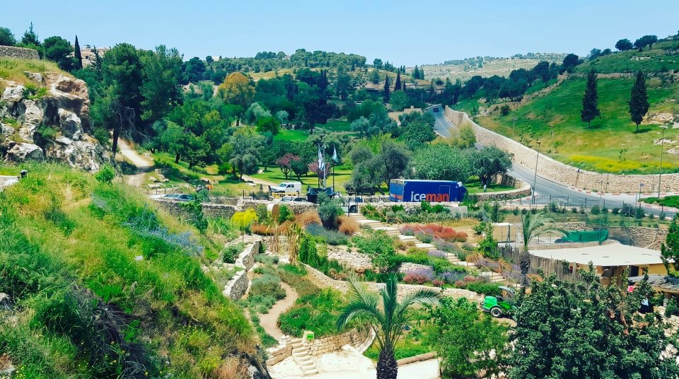
Ein Haniya spring lies in the Rephaim Valley, among the Judean Hills southwest of Jerusalem’s dense urban development. Terraced slopes, the nearby village of al-Walaja and the railway through the valley help place it in its surroundings. The official description locates the site within Judean Mountains National Park. This is a compact archaeological site built around a water system, best explored by looking closely rather than by covering a long hiking distance. The approach from Jerusalem is described via Malha and Ein Yael. When looking at a map, distinguish Ein Haniya from Ein Lavan and Ein Yael: they occupy the same general area but are separate destinations. Here, the focus is on how spring water was collected and stored. The paths take you around that working landscape rather than along an urban waterfront.
Following the water downhill
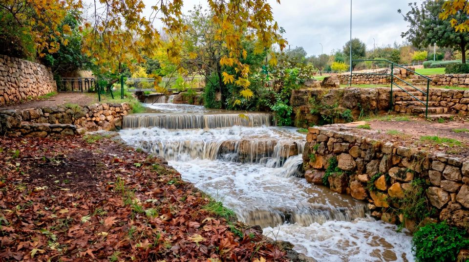
Water comes out of a short rock-cut passage and enters a restored network of channels. The drop between the spring outlet and the storage pool is easy to see. Following that descent reveals how the former agricultural system collected water and directed it towards cultivated plots. The reconstructed sections make the engineering easier to understand than a general account of ancient water management would. Trace the flow towards the pool, then look at the terraces: storing water mattered because there was farmland to irrigate. Modern restoration has made the channels legible again and restored the flow through them. It does not mean that every stone you see is in its original position. As you walk, distinguish the surviving ancient structures from reconstructed links that help explain how the system worked.
Four features worth a closer look
1
The Roman nymphaeum
A niche and stone façade give this ornamental fountain its architectural presence. The word ‘nymphaeum’ comes from the ancient culture surrounding springs. What you can examine here is a structure designed to present water impressively; its name alone cannot establish exactly which rituals, if any, took place beside it.
2
Ein Haniya’s Byzantine pools
Excavations uncovered two pools dating to the Byzantine period. The large basin formed part of an irrigation system. Seeing it filled helps explain its role as a reservoir, although its ancient function and the conditions governing its use today are different matters.
3
The restored channels
The channels connect the spring outlet with the pools. Look at their gradient, the points where the water changes level and the way each channel meets its stone supports. These small details explain how water reached the places where it was needed.
4
Terraces and fruit trees
Stone retaining walls hold soil on the slope. The Israel Nature and Parks Authority restored old terraces and planted fruit trees. This is a cultivated landscape shaped by labour over time, with deliberate planting and construction behind the greenery.
Water framed by Roman architecture
At a simple spring, your eye follows the opening in the rock and the stream emerging from it. Here, a built façade gives the water outlet its own composition. The stonework defines a space, establishes a centre and invites you to stand back far enough to see the whole structure. That architectural treatment distinguishes a nymphaeum from a channel serving purely agricultural needs. An ancient fountain could combine a practical function with status and visual display. Beside the large pool, the difference between presenting water and storing it becomes particularly clear. The official account dates the nymphaeum to the Roman period and the excavated pools to the Byzantine period. They should therefore be understood as parts of a site that developed over time, rather than as a single scheme built at once. The surviving forms and the connections between them provide ample interest without unsupported claims about the country’s largest or grandest fountain.
Different periods around one spring
- The First Temple period
Finds include a carved column capital comparable to architectural details from prestigious buildings in the Kingdom of Judah. It supports discussion of a substantial estate here, but does not prove that a particular king’s palace stood on this spot.
- The Roman period
The nymphaeum belongs to this phase: an ornamental fountain in which water became part of an imposing architectural structure. Its remains are among the most readily identifiable features of the complex.
- The Byzantine period
Pools and Christian buildings were added. A published account of the site describes the excavated outlines of a small church. Agricultural use of the spring existed alongside the religious significance of the place.
- Modern conservation
Archaeological investigation, channel restoration and work on the terraces have made the different parts understandable as a connected system. Some elements are managed for conservation under different rules from the recreation area beside the large pool.
What a single column capital can tell us
The carved capital shifts attention from the visible water to the buildings that once surrounded it. Archaeologists compare details of this kind with known finds to assess the status of an ancient site. A recovered stone, however, leaves much to establish before anyone can reconstruct a palace with confidence. The capital may have belonged to a prestigious building; it does not identify an owner, reveal the complete plan or document events in that person’s life. The useful point is the reasoning behind the interpretation. The spring attracted people in successive periods, and the quality of individual finds suggests that the surrounding settlement mattered. Do not expect to see every excavated object displayed exactly where it was found. The history of the excavations and the features available on a visitor route are separate things. At Ein Haniya, the clearest evidence on the ground remains the flowing water, the built stone structures and the shape of the terraced slope.
A spring with a place in Christian pilgrimage
Ein Haniya holds religious significance for Armenian and Ethiopian Christians. The Israel Nature and Parks Authority identifies the property around the pool and nymphaeum as belonging to the Armenian Church. For believers, the spring carries associations with an early Christian baptism. Such identifications belong to religious tradition; dating walls or floors cannot establish them. Traces of a church demonstrate Christian use of the site, but do not fix the precise location of a particular New Testament event. Keeping that distinction clear allows both the archaeology and the living tradition to be treated respectfully. People come to the same spring to relax, to pray or to examine its ancient structures. Give worshippers space and avoid intruding on prayers. Ask permission before taking a close photograph of someone, even when the surrounding pool area is busy with other visitors.
The different jobs of pools, fountain and terraces
- The spring outlet
- The start of the water’s journey
- This shows where the complex receives its water. The presence of a short rock-cut passage should not be taken as permission to enter it independently.
- The nymphaeum
- An architectural setting for water
- The Roman fountain deserves attention for its architecture and façade. Treat it as a historic structure in its own right; do not climb its masonry for a photograph from above.
- The large pool
- Storage for irrigation
- This ancient basin served the agricultural use of the spring. Whether you may enter the water depends on the rules for that area, rather than on what other visitors happen to be doing.
- The upper pool
- Part of the conserved water system
- Official information treats the upper area as a conservation zone. Being able to view the basin does not mean it can be used in the same way as the large lower pool.
- The terraces
- Ground prepared for cultivation
- Retaining walls divided the slope into plots suitable for cultivation. Look at them together with the direction of the channels to understand their place in the irrigation system.
The spring water is not disinfected
A walk that explains the water system
- 1
Start with the overall layout
Locate the nymphaeum, the large pool and the terraced slope before focusing on details. Notice their positions relative to one another. That first overview makes the closer examination that follows much more useful.
- 2
Trace the channels
From the permitted paths, connect the spring outlet with the restored channels and pools. There is no need to walk on the masonry itself: the arrangement can be understood from the side.
- 3
Give the fountain its own stop
Choose a spot where you can take in the façade and its relationship with the water. Pair a wider photograph with a detail of the dressed stone, keeping clear of fragile surfaces.
- 4
Look back towards the terraces
The cultivated plots explain why water was stored here. Once you have followed that connection, you can rest beside the designated pool area or finish with a final look at the architecture.
Warm stone, spring water and limited shade
In summer, the contrast between the water and the sun-warmed slope is particularly striking. Much of the site is exposed, so do not rely on continuous natural shade. Bring a hat and your own drinking water even if you are planning only a short visit. Cooler weather makes it easier to spend time looking at the architecture without constantly seeking relief beside the water. Winter rain changes the grip of shoes on stone; approach pool edges carefully. In spring, vegetation on the terraces provides a green background to the fountain and channels. For photographs, pay attention to the direction of light across the stone façade. There is plenty to work with in the pool’s surface, the masonry and the line of the channel without trying to include a passing train in the valley. Photograph from dry, stable ground and leave the path clear for others.
Getting to the entrance and choosing an accessible route
Plan the drive from the Malha and Ein Yael side using the official Ein Haniya entrance as your destination. A pin marking the spring on a satellite map is not a substitute for the correct vehicle approach. The site adjoins the surroundings of al-Walaja; improvised shortcuts through local roads or fields are unsuitable ways to find the entrance. Official information describes an accessible path from the entrance towards the large pool and nymphaeum. Conditions differ around the upper pool and on some connecting approaches. This offers a worthwhile architectural visit for people with limited mobility, but does not establish that every historic feature or the water itself is accessible. Before travelling, check entry arrangements, tickets and the specific section of route you need. Nearby Ein Lavan and Ein Yael have their own entrances and activities. Visiting one does not automatically include either of the others.
Questions about Ein Haniya spring
- Is Ein Haniya a large national park in its own right? It is a compact spring and archaeological complex in the Rephaim Valley. The official page places it within Judean Mountains National Park. Its main features are grouped around the spring, pools and nymphaeum, rather than spread across an extensive hiking area.
- Were the fountain and pools built at the same time? The official description distinguishes a Roman nymphaeum from two Byzantine-period pools. The complex developed in stages. Restored channels help explain how these different elements connect, without making them all the work of one building campaign.
- Is the water treated like water in a swimming pool? No. The authority warns that this is natural groundwater without disinfection. Bring drinking water rather than relying on the spring. Check the rules for contact with the water separately in each part of the site.
- Does permission to bathe apply to every pool? No such assumption is safe. The large pool and the conserved upper area have different conditions of use. Follow the signs on site and do not copy behaviour from one area in another.
- Was a royal palace really discovered here? A carved column capital allows archaeologists to discuss the possibility of a prestigious estate. It does not identify a specific owner or prove that the palace of a named ruler stood here.
- Can I visit just for the architecture? Yes. The nymphaeum, Byzantine pools, channels and terraces make a substantial visit in their own right. You can understand the spring and its history without entering the water.
- Should wheelchair users check the route beforehand? Yes. An accessible path approaches the large pool and nymphaeum, but this is not a promise of step-free access to every part of the site. Check the upper area and any access to the water separately.
- Why do pilgrims visit the spring? Armenian and Ethiopian Christians venerate the site. Its connection with an early baptism belongs to religious tradition. Remains of Christian buildings demonstrate use of the place, but do not establish the exact location of a particular biblical event.
Sources
History
Finds include a carved column capital comparable to architectural details from prestigious buildings in the Kingdom of Judah. It supports discussion of a substantial estate here, but does not prove that a particular king’s palace stood on this spot.
The nymphaeum belongs to this phase: an ornamental fountain in which water became part of an imposing architectural structure. Its remains are among the most readily identifiable features of the complex.
Pools and Christian buildings were added. A published account of the site describes the excavated outlines of a small church. Agricultural use of the spring existed alongside the religious significance of the place.
Archaeological investigation, channel restoration and work on the terraces have made the different parts understandable as a connected system. Some elements are managed for conservation under different rules from the recreation area beside the large pool.