At a glance
What awaits you
Visit duration
180min
Accessible itinerary: 2–3 hours or longer, depending on interest
Source and itineraryDifficulty
Not yet provided
Dogs are permitted on a leash and with a muzzle, except in the visitor centre. Ancient paving varies in wheelchair and stroller usability.
Route length
Not yet provided
Who is it for
Popular visiting hours
Verified busyness data is not available yet
Best time to visit
JanFebMarAprMayJunJulAugSepOctNovDec
BestGoodHot
5-day forecast
Forecast loads when this section is viewed
About this place
Caesarea National Park
At Caesarea, the sea reaches the very foundations of the ancient city. Beyond the theatre’s semicircle lie the remains of a palace on a rocky promontory. A long arena follows the shore, while farther north a Crusader moat and gate lead towards the harbour. The walk reveals how a port sustained a substantial city and why successive periods left such different buildings on the same coast. The ruins become far more revealing once you begin to tell them apart.
A city facing the Mediterranean
Caesarea National Park protects an ancient urban site on the coast between Tel Aviv and Haifa. Modern Caesarea, the archaeological park and the beach with its aqueduct are separate destinations. Within the historical site, the scale changes too. Large Roman public buildings occupy the southern area; farther north, a more compact medieval town surrounds the harbour. The sea connects these contrasting spaces. Beside the open venues for public entertainment stands a palace. Beyond are working and administrative quarters, then the waterfront that helped give the city its importance. Look for relationships between the buildings: whom they served, where their water came from and why a trading port supported such an extensive urban life.
The Roman theatre: a semicircle facing the stage
The Roman theatre stands in the southern part of the park. Its semicircular seating faces the stage, making it an accessible starting point for understanding classical architecture. Aisles divide the audience into sections, stairs direct movement, and the space below draws attention towards the performance. The building has undergone alterations and restoration. The rows visible today cannot all be treated as untouched seats from Herod’s time. Compare the stone auditorium with the reconstruction of the high stage backdrop on the information panel. In antiquity, that wall separated a performance from the surrounding landscape; today the sea forms part of the experience. The theatre is also used for modern concerts, so an archaeological visit and attendance at a performance require separate plans.
Beside the theatre: palace, inscription and carved stone
1
The Promontory Palace
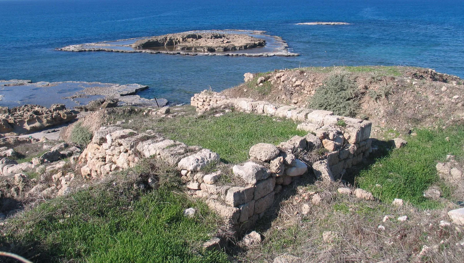
From a large courtyard, the view opens towards a rocky projection into the sea. The palace complex had upper and lower sections; beside the water are traces of a rock-cut pool and adjoining rooms. Its location made the seascape part of the residence. The building is commonly associated with Herod and the Roman administration, although the precise history of its construction remains a subject of scholarly discussion.
2
The Pontius Pilate inscription
This Latin dedication was discovered during excavations of the theatre. It names Pontius Pilate and gives his office as prefect of Judaea. The park displays a replica; the original is in the Israel Museum in Jerusalem. Here a written document recovered by archaeologists can be distinguished clearly from later accounts of the ancient city.
3
The stone garden
Architectural fragments beside the theatre reward close examination. Capitals, pieces of cornice and sarcophagi retain carved details and surface patterns. Pause over a few objects after taking in the wider views. A fragment from a column can suggest the finish of buildings that now survive mainly as foundations.
The hippodrome beside the shore
Beyond the palace, a long arena stretches parallel to the sea. The hippodrome was associated with chariot racing and public competitions, and was adapted for other spectacles as the city changed. Its elongated axis works differently from the theatre’s semicircle: spectators needed to follow movement along the course. Examine the seating, the turns in the arena and the relationship between the hippodrome and palace. The open ground conveys how much urban space was devoted to mass entertainment. In casual descriptions, ‘theatre’, ‘hippodrome’ and ‘amphitheatre’ are often used loosely. On site, distinguish the buildings by their shape and purpose, and use the reconstructions on the panels to understand changes through their different phases.
Daily life and administration beyond the arena
1
The public baths
The bath complex reveals arrangements for leisure and control of water temperature. It included spaces for preparing to bathe and separate cold and hot sections. Where heating remains survive, concentrate on their construction rather than comparing them with a modern bathroom: air and heat circulated through a purpose-built system.
2
The tax archive
An inscription identifies this administrative building. In the Byzantine period, officials worked here with tax revenues. After palace and arena, it offers a useful change of subject: the port city’s wealth depended on records and administration. Mosaic inscriptions also show how writing formed part of the decoration of public rooms.
3
The nymphaeum
Remains of a monumental public fountain survive in the northern urban area. Water supply, decorative architecture and everyday meetings came together in such buildings. View it in relation to the street and the route towards the port. Water belonged to the city’s infrastructure as well as its public appearance.
Sebastos Harbour and building in the open sea
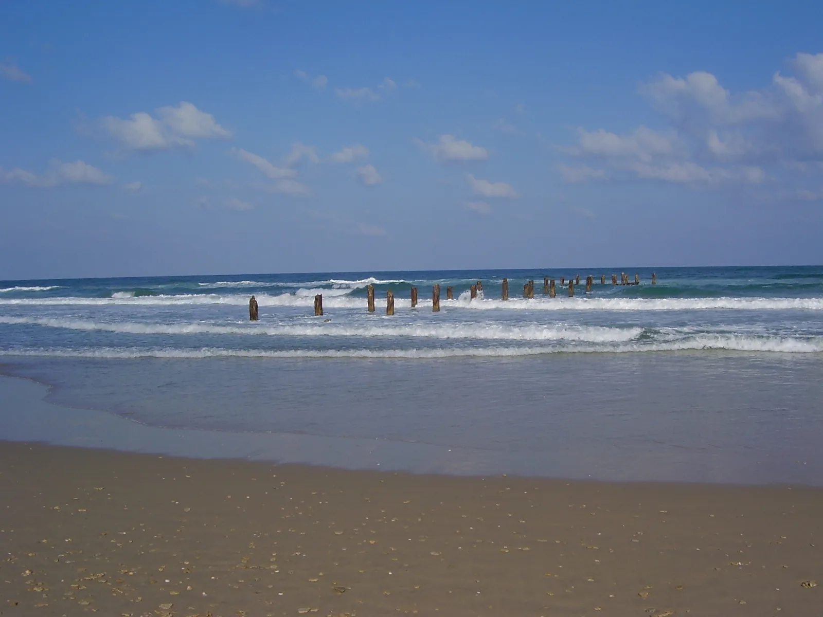
Sebastos Harbour was the central engineering project of Herod’s Caesarea. The coast lacked a large, naturally sheltered bay, so an artificial harbour had to be built. Roman concrete and underwater construction methods made the work possible. Breakwaters were intended to shelter ships while they waited out rough weather, replenished supplies or handled cargo. Trade connected the city with other parts of the Mediterranean and generated revenue. The small harbour visible today conveys neither the full size nor the arrangement of the ancient port. Some remains lie underwater. From the shore, use a reconstruction to grasp the overall design and compare it with the present enclosed water. Every visible piece of waterfront masonry should not automatically be identified as a surviving quay of Herod’s harbour.
The periods you meet along the way
- Persian period
A small coastal trading settlement known as Straton’s Tower existed here before the large Roman city.
- The reign of Herod the Great
The port city took shape and was named Caesarea in honour of Augustus. This building programme established the main directions of development along the coast.
- Roman and Byzantine periods
Caesarea served as an administrative, commercial and cultural centre. Public buildings, water systems and urban neighbourhoods developed over these centuries.
- The Crusader period
A smaller city received fortifications around the port area. Its medieval scale contrasts clearly with the extent of the classical ruins.
- Late Ottoman period
Immigrants from Bosnia established a settlement beside the harbour. The surviving mosque belongs to this later chapter of the coast’s history.
A medieval gate that makes you change direction
In the northern part of the walk, fortifications associated with King Louis IX are especially striking. The moat, sloping wall bases and elaborate entrance formed a single defensive system. The route through the gate turns rather than continuing straight ahead. This made a rapid entry more difficult and exposed attackers to defenders’ observation. Move slowly through it, noticing the changing lines of sight and why the wall extends beyond the arch itself. Inside, the medieval town feels much more confined than classical Caesarea. The difference makes clear that theatre, baths and fortified gate were not all built together. Several successive versions of the city occupy this same strip of coast.
How to read Caesarea’s principal structures
- Theatre
- Sound and sightlines
- The semicircular rows focus attention on the stage. Look at how performances were seen and how audiences reached their places.
- Hippodrome
- Movement along a long course
- The elongated arena was designed for movement and competition. Walking beside the shore makes its shape easier to appreciate.
- Promontory Palace
- Living at the water’s edge
- The arrangement of rooms and pool shows how a residence took advantage of its position beside the sea.
- Baths and archive
- Urban organisation
- Practical systems and inscriptions reveal the everyday operation of a wealthy city.
- Crusader gate
- Controlling entry
- The moat and turning passage explain the logic of medieval defence.
- Harbour
- Mediterranean connections
- A reconstruction of the ancient port helps you look beyond the small basin visible from the waterfront today.
Vaults by the harbour and the business of trade
The port area shifts attention from large ruins to smaller finds. An exhibition in ancient vaulted spaces explains harbour construction and maritime trade. Pottery, coins and glass help visitors picture the movement of goods. After walking through arena and palace, these objects bring the architectural scale back to things people handled and used. The vaults themselves deserve attention: they show how space near the port was arranged on different levels. Restaurants and galleries along the waterfront belong to the place’s modern life. Exhibition rooms, archaeological areas and harbour businesses may have different visiting arrangements. An evening stroll beside the water does not replace exploration of the archaeological route during its permitted hours.
The aqueduct adds the freshwater story
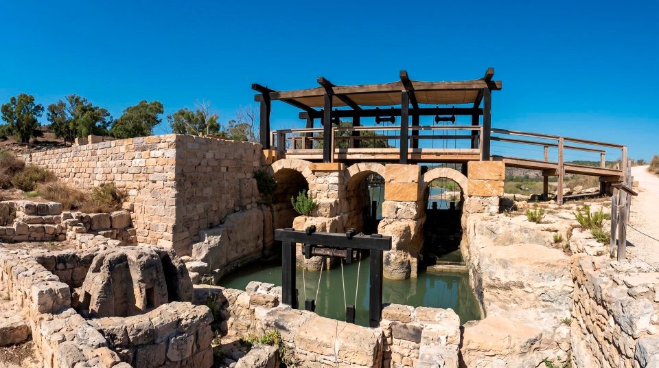
The aqueduct arches on the beach are often included among Caesarea’s sights. That stretch is separate from the main theatre-to-harbour route, however, and should not be sought immediately beyond the Crusader gate. It adds the story of freshwater delivery. A coastal city needed water for its inhabitants, baths and public fountains; proximity to salt water did not solve that problem. If you want to include the aqueduct on the same day, allow a separate stop and approach. The engineering story then falls into complementary parts: the harbour protected ships from the sea, while aqueducts supplied the city with water from inland. Examine the arches from ground level rather than climbing the ancient masonry.
A route with a clear sequence
- 1
Choose your starting point
The southern entrance suits a start with the theatre and Roman urban life. The northern entrance introduces medieval defences and the port. When navigating, distinguish the specific entrances from the modern town.
- 2
Connect theatre, palace and arena
Compare the forms and functions of these buildings. A separate pause at the inscription and carved fragments adds the human detail preserved in objects and writing to the broad scale of the ruins.
- 3
Keep some attention for the harbour
After the open archaeological area, examine the gate, urban remains and waterfront vaults. Avoid using all your energy at the first stop: the character of the monuments changes considerably along the way.
- 4
Plan the return
The long walk between southern and northern sections need not end beside your car. Check entrance, exit and return route on the map, especially if you also plan a separate stop at the aqueduct.
Coastal light, wind and a walk with children
Caesarea is an exposed coastal site. Sun feels stronger on the arena, beside the palace and between quarters than near individual sheltered buildings. The cooler season suits a leisurely examination of stonework and sea; after rain, take particular care on smooth or uneven surfaces. In warm weather, alternate the large outdoor spaces with an exhibition visit where available. Side light brings out steps, masonry relief and the outline of the palace pool. A beautiful sunset, however, does not mean every archaeological area remains accessible until dark. With children, focus on specific things to investigate: the difference between theatre and hippodrome, the turn inside the gate, or the contrast between today’s harbour and its reconstruction. Questions about visible structures hold attention better than a list of every historical period.
Questions before visiting Caesarea
- Are Caesarea and Caesarea Philippi the same place? No. This guide concerns the Mediterranean coastal city. Caesarea Philippi is associated with the Banias area. For this outing, select Caesarea National Park rather than the similarly named historical site elsewhere.
- Which entrance should I use? Start in the south for the Roman theatre and palace, or in the north for the Crusader gate and harbour. Choose according to your main interest and return plan. Reaching both principal areas involves a walk between them.
- Is the aqueduct on the main walking route? The beach arches are a separate stop beyond the theatre, palace and port sequence. Allow time specifically for reaching them rather than expecting to find them as you leave the harbour.
- Can I see the original Pilate inscription? The park displays a replica of the inscription found during excavation. The original is in the Israel Museum in Jerusalem. Keep that distinction in mind if your trip is focused on the archaeological objects themselves.
- Is the park suitable for a pushchair or wheelchair? Some areas have developed visitor paths, but archaeological surfaces and approaches to individual monuments vary. Choose a specific suitable route in advance for a pushchair or limited mobility rather than assuming every ruin can be reached.
- Can I swim during the archaeological visit? The palace pool, harbour remains and archaeological shoreline are not invitations to swim. Plan a beach visit separately, and only use an appropriate area where bathing is permitted.
- Should I come in the evening for the light? Soft light suits the stone architecture, but access hours for the ruins and harbour area may differ. Before setting out, check entry rules and the availability of any exhibition you want to visit with the site administration.
Sources
History
A small coastal trading settlement known as Straton’s Tower existed here before the large Roman city.
The port city took shape and was named Caesarea in honour of Augustus. This building programme established the main directions of development along the coast.
Caesarea served as an administrative, commercial and cultural centre. Public buildings, water systems and urban neighbourhoods developed over these centuries.
A smaller city received fortifications around the port area. Its medieval scale contrasts clearly with the extent of the classical ruins.
Immigrants from Bosnia established a settlement beside the harbour. The surviving mosque belongs to this later chapter of the coast’s history.