At a glance
What awaits you
Visit duration
Not yet provided
Difficulty
Not yet provided
Route length
Not yet provided
Who is it for
Popular visiting hours
Verified busyness data is not available yet
Best time to visit
JanFebMarAprMayJunJulAugSepOctNovDec
BestGoodHot
7-day forecast
Forecast loads when this section is viewed
About this place
HaBesor National Park (Eshkol Park)
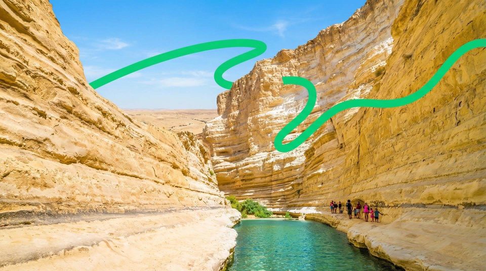
At Eshkol Park, pale, dry slopes meet lawns and palms beside a spring. This quiet landscape brings together very different histories: an Egyptian way station, a Byzantine church and a mosaic found by soldiers during the First World War. HaBesor National Park rewards attention to both its roles, as a place to relax beside water and as part of a valley used by travellers long before modern roads.
Where HaBesor is, and why it has two names
The park lies in the northwestern Negev, beside Highway 241 between Urim and Maon junctions, east of the Besor streambed. HaBesor, Habesor and Eshkol Park are names or spelling variants used for the same place. Besor refers to the watercourse and valley; Eshkol commemorates Levi Eshkol. When travelling here, navigate to the national park entrance rather than an arbitrary point along the long streambed. The community of Ein HaBesor should also be distinguished from the spring inside the park. This is not a narrow mountain canyon. Open western Negev terrain, low hills and greenery around the emergence of groundwater give the landscape its character.
A green landscape shaped by people
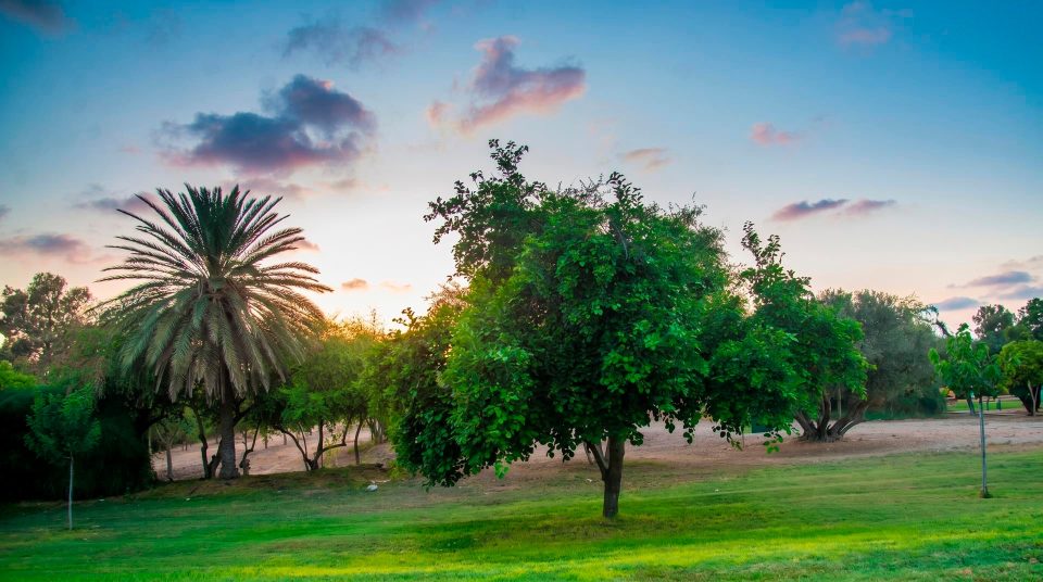
Much of the park's familiar appearance comes from deliberate landscaping. Ground preparation and planting began in 1967. Yosef, or Joe, Yehezkel of nearby Kibbutz Urim was one of its initiators and its first manager. Trees and shrubs tolerant of brackish water were selected, and the spring provided the irrigation supply. The even green lawns among dry slopes therefore tell a story of both a natural resource and human work. Look at the boundary between lawn and uncultivated ground. It makes the distinction between the maintained recreation area and the surrounding landscape particularly clear. Describing the whole park as an untouched natural oasis would miss an important part of its history. Its present appearance reflects design and continuing care.
Ein HaBesor: water from a shallow aquifer
Ein HaBesor spring lies in the northern part of the park. It draws on a near-surface aquifer replenished by winter rainfall. This explains the lasting patch of greenery in an area with a pronounced dry season. The water is brackish, which influences the choice of plants irrigated with it. The spring and the pool it feeds form the heart of the park landscape, but visible water does not make every pool a bathing place. The large artificial pool should not automatically be treated as a children's swimming pool. Look instead at where water emerges, the fringe of vegetation and the relationship between the pool and surrounding planting. These details explain how the place works. Bring a separate supply of drinking water for your walk.
Water’s different roles in the park
- The spring outlet
- The natural foundation
- Groundwater sustains the greenery and feeds the landscaped water system. The presence of a spring does not establish that its water is safe to drink.
- The park pool and shallow-water areas
- A managed setting
- Different sections serve different purposes. Enter the water only where the applicable rules explicitly permit it. The large pool should not be equated with a designated bathing area.
- The Besor streambed
- A wadi system
- The stream belongs to a large catchment subject to winter floods. Permanent water at the spring is not evidence of year-round flow throughout the valley.
- Irrigation of lawns and trees
- Managing a resource
- Care and irrigation maintain the green park. The edges of the planting help distinguish the designed landscape from the dry slopes around it.
Places with stories of their own
1
The spring and the green heart of the park
Here the contrast between water and dry ground is easiest to see. Compare the vegetation beside the spring with areas farther away, and notice how the bank has been shaped by people.
2
Khirbet Shalala hill
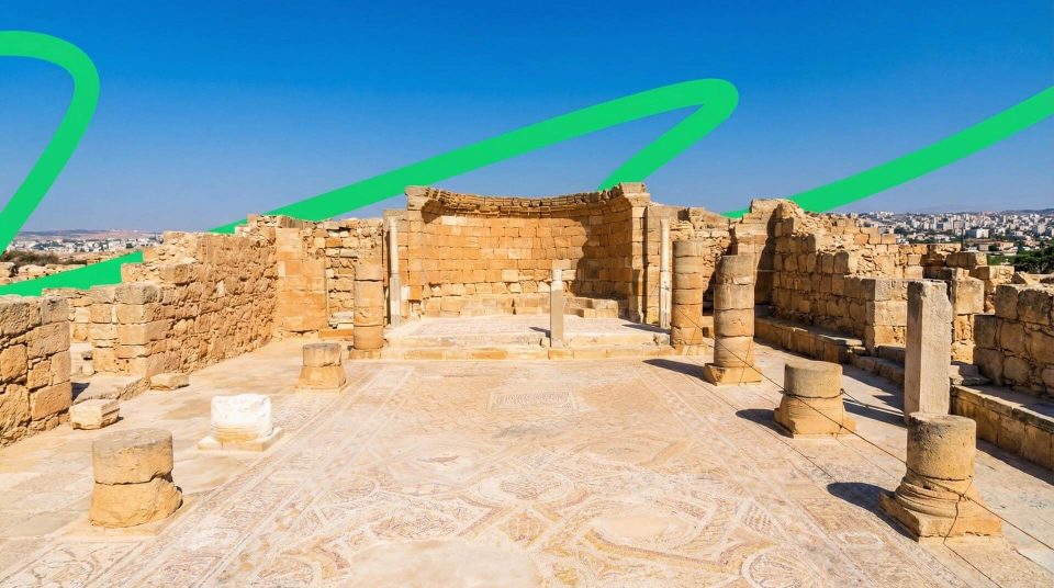
Traces of a Byzantine church survive on this rise. The discovery of its mosaic during the First World War is the central episode in its modern history. Visit for the place of discovery and its relationship to the valley, rather than expecting the original mosaic floor.
3
Tel Ein HaBesor
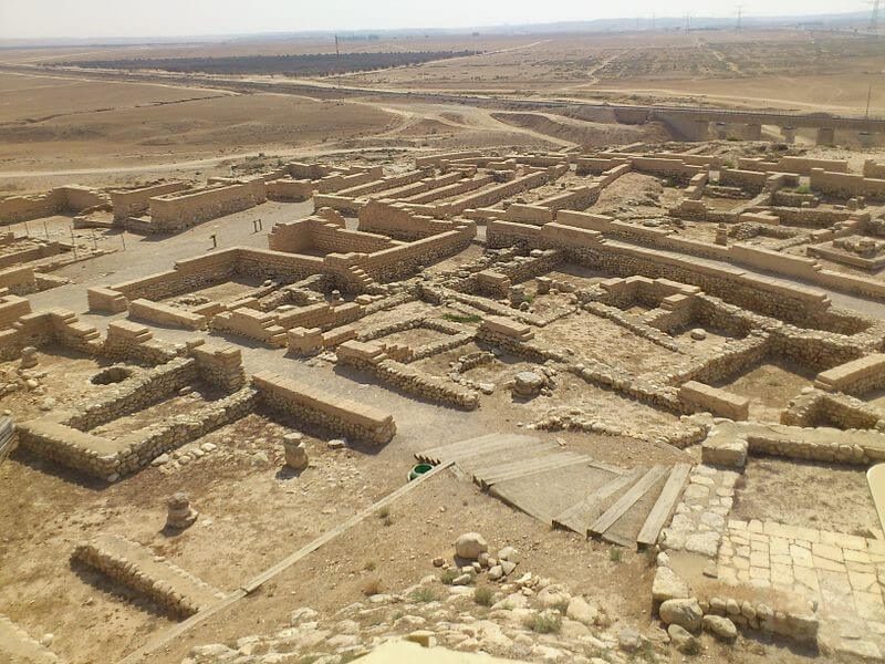
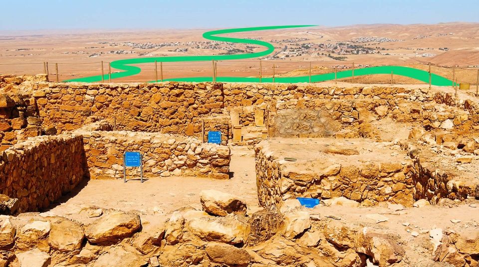
This small archaeological mound southwest of the spring is associated with ancient settlements and an Egyptian way station. Its building remains need a close look. Their significance becomes clearer through the history of people and goods moving through the area.
4
Open ground beside the valley
These areas reveal how the green park fits into the drier terrain. A modest rise or a change of viewpoint helps connect the spring and hills with the direction of the streambed.
The Shellal Mosaic is far from its place of discovery
The Shellal Mosaic, associated with the site also called Shalala, was made in 561–562 CE. Its floor design included animals, birds, grape motifs and geometric ornament. Such details help bring Byzantine art into focus: the church contained a rich world of images that is easy to miss when looking only at the remaining walls. The original is now held by the Australian War Memorial in Canberra. A visit to the hill inside the park cannot include viewing this original floor in place. Here you encounter the archaeological site from which it came. Study the design beforehand in photographs from the museum collection. That preparation changes the way you see the low ruins, giving them the context of a specific sixth-century interior.
A Byzantine floor in a wartime landscape
On 17 April 1917, Australian signallers discovered the mosaic at a position where Turkish trenches had already exposed part of the ancient floor. A military task brought soldiers into contact with a monument from a very different era. Before it was dismantled, colour drawings were made to guide its later reassembly. The pieces were then packed and sent via Cairo. Its removal to Australia involved a dispute over where the find should be kept. This is a story of cultural heritage being moved, rather than a straightforward excavation discovery destined for a museum. Keep both histories in view at Shalala: a Byzantine church once stood here, and centuries later its remains became part of a battlefield. A walk on the hill passes through the place where those histories overlapped.
A way station and the connection with Egypt
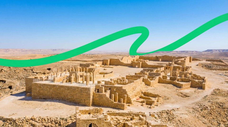
Tel Ein HaBesor reveals an earlier chapter in the valley's history. Archaeologists found settlement remains and a structure interpreted as an Egyptian state way station. The finds indicate an Egyptian presence in southern Canaan at an early stage of its history. For a visitor, the important point is the function of a stopping place beside water within a wider travel network. Journeys needed supply points, and a dependable spring increased the value of this location. A later Hellenistic layer shows that people returned in different periods. The mound's small size gives little indication of the reach of its historical connections. These low walls concern movement between regions; there is no need to imagine a large palace to understand their importance.
Layers of time in a single valley
- Early settlement history
Contacts between southern Canaan and Egypt left traces beside the spring. Interpreting the building as a way station connects the local water supply with long-distance routes.
- The Hellenistic period
A layer from this period was identified at Tel Ein HaBesor. It shows renewed use of the site rather than the continuous life of a single town.
- 561–562 CE
The mosaic floor of Shalala's Byzantine church was created. The dating is supported by the Australian War Memorial's research and account of the mosaic.
- 1917
Australian servicemen uncovered the mosaic during wartime operations. It was later dismantled and removed from the discovery site.
- 1967
Work began on developing and planting the park, shaping much of the green landscape familiar to visitors.
The wider valley beyond the lawns
The Besor Stream valley extends well beyond the national park. Its catchment begins in the Negev, with drainage directed towards the Mediterranean Sea. Other archaeological mounds and scenic areas lie in the wider region, but they should not automatically be folded into a walk within the park. More useful here is an understanding of how a wadi changes: its channel may look quiet or dry, while heavy rainfall can bring a flood. Water at the spring and water in the main channel follow different patterns. After rain, do not judge whether to enter the streambed from the appearance of the nearest patch of sky. Rain may have fallen higher in the catchment. Observe the valley from permitted paths rather than casually extending a park stroll into a separate streambed hike.
How the seasons change the park
In cooler months, the connection between the park and its surrounding slopes becomes more apparent. After rain, dry ground turns green and the boundary between planted areas and open terrain looks different. Seasonal flowers bring colour to the western Negev, although their timing depends on rainfall. Photographs of red fields do not promise an identical scene on every visit. In hot weather, the contribution of trees and irrigation becomes more noticeable. Time in the green area can be alternated with short walks to historic points, allowing for the sun and how everyone feels. Stay on the paths rather than trampling ground to reach a flower. Comparing the wider landscape tells you more about the balance between natural seasonal change and the continuing work of maintaining the park.
Combining relaxation with history
- 1
Find the spring on the map first
Locate the central green area and the archaeological sites. This helps combine a picnic with exploring, instead of searching for unrelated ruins beyond the walk you intended.
- 2
Choose a historical focus
Shalala tells the story of a Byzantine church and its mosaic; Tel Ein HaBesor concerns ancient routes and Egypt. For a short visit, one subject examined carefully can be enough.
- 3
Leave time to look closely
Turn from the spring towards the dry slopes. With children, discuss why the trees and lawns are concentrated here, and how water influenced the establishment of settlements.
- 4
Plan time beside the water separately
Before travelling, find out the rules for the particular water area and the admission arrangements. For the walk itself, bring drinking water and shoes suited to the ground. Swimwear does not replace preparation for the sun.
Who will enjoy this kind of park?
HaBesor suits visitors who enjoy alternating quiet relaxation with short, thoughtful stops. You can examine how the spring works, then turn to the story of a church floor or an ancient way station. Anyone hoping for towering monumental ruins should adjust their expectations: much of the archaeology consists of low remains, and the celebrated mosaic has been removed. The park's character comes from the proximity of traces of different periods to a green setting created and maintained by people. For photographs, try including water, planted areas and the pale ground beyond in a single frame. That view conveys HaBesor more precisely than a close shot of lawn that could belong to almost any park.
Questions about HaBesor and Eshkol Park
- Are HaBesor and Eshkol Park different parks? They are names for the same national park. Besor refers to the stream and valley; Eshkol commemorates Levi Eshkol. Navigate to the official entrance rather than the similarly named community or a random point along the streambed.
- Can I see the original Shellal Mosaic here? The park contains the site of the Byzantine church where the mosaic was discovered. The original is held by the Australian War Memorial in Canberra. Looking at the museum's images beforehand helps explain the significance of the hill.
- Does water flow through the entire Besor valley all year? Do not assume so. The spring has a dependable supply, but the wider valley is a wadi system with seasonal runoff and floods. The green central park area does not indicate the condition of the entire streambed.
- Is every pool in the park intended for bathing? No. The large artificial pool and a permitted shallow-water area are different things. Whether you may enter a particular section depends on the applicable rules and signs. The spring is not a substitute for a drinking-water supply either.
- Are the green lawns natural? Much of the present landscape results from landscaping and planting. Spring water irrigates plants chosen to tolerate its brackish conditions. This combination of a natural resource and continuing care is an important feature of the park.
- What is known about the Egyptian station? The remains were found at Tel Ein HaBesor, southwest of the spring. They are interpreted as a state way station. The discovery illuminates longstanding connections between Egypt and southern Canaan rather than the history of a large palace.
- Can I continue walking straight along the streambed? Do not treat the channel as a continuation of the park paths. Exploring the valley needs a separate route plan, and entering the streambed is dangerous when flooding threatens. Use the permitted layout when visiting historic points inside the park.