At a glance
What awaits you
Difficulty
Not yet provided
Accessible boardwalk/concrete paths reach major nature points; mill and Israelite gate have no accessible route.
Route length
Not yet provided
Who is it for
Popular visiting hours
Verified busyness data is not available yet
Best time to visit
JanFebMarAprMayJunJulAugSepOctNovDec
BestGoodHot
5-day forecast
Forecast loads when this section is viewed
About this place
Tel Dan Nature Reserve
At Tel Dan, paths wind between little streams beneath a dense canopy before emerging beside the gates of an ancient city. A Bronze Age mudbrick arch, an Iron Age stone road and a sanctuary on the mound belong to different chapters of its history. Water connects them with the woodland growing here today. Beside the Dan springs, it becomes clear why people repeatedly chose this part of Upper Galilee as a place to live.
An ancient mound beside the Jordan headwaters
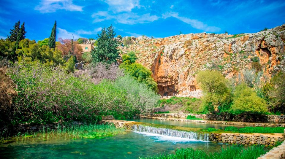
Tel Dan Nature Reserve lies in the far north of Upper Galilee, north of Kibbutz Dan, at the foot of the Mount Hermon region. Springs here feed the Dan River, one of the Jordan’s principal headwaters. Beside them rises the tel, a mound formed by the remains of successive settlements and the accumulation of archaeological layers. The name therefore refers both to a protected natural area and to an ancient site. The woodland paths and excavated structures belong to the same story. Abundant water, fertile surroundings and road connections explain the city’s importance. On a first visit, allow time for both parts. The ruins reveal the history of the place; the springs help explain why that history began here.
The Dan springs: from groundwater to a river
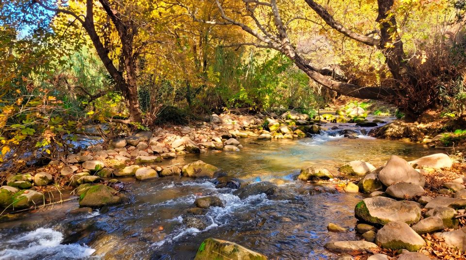
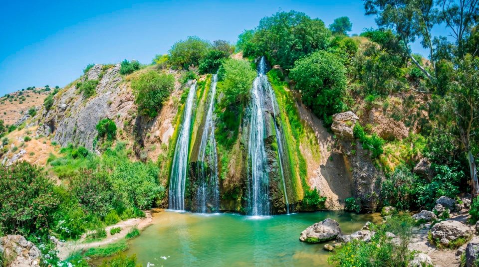
Water from the mountain region travels underground and emerges at the foot of the slopes through a system of springs. Within the reserve, the source does not always take the form of one conspicuous, formally marked outlet. Small channels meet, divide around patches of ground and gather into a stronger flow. Dan and Leshem are among the principal springs named here. Of the three main streams feeding the upper Jordan, the Dan carries the most water; the other two are the Banias and Snir. Watch how still-looking water gives way to a swift current. In one place, you can see the surface beneath overhanging leaves; elsewhere, water pushes forcefully around roots and stones. These are natural channels rather than ornamental park waterways. Protecting them is part of the reserve’s purpose, and a path running close to the water does not make every bank a permitted entry point.
Woodland details worth slowing down for
1
Paradise Springs
This name is given to an area of small streams passing through dense vegetation. Its appeal is built from close detail: water around roots, damp soil and gaps between trunks. Walk slowly and pause where the ground is stable enough to look without blocking the path.
2
Syrian ash and the understorey
The moist habitat supports trees and shrubs unlike those of the exposed surrounding slopes. Syrian ash is among the species recorded here. Notice leaf shapes, the shade and a tree’s position beside the channel rather than reducing the woodland to a search for one famous trunk.
3
Fallen trunks
Dead wood appears along the trails in twisting forms, sometimes with hollows. It belongs to the woodland’s natural cycle and is not necessarily evidence of neglected maintenance. Leave hollow and fallen trunks as habitat and landscape features rather than using them as climbing equipment.
4
Short stretches of fast water
Small rapids make the current’s power particularly visible. Observe them from the designated path or platform. A shallow-looking branch of the stream tells you little about the conditions in the channel beside it.
The Canaanite gate and its mudbrick arch
The Canaanite gate at Tel Dan dates to the Middle Bronze Age, around 1750 BCE. Built of mudbrick over a stone base, it includes an arched passage. The material makes the monument both revealing and vulnerable. Unfired brick needs protection from moisture and decay, while the surviving form shows the capabilities of ancient builders. Look at how the laid elements create a vault above the passage and how the entrance relates to the city’s defences. Its popular name, Abraham’s Gate, refers to the biblical account of Abraham pursuing his enemies as far as Dan. The name does not prove that the patriarch walked through this particular arch. The archaeological dating of the structure and its religious association remain separate ways of understanding it.
Two gates from different periods
- The Canaanite gate
- Mudbrick and early urban defence
- This Bronze Age entrance is built of mudbrick. Its arch, construction material and relationship to the early defences of Laish are the key features to notice.
- The Iron Age gate
- Stonework and public space
- The later entrance stands in a different location. Stone walls, passages and the adjoining plaza reveal another phase in the life of the city of Dan.
- The platform by the later gate
- Authority and civic gatherings
- A raised platform with worked stone sockets at its corners is interpreted as a possible seat for a ruler or judge beneath a canopy. That interpretation helps explain the plan without identifying a particular person who sat there.
- The sanctuary
- The city’s religious centre
- This is a separate complex on the mound rather than a room within either gate. Its layout and evidence of repeated alteration reveal the organisation and long use of sacred space.
Following the stone road into Iron Age Dan
Read the Iron Age entrance complex from outside to inside. First came a plaza before the gate, then a passage between defences and chambers beside the entrance. Changes in direction made a direct approach into the city more difficult, while walls and rooms helped control movement. The gate also served as a public place. Stone benches and a platform with sockets for canopy supports open up discussion of assemblies, administration and judicial functions at the city entrance. This provides a useful contrast with the mudbrick arch. At the earlier gate, material, technique and preservation draw attention; here, the arrangement of urban life becomes clearer. Take time to follow the authorised route rather than rushing between photo stops. It is easier at a slow pace to picture an arrival at the walls, a pause at the entrance and the final approach into the settlement.
The Tel Dan stele: a few lines with wider significance
In 1993, a fragment of a basalt stele bearing an Aramaic inscription was found near the entrance complex; further pieces were discovered later. The inscription dates to the ninth century BCE and belongs to an Aramean royal tradition of commemorating victory. Most scholars read its best-known sequence of letters as “House of David”. The find is important as evidence outside the Bible for a dynastic name familiar from biblical texts. A few surviving lines, however, cannot independently verify every account of David and his kingdom. The find context matters too. The fragments had been reused in building work; they were not discovered as a neatly positioned monument with its meaning intact. Understanding the stele means following the archaeological work of discovery, joining fragments and interpreting a damaged text.
The sanctuary on the mound
Dan’s sanctuary includes a substantial raised platform, a staircase and an altar area. A metal framework suggests the altar’s form while remaining visibly distinct from the ancient masonry. Consider the scale of the structures in relation to a person and the sequence of approach from open ground to steps and elevated platform. The biblical account links Dan with King Jeroboam and one of the golden calves installed in his kingdom. Excavation has established the presence of a significant religious centre, but a stone podium is not the discovery of a golden calf. The precinct was altered and reused in later periods. Its remains reveal a long history of religious activity rather than one episode preserved unchanged.
Laish, Dan and the archaeological sequence
- Middle Bronze Age
The fortified city known as Laish had substantial defences. The surviving mudbrick entrance dates to approximately the eighteenth century BCE.
- Iron Age
Dan was associated with the northern Kingdom of Israel. Its stone gates, fortifications and sanctuary reflect this period of the city’s history.
- Ninth century BCE
The Aramaic inscription known as the Tel Dan stele is dated to this century. Its text belongs to the history of rivalry between regional kingdoms.
- Hellenistic period
Religious activity continued on the mound. A bilingual dedicatory inscription provides evidence that the name Dan remained in use.
- 1993
Discovery of the first stele fragment marked an important moment in research at the site. The significance of its surviving lines reached far beyond the boundaries of the nature reserve.
The mill adds a later chapter of working water
A watermill survives in the wooded part of the reserve. A channel diverted water from upstream, and the drop at the building powered the grinding mechanism. The installation shows the river as a working resource as well as a landscape feature. Use its external elements to trace the arrangement: where the water arrived, how it was raised relative to the machinery and where it left after doing its work. An old description is no basis for assuming that the interior will be accessible or a demonstration available. The mill belongs to a different period from either the Canaanite or Israelite gates. It is evidence that the springs remained useful after the ancient city’s decline. The natural advantage persisted even as the ways people worked with it changed.
A modern military post beyond the woodland
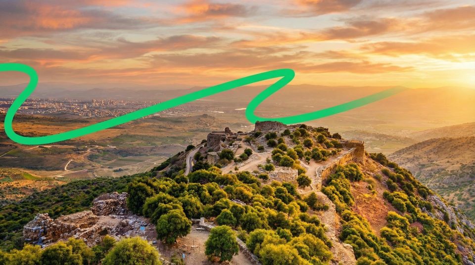
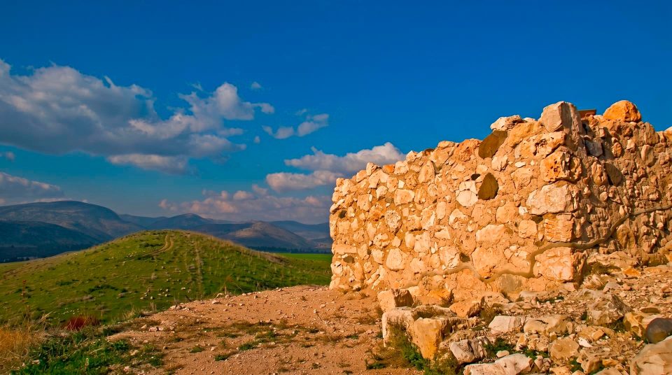
On a more exposed part of the mound stand remains of a modern military post. They belong to the history of this border region and differ from the ancient walls in material, shape and purpose. Stone and concrete structures scattered over the site should not all be folded into one supposed biblical city. Comparing the periods is part of Tel Dan’s interest. An ancient sanctuary, later defensive works and views towards Hermon occupy the same terrain. Treat surviving trenches and installations as historical remains rather than places for unsupervised exploration. From a permitted viewing area, notice how closely the valley and mountain slopes meet beside the springs. The wider view brings a woodland walk back to the geography that shaped the site.
Combining the water and the ancient city
- 1
Begin with the reserve map
Choose a route combining woodland with the archaeological features you want to see. Branching paths have different surfaces, so a single assurance of accessibility cannot sensibly cover the entire site.
- 2
Compare small channels with the main flow
Look at a narrow branch of water and then a stronger stream. Those observations reveal the city’s natural resource more clearly than a single general photograph of green vegetation.
- 3
Keep the two gates distinct
At the mudbrick arch, concentrate on material and construction. At the stone complex, trace the plaza and sequence of entry. This makes it easier to keep their different periods clear in your mind.
- 4
Separate tradition, excavation and reconstruction
Beside the podium, distinguish surviving ancient fabric from modern explanatory work. When discussing the golden calf and stele, include a clear account of what archaeologists actually found.
Woodland shade does not cover the whole visit
Wet stones and roots call for secure footwear and careful steps. Unlike channels beneath the trees, the open excavations may be fully exposed to the sun. In the cooler season, fresh growth and the presence of water give the woodland much of its character. Summer crowns provide welcome shade, but it is sensible to visit the archaeology before a group becomes tired by the heat. With children, focus on specific things to work out: finding the arch, following a turn at the gate or understanding the mill. Visitors with mobility requirements should check the exact section they need rather than rely on a general description of the reserve. Even if a designated water area is open for use, permission does not extend to neighbouring channels. Before travelling, check entrance arrangements and available trails. Carry drinking water regardless of any plans involving the stream.
Questions about Tel Dan
- Are Dan and Banias the same place? No. They are neighbouring but separate natural and historic sites. The Dan and Banias are among the principal headwaters of the Jordan. At Tel Dan, the main archaeological features are the ancient gates and sanctuary on the mound.
- Why is the mudbrick entrance called Abraham’s Gate? The name refers to the biblical account of Abraham’s pursuit as far as Dan. It is not archaeological evidence that he passed through this structure. The gate itself is dated to the Middle Bronze Age.
- Do the Canaanite gate and stone gate occupy the same site? They are separate entrance complexes. The mudbrick arch belongs to the Bronze Age, while the stone gate reflects the city’s later history. Seeing both and comparing their layouts helps make the sequence clear.
- What does the “House of David” inscription establish? That is how most scholars read a sequence of letters on the ninth-century BCE Aramaic stele. The inscription is important evidence for a dynastic name, but it does not automatically confirm every event described in the Bible.
- Was a golden calf found at the sanctuary? Excavations revealed a substantial religious complex. The biblical account associates Dan with Jeroboam’s golden calf, but the visible podium and altar remains are not the discovery of the cult image itself.
- Can I visit only the woodland? Choose according to the permitted trail arrangement and your group’s interests. The springs provide a worthwhile nature walk in their own right. Even then, it helps to know that the nearby mound contains a many-layered ancient city rather than being an ordinary natural hill.
- Does water beside the path mean swimming is allowed? No. A walkway or convenient bank does not imply permission to enter a channel. Use only specifically designated water areas when they are open, following signs and instructions from the reserve administration.
Sources
History
The fortified city known as Laish had substantial defences. The surviving mudbrick entrance dates to approximately the eighteenth century BCE.
Dan was associated with the northern Kingdom of Israel. Its stone gates, fortifications and sanctuary reflect this period of the city’s history.
The Aramaic inscription known as the Tel Dan stele is dated to this century. Its text belongs to the history of rivalry between regional kingdoms.
Religious activity continued on the mound. A bilingual dedicatory inscription provides evidence that the name Dan remained in use.
Discovery of the first stele fragment marked an important moment in research at the site. The significance of its surviving lines reached far beyond the boundaries of the nature reserve.