At a glance
What awaits you
Difficulty
Not yet provided
Accessible paths exist in springs area, not all antiquities, waterfall or suspended trail. Service dogs allowed; pets prohibited.
Route length
Not yet provided
Who is it for
Popular visiting hours
Verified busyness data is not available yet
Best time to visit
JanFebMarAprMayJunJulAugSepOctNovDec
BestGoodHot
5-day forecast
Forecast loads when this section is viewed
About this place
Banias Nature Reserve (Hermon Stream)
At the Banias springs, water emerges beneath a cliff beside a cave and the carved niches of an ancient sanctuary. Downstream, the flow gathers strength, passes old milling installations and enters the confined channel leading to the waterfall. A visit can reveal how one stream connects ancient worship, city life and a wooded landscape. Planning it well starts with distinguishing the springs area from the separate waterfall section.
The Hermon Stream at the foot of the mountain
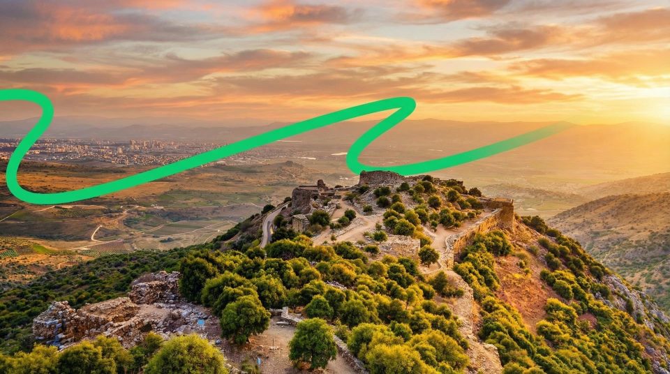
Banias Nature Reserve lies at the foot of Mount Hermon on the northern edge of the Golan Heights. Banias, Banyas and Nahal Hermon are names associated with the same stream and its natural and historic surroundings. The upper section begins at the springs beside the ancient city remains. The lower section is known for the waterfall and hanging trail. Road 99 is the main road reference for reaching the area. Although the two sections look close together on a map, your choice of entrance determines what you see first. A destination labelled simply “Banias” may lead you to neither the waterfall nor the Cave of Pan entrance you intended. Decide whether your priority is water moving through the canyon, the ancient monuments or a planned visit to both.
The springs and waterfall offer different perspectives
- The springs area
- Pan, Caesarea Philippi and the source of the stream
- The cave, carved niches and sanctuary remains invite you to begin with history. Here, the water is still experienced as a group of springs around which a religious centre and a city developed.
- The upper stream
- Water as a working resource
- A bridge, mill and surviving water installations show how people put the flow to work. The natural setting is closely bound up with the everyday lives of earlier inhabitants.
- The waterfall area
- The canyon and falling water
- Moving water, a narrow channel and views from designated platforms take centre stage. The hanging trail brings you close to the current, with an outdoor canyon walk quite different from the upper archaeological site.
- Walking between the sections
- A separate route-planning decision
- Combine them only by a permitted route with a clear return plan. Continuing downstream on a linear trail does not automatically provide a short loop back to your car.
The sanctuary of Pan: cave and cliff niches
A large opening in the cliff immediately draws attention in the upper section. Nearby are carved niches and the foundations of a sanctuary associated with the Greek god Pan. For ancient worshippers, cave, rock and emerging water formed a single sacred setting. The name Paneas derives from Pan; Banias preserves it in an adapted Arabic form. Look at the niches as elements of a deliberately arranged sanctuary. Their relationship to one another, their worked surfaces and the terraces in front of the rock matter more than any resemblance to natural hollows. Ancient ideas about the cave’s depth and the underworld belong to the history of belief. They are not geological explanations for the spring, nor do they make the grotto an invitation to explore beyond the designated visitor area.
Reading the ancient sanctuary
1
The grotto as a natural focal point
The cave was the defining feature of the sacred precinct before elaborate buildings surrounded it. Its setting shows how a natural form could shape both the architecture and the religious importance of a place.
2
Niches cut into the cliff
These worked recesses formed part of the cliff’s religious decoration. Look at their frames and arrangement to imagine where images and dedications belonged, even though the statues themselves have not survived.
3
Temple foundations
Low walls mark several parts of a sanctuary that developed gradually. Without an explanatory reconstruction, their original height cannot be read from the remains alone. Compare building plans, entrances and their relationship to the cliff face instead.
4
The disputed location of the temple to Augustus
Historical accounts connect Herod with a temple honouring Augustus in this area. Its exact location remains debated, and nearby Omrit is another candidate. A particular foundation beside the cave should therefore not be labelled unconditionally as the established site of that temple.
Caesarea Philippi extended beyond the sanctuary
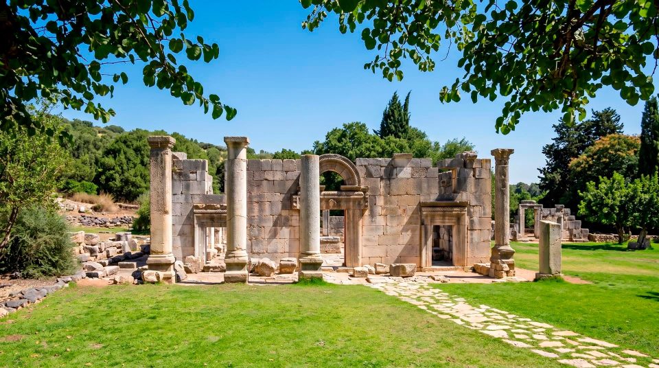
Herod’s son Philip developed the settlement into the city known as Caesarea Philippi. The second part of the name distinguished it from other Caesareas, especially the Mediterranean port of Caesarea Maritima. Later major building activity is associated with Agrippa II. Beyond the sanctuary, archaeologists have investigated streets, public buildings, courtyards and water infrastructure. A substantial complex is traditionally called the Palace of Agrippa II. Treat that attribution as an archaeological interpretation, rather than the equivalent of a surviving owner’s inscription. The urban remains widen the story of a visit: people came to the springs for much more than ritual. They lived here, administered territory, traded and built roads. Water was part of the city’s economy, helping explain why successive communities continued to value the site.
Peter’s confession in the Gospel accounts
The Roman bridge and the meeting of streams
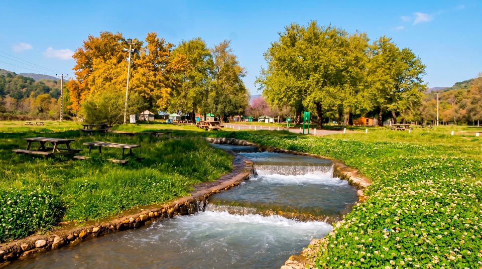
From the springs, the water runs beside the ancient urban area. The upper section includes the base of a Roman bridge that carried an earlier road. Near the bridge, the Guvta stream, also written Guveta, joins the Banias. Farther downstream, the system also receives the Sa’ar, which drains slopes of Mount Hermon. These confluences are useful things to look for during a walk: channel width, the movement of the water and the shape of the banks change along the way. At the bridge, consider how its masonry allowed the road to cross the stream, then look for places where water was diverted towards working installations. Together, the road and water supply help explain the city’s location. Surviving bridge masonry is a historical feature to observe from the trail, not a way to make your own crossing beyond it.
Matruf Mill: turning water into motion
Matruf Mill reveals the practical side of Banias. A channel carried water to the building, where a drop in height provided the power to turn the mechanism and millstones. Follow the sequence as a whole: the upstream supply, the point where water fell, the working space and the lower outlets. That makes the idea of river power tangible. The mill served neighbouring settlements and belongs to a much later period than the ancient sanctuaries. Nearby are the remains of a small hydroelectric station that supplied the former village. The two installations did different jobs. The mill used mechanical rotation for grinding; the power station converted motion into electricity. Their survival does not guarantee that machinery will run, milling will be demonstrated or any associated shop will be operating during your visit.
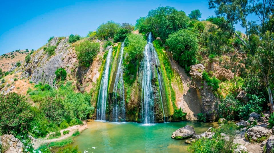
Banias Waterfall and the confined channel
Farther downstream, the focus shifts from sanctuary and city walls to the channel itself. Water accelerates between rocky sides and plunges over a ledge. Banias Waterfall is best appreciated through movement and sound: spray, changing patterns in the current and the steady noise of falling water reveal more than a quick, static photograph. The lower section has designated viewpoints and a hanging trail beside the canyon. This suspended walkway offers a closer view of the current and the narrow rock corridor than an ordinary bank-side path. It is a fixed walking structure, not a rope crossing, and it gives no permission to descend into the stream. On confined stretches, keep space for other visitors. A group stopping across the whole walkway for repeated photographs quickly blocks the route.
Riverside woodland follows the water
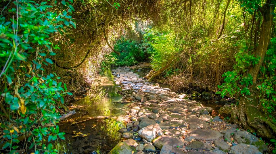
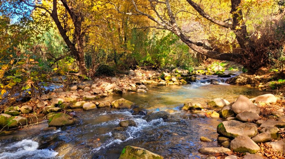
Plane, walnut and poplar trees grow along the banks of the upper Banias. Trees, dense shrubs and the constant sound of water contrast strongly with the open slopes around them. Rather than searching for a checklist of rare species, notice how the woodland depends on the river. Crowns extend over the flow, roots hold in the bank and quieter stretches reflect the rock walls. Together with the Dan and Snir, the Banias is one of the main headwaters of the Jordan. Its importance therefore extends beyond an attractive canyon. Protecting its banks and channel matters to the wider river system. For visitors, that means staying on marked paths, leaving plants undisturbed and treating the stream as a protected habitat rather than a place to enter wherever the bank happens to be convenient.
From sanctuary to a settlement with many layers
- Hellenistic period
A centre of worship dedicated to Pan developed beside the cave. The natural opening and springs formed the heart of the sacred precinct.
- Roman period
The city grew under Philip and Agrippa II. Temple precincts stood alongside streets, public buildings and engineered water installations.
- Byzantine period
Christian tradition brought new religious significance to the city. Banias retained a sacred role as patterns of worship and the built environment changed.
- Middle Ages
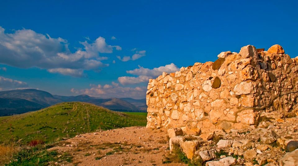
The town occupied important road connections and was repeatedly fortified. Surviving stretches of wall and gateways belong to this complex later history rather than the original sanctuary of Pan.
Planning time to understand what you see
- 1
For archaeology, begin at the springs
Look first at the cliff and sanctuary terraces, then move on to the urban remains. The sequence makes it easier to understand how a naturally sacred setting developed into a substantial settlement.
- 2
For the landscape, give the lower section its own time
If your main interests are the hanging trail and waterfall, choose that entrance. Avoid using up the time and energy set aside for your route on an improvised attempt to join every part of the reserve.
- 3
For both sections, settle the return plan first
Compare the permitted connections on the official map. If starting and finishing in different places, arrange transport accordingly. A short distance on a map does not remove the need to walk back.
- 4
For a family visit, consider the ground as well as the sights
At the springs, the cave, niches and milling mechanism provide concrete subjects for children. The waterfall is louder and more immediately dramatic. Steps, wet surfaces and narrow walkways matter more than a general label such as “family-friendly”.
How the seasons change a visit
Winter rain can make the river landscape particularly lively, but it also leaves stones and walkways slippery. Spring adds green slopes around the water. In summer, riverside trees provide welcome shade while the open archaeological areas and approaches can still be hot. An autumn visit focused on ruins and the mill has a different rhythm from a spring walk beside a forceful current. Whatever the season, establish exactly which sections are open to visitors. Check entrance arrangements, connections between the areas and trail restrictions with the reserve administration before travelling. Do not assume every part of Banias follows identical arrangements. Carry drinking water and plan a visit around observing the river, without treating swimming as a promised part of the day.
Questions before visiting Banias
- Are Banias and Nahal Hermon separate reserves? These names are associated with the same stream. Banias also names the ancient city beside the springs. When choosing an entrance, distinguish the upper archaeological area from the lower waterfall section with its hanging trail.
- Can you see the waterfall immediately from either entrance? No. The springs and cave occupy a different part of the reserve from the lower waterfall area. If falling water and the canyon walkway are your priority, use the reserve map to select the entrance serving that section.
- Is the hanging trail a bridge across the river? It is a walkway running beside the confined channel, offering close views of the flow. Do not picture a rope crossing. It belongs to a particular walking route and is not an independent means of crossing the stream wherever you choose.
- Can I walk from the springs to the waterfall? That depends on the permitted connecting routes and your chosen itinerary. Establish the distance, exit point and return arrangements from the map first. Two reserve sections do not automatically make a short circular walk.
- Will Matruf Mill be working when I visit? The surviving structure helps explain water-powered milling. Active grinding, demonstrations and visitor services should not be promised without separate confirmation. You can still understand the engineering arrangement without a live demonstration.
- Where exactly did Peter make his confession? The Gospels associate the event with the vicinity of Caesarea Philippi. Archaeology does not establish an exact spot beside the cave for the conversation. The connection with the area matters for pilgrimage without requiring invented precision.
- Should I bring swimming gear? Plan Banias as a walk through a natural and archaeological landscape. Proximity to water does not establish permission to enter the channel. Follow the applicable restrictions and signs in every season.
Sources
History
A centre of worship dedicated to Pan developed beside the cave. The natural opening and springs formed the heart of the sacred precinct.
The city grew under Philip and Agrippa II. Temple precincts stood alongside streets, public buildings and engineered water installations.
Christian tradition brought new religious significance to the city. Banias retained a sacred role as patterns of worship and the built environment changed.
The town occupied important road connections and was repeatedly fortified. Surviving stretches of wall and gateways belong to this complex later history rather than the original sanctuary of Pan.