At a glance
What awaits you
Visit duration
120min
Tour up to 2 hours; excludes picnics and additional leisure time
Source and itineraryDifficulty
Not yet provided
Route length
Not yet provided
Who is it for
Popular visiting hours
Verified busyness data is not available yet
Best time to visit
JanFebMarAprMayJunJulAugSepOctNovDec
BestGoodHot
5-day forecast
Forecast loads when this section is viewed
About this place
Yarkon National Park Yarkon Sources
Tall papyrus stems, dark water beneath the foliage, the long shell of an old mill and a concrete guard post beside a railway bridge: small details tell the story at Yarkon Springs. This riverside section of Yarkon National Park has a different feel from the neighbouring fortress at Tel Afek. Follow the bank and the connections emerge between a single river and the wildlife, farming and transport it sustained over the centuries.
Getting to know the upper Yarkon
Yarkon Springs lies between Petah Tikva and Rosh HaAyin, in the upper part of the river system. Here, ‘Springs’ means a separate visitor area, rather than a single dramatic spot where water gushes from a rock. A walk beside the channel forms the backbone of a visit, linking stretches of riverside vegetation with a mill and structures from several periods. The landscape and route are quite different from those around the Yarkon's urban mouth in Tel Aviv. Access to this section is from the Road 40 side. When setting your navigation, look for Yarkon Springs or Mekorot HaYarkon: neighbouring Tel Afek has its own entrance. Choosing the right one determines whether your day begins beside a quiet riverbank or at a fortress.
A river that needed restoring
The Yarkon is often pictured as a green corridor through an urban landscape, but proximity to its springs alone cannot explain the river's condition. Water abstraction altered its natural flow, while urban and industrial development brought pollution. A reduced flow also leaves a river less able to cope with the pollution reaching it. Restoration involves wastewater treatment, managing flows and re-establishing conditions in which native organisms can survive. A clear patch beside the path therefore tells you little about the cleanliness of the whole river. Nor does abundant greenery mean this is an environment untouched by people. At the springs, the interest lies in seeing these things together: a surviving waterside landscape, evidence of water use and work to protect its living habitats.
Riverside details worth slowing down for
1
Papyrus
The tall stems with their spreading crowns have a strikingly different outline from ordinary bankside grasses. Compare their silhouette with the surrounding vegetation as you walk. Papyrus has a familiar place in the history of writing materials; here, it is also a living part of the river habitat.
2
Wooden riverside platforms
The designated platforms offer a close view of the water and opposite bank without cutting your own way down through the plants. Pause to notice how differently the light reflects from open water and from stretches shaded by overhanging foliage. These small changes are easy to miss while walking.
3
Old water-management structures
Along the channel are traces of the river's agricultural uses. Read them in relation to the flow: where was water taken off, where was it directed, and why were working buildings placed beside the bank? The structures give the riverside walk a clear historical thread.
Al-Mir flour mill and the power of the river
Al-Mir flour mill is the main historical landmark in the riverside section. It operated during the Ottoman period and took its name from the nearby Arab village of Mir. Setting millstones beside a river was only part of the engineering. A dam gathered water in the channel and diverted it towards the mill, providing the flow needed to drive its machinery. The surviving, elongated building suggests an operation intended to handle a substantial workload. Trace the relationship between the water and the structure, then compare what remains with the diagram on the information board. Even without working machinery, it becomes easier to understand why a decline in river flow affected people's livelihoods. The same water supported the natural habitat, irrigated farmland and supplied energy for grinding grain.
Reading the mill from the evidence
- 1
Work out the direction of flow
Start with the building's position beside the channel. Moving water explains how a mill worked; an isolated wall tells you much less if you overlook its connection with the riverbank.
- 2
Compare the remains with the diagram
A plan or drawing on the information board helps distinguish the channels, working areas and main building. Use it to identify what has disappeared as well as what survives. Missing timber and metal components should not be mistaken for an intact mechanism.
- 3
Notice the building’s length
The long structure gives a sense of the scale of the enterprise. This was a working production site serving the surrounding area, rather than a small ornamental building placed beside the water.
- 4
Look back at the river
After the mill, the river landscape takes on another meaning. Suitable banks and a dependable flow determined where people worked long before this became a place for recreational walks.
A protected pool and the return of native fish
Near the mill is an area associated with restoring fish populations in the upper Yarkon. An important species is the Yarkon bleak, Acanthobrama telavivensis, also called the Yarkon bream. Pollution and the drying of coastal streams drastically reduced its numbers. Recovery work involved breeding fish and returning their offspring to suitable habitat. On-site information has also described work with another native fish species. The small pool should therefore be understood as a conservation facility, rather than a permanent outdoor aquarium with an unchanging collection. Its purpose is to provide protected breeding conditions and help conserve populations. You may need patience to spot a fish, and a sighting is never certain. Watch the surface from the permitted bank; do not feed or catch the fish, or cross the enclosure.
Where the river meets the railway
- Ottoman period
Al-Mir mill used a diverted river flow to grind grain. The bank was part of the working landscape of the surrounding settlements.
- 1922
A railway branch towards Rosh HaAyin was established on the initiative of Petah Tikva residents. It connected local agriculture with the wider transport network.
- 1936–1939
A British pillbox guarded the railway and the bridge across the river during the Arab Revolt. The small concrete post records a different use of the same river corridor.
The Yarkon pillbox and the bridge it guarded
The rounded concrete post with narrow openings is easy to distinguish from the mill's masonry. Its role was to protect railway infrastructure. The river crossing made the bridge a vulnerable link: trains could travel a considerable distance along the line, yet still depended on this one structure. The pillbox occupied a position from which that crossing could be watched. The local railway also had a civilian story, carrying agricultural produce to ports and passengers between Petah Tikva and Rosh HaAyin. Compared with the large fortress at Tel Afek, military history here is represented by a small, purpose-built structure. Approach only along open paths. A symbol on the park map does not grant access to the bridge or railway tracks.
Yarkon Springs and Tel Afek offer different walks
- Yarkon Springs
- Riverbank and living habitats
- The channel, bankside plants and traces of water management shape a riverside visit. The principal historical themes are the mill and railway guard post.
- Tel Afek
- Fortress and settlement mound
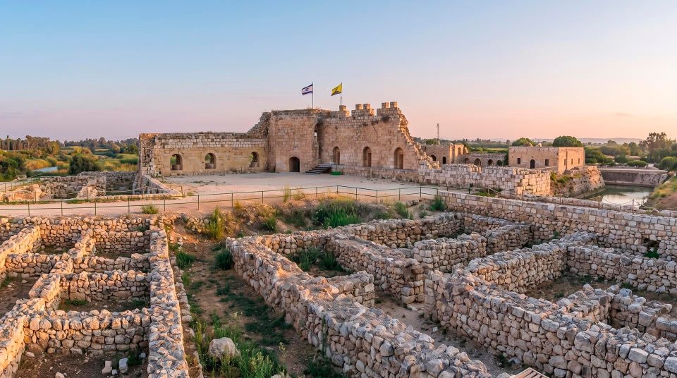
- The archaeological mound, Ottoman fortress, remains of the ancient city and artificial lake belong to a separate section. They call for a different route and sequence of stops.
- Walking between the sections
- A link to plan separately
- The connection depends on which passages are open to visitors. Do not automatically plan both areas as one walk simply because they belong to the same national park.
- Driving between entrances
- Two separate vehicle entrances
- There is no internal road connecting the two sections. To change entrances by car, you need to leave one area and approach the other using roads outside the park.
The Romantic Path towards the Concrete House
Near the mill is the start of the route known as the Romantic Path, characterised by thick vegetation and close views of the river. Descriptions lead it towards the Concrete House, one of the area's historical landmarks. That should not be read as a guarantee of an uninterrupted through-route: individual gates and stretches have their own access restrictions. For a first visit, treat it as a possible branch from a riverside walk that already has plenty to see. Making the house an absolute goal can distract from the mill and the riverbank along the way. When accessible, the path adds the experience of a leafy corridor. When it is not, the story of the upper Yarkon remains just as coherent without it.
Aquatic plants and the routes between the sections
Park maps mark ponds with aquatic plants between Yarkon Springs and Tel Afek. Photographs of them sometimes become the main expectation for a visit, although both access and appearance depend on the particular pond and the season. Look at how the plants occupy the water: leaves spread over the surface, stems connect them to the bottom, and denser growth alters the light and shelter available to aquatic life. A quiet spot beside a permitted path lets you compare an open river channel with a vegetation-filled pond. Do not expect an unbroken carpet of flowers on every visit. When adding a detour, distinguish a separate destination on the map from an ordinary stretch of bank within Yarkon Springs itself.
Making time for the river before a picnic
Rest and picnic areas make it easy to spend the whole visit at a table. To get a sense of the place, walk the main riverside section first, taking in the plants, mill and protected pool. A break afterwards then follows naturally from what you have seen. In warm weather it is pleasant to alternate exposed stretches with shade, but shade is not continuous. Rain changes the grip on unpaved approaches and wooden surfaces. Seasons also affect what you can see: dense foliage may obscure details along the bank, while reflections on open water change with the light through the day. Children can look for papyrus and work out why the mill needed a dam. Both are specific to this place and need no promise of rare-animal sightings or flowers in bloom.
The water’s edge is a habitat to protect
Questions about visiting Yarkon Springs
- Is this the riverside park in Tel Aviv? This guide covers the Yarkon Springs section of Yarkon National Park between Petah Tikva and Rosh HaAyin. The urban promenades and parks farther downstream are different places to begin a walk. Make sure your chosen entrance is in the upper-river area described here.
- Which entrance should I use for Al-Mir flour mill? Choose Yarkon Springs, also known as Mekorot HaYarkon, approached from the Road 40 side. Tel Afek focuses on the fortress and archaeological mound. It has a separate entrance, rather than another car park beside the same riverside trail.
- Where is the fortress often called Antipatris? The fortress commonly given that name is in the Tel Afek section. It is not a stop to assume on a short circuit of Yarkon Springs. Combining the two areas takes a separate plan for access and the return journey.
- Will I see rare fish? The protected pool introduces work to restore native species. A particular fish may be difficult to spot, and the conservation area's inhabitants can change. Observe from the permitted path; the value of the site does not depend on a guaranteed sighting.
- Does the Romantic Path always reach the Concrete House? Do not rely on a guaranteed through-route. Gates and side paths may have access restrictions. You can build a worthwhile visit around the mill, riverside vegetation and available viewing platforms without committing to the house as an endpoint.
- Should the aquatic flowers be an essential stop? The ponds with aquatic plants are a separate destination between the park sections. Flowering and access are not fixed features of every visit. The river itself has enough detail for a satisfying walk without making a flower display a condition of the day.
- Can I picnic right beside the channel? Use the park areas intended for breaks. Making your own descent through vegetation or crossing fences damages the bankside habitat. Keep close observation of the water separate from eating and settling in for a longer stop, especially near conservation enclosures.
Sources
History
Al-Mir mill used a diverted river flow to grind grain. The bank was part of the working landscape of the surrounding settlements.
A railway branch towards Rosh HaAyin was established on the initiative of Petah Tikva residents. It connected local agriculture with the wider transport network.
A British pillbox guarded the railway and the bridge across the river during the Arab Revolt. The small concrete post records a different use of the same river corridor.